

LIVE UPDATES: Super Typhoon Henry, Tropical Depression Gardo latest news
- Henry entered the Philippine area of responsibility at 5:30 p.m. on Wednesday, August 31.
- Gardo was absorbed by Typhoon Henry on Thursday, leaving the typhoon’s radius vastly expanded.
Typhoon Henry exits PAR; cloudy Sunday with rains expected — Pagasa
September 4, 2022 – 07:09 AM
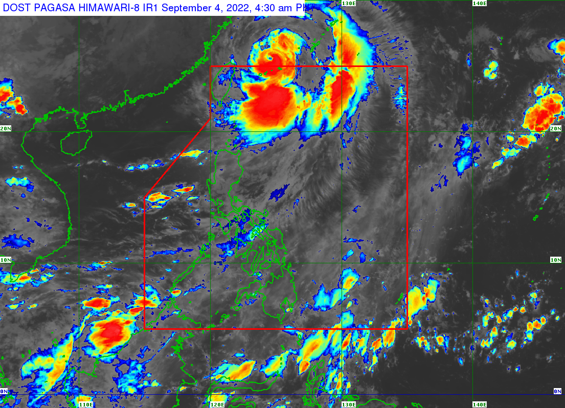
Typhoon Henry (international name: Hinnamnor) exited the Philippine area of responsibility but is still expected to trigger monsoon rains in parts of the country, the Philippine Atmospheric, Geophysical and Astronomical Services Administration (Pagasa) said Sunday morning.
All storm warning signals have likewise been lifted.
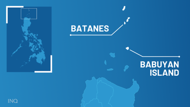
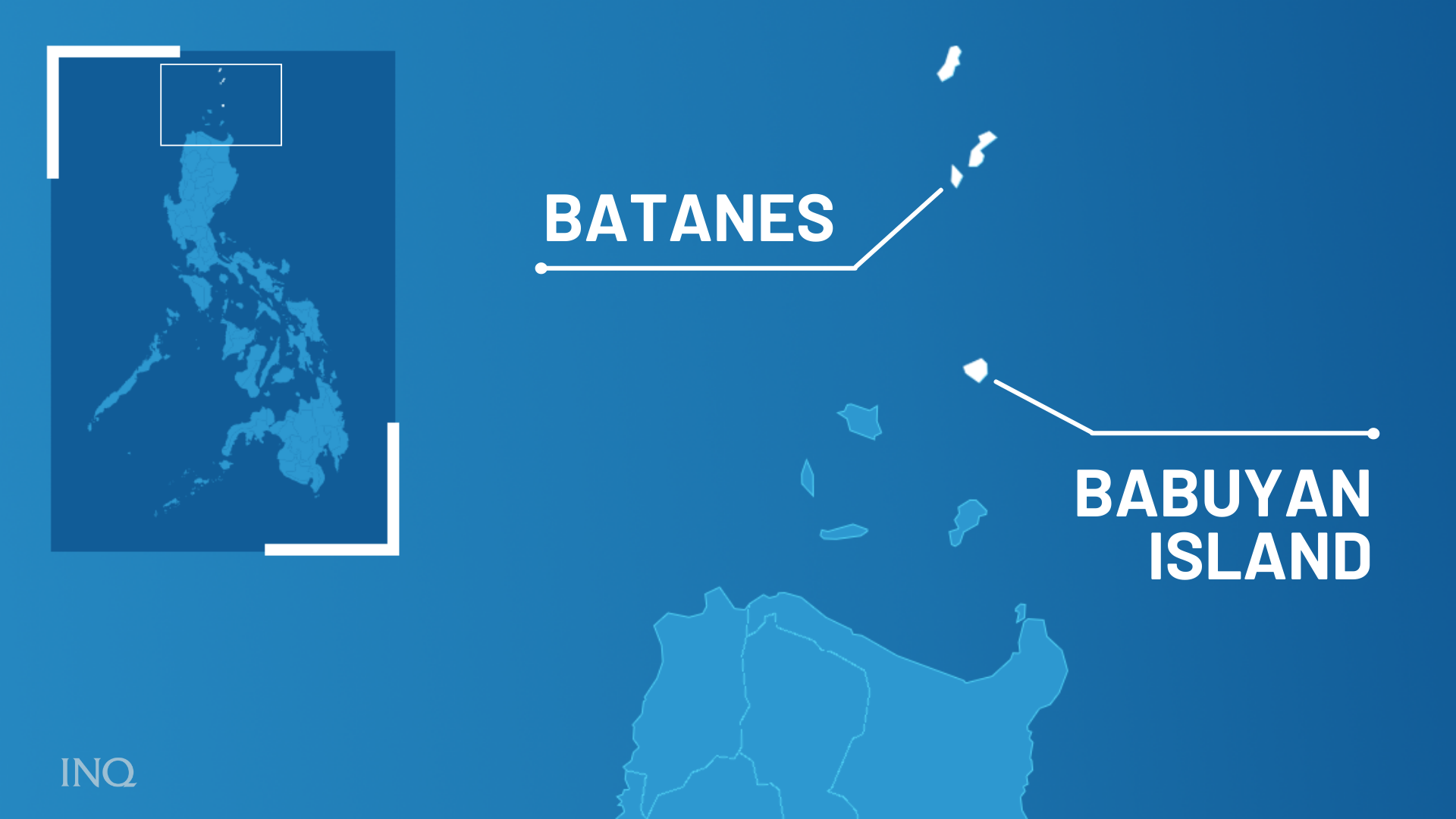
In its 5:00 a.m. update, Pagasa reported that “Henry” was located some 590 kilometers north-northwest of Itbayat, Batanes, moving northwest at 15 kilometers per hour (kph), packing maximum sustained winds of 150 kph near the center and gustiness of up to 185 kph.
Read more
Batanes back to Signal No. 1 as Typhoon Henry heads out of PAR
September 3, 2022 – 06:40 PM
State meteorologists have lowered the Tropical Cyclone Wind Signal (TCWS) hoisted in Batanes down to Signal No. 1 as Typhoon Henry (international name: Hinnamnor) continues to move out of the Philippine Area of Responsibility (PAR) on Saturday.
Both Batanes and the northeastern portion of the Babuyan Islands (Balintag Island, Calayan Island, Camiguin Island, Didicas Island) are under Signal No. 1, as strong winds are expected to prevail within the next 36 hours, the state weather bureau’s bulletin said.
Read more.
Typhoon Henry, southwest monsoon bring flood to Bataan
September 3, 2022 – 06:25 PM

The town of Mariveles in Bataan was hit by flood due to rain dumped by Typhoon Henry.
While Henry did not have a direct effect on Bataan, it did enhance the southwest monsoon or “habagat” prompting the Philippine Atmospheric, Geophysical and Astronomical Services Administration (Pagasa) to issue a weather advisory warning of possible landslides and flash floods in the area due to rain.
Read more.
Makalas na hangin umiihip sa Batanes
Malakas na hangin ang umiihip sa Batanes kaninang umaga dulot ng Bagyong si Henry. Nakataas ang Signal No. 1 sa Batanes at hilagang-silangang bahagi ng Babuyan Islands ayon sa 5pm na bulletin ng Pagasa. (Video: Provincial Government of Batanes)
Posted by Bandera on Saturday, September 3, 2022
Heavy downpour due to Henry triggers flooding in Mariveles
Class suspensions on Saturday, September 3 due to Typhoon Henry
September 3, 2022 – 03:11 PM

Due to inclement weather caused by Typhoon Henry (international name Hinnamnor), classes in several public and private schools were suspended on Saturday, September 3.
Suspended were classes in the following:
ALL LEVELS
Caloocan City
Malabon City
Marikina City
Pasay City
Quezon City
Henry to exit PAR Saturday night, but will still bring rains over Luzon
September 3, 2022 – 011:59 AM

Typhoon “Henry” (international name: Hinnamnor) will exit the Philippine Area of Responsibility on Saturday night, but its effects combined with the southwest monsoon or “habagat” will bring rains over many parts of Luzon, the state meteorologist said.
Henry and the habagat will bring moderate to heavy with at times intense rains over Metro Manila, Ilocos Region, Cordillera Administrative Region, Zambales, and Bataan in the next 24 hours, according to the Philippine Atmospheric Geophysical and Astronomical Services Administration (Pagasa) weather bulletin issued at 11 am.
Read more.
Henry brings strong winds to Batanes
WATCH: As of 8:30 am, Sept 3, the weather situation in Batanes as the typhoon Henry weakens but signal no. 2 still up in the province according to Pagasa. The video was taken in front of Honesty Coffee Shop. Video: Merlyn Gabilo pic.twitter.com/PpsoU5h1ov
— noy (@dMorcosoINQ) September 3, 2022
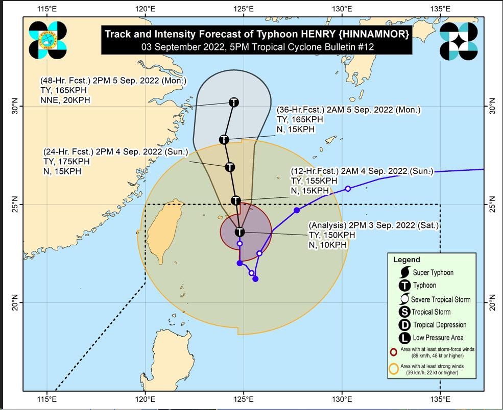
Henry moving away from PH; Rainy, cloudy Saturday expected
September 3, 2022 – 07:10 AM
Typhoon Henry is swirling away from the country but will still trigger moderate to heavy rainfall in Batanes, Babuyan Islands and other parts of Luzon on Saturday.
In its early morning update, Pagasa said “Henry”, as of 3:00 a.m. on Saturday, was spotted some 355 kilometers east-northeast of Itbayat, Batanes with maximum sustained winds of 150 kilometers per hour (kph) near the center and gustiness of up to 185 kph while slowly moving north.
Read more.
Typhoon Henry weakens further, but movement slows down
September 3, 2022 – 12:07AM
Typhoon Henry weakened further o Friday night, but its movement slowed down.
Pagasa’s bulletin at 11:00 p.m. showed that Henry now has maximum sustained winds of 150 kilometers per hour (kph) near the center, and gustiness of up to 185 kph.
Read more.
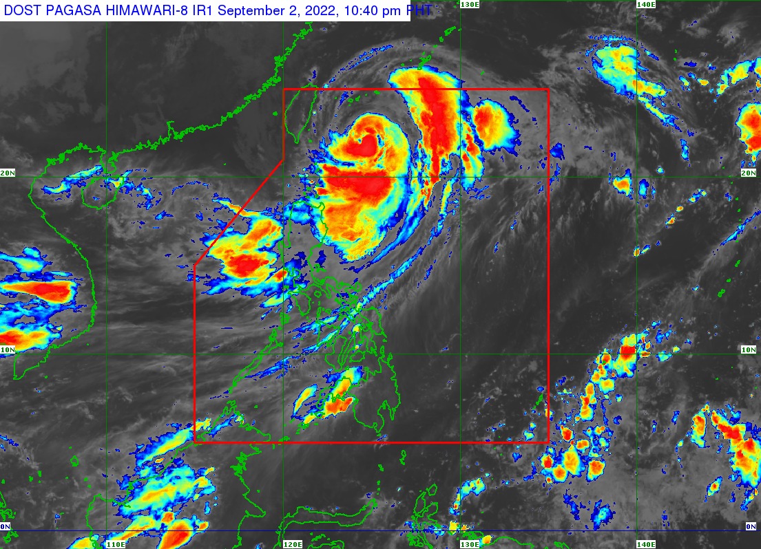
Henry continues to weaken, but Signal No. 2 still up in Batanes
September 2, 2022 – 5:52PM
Typhoon Henry has continued to weaken as of Friday afternoon, but Tropical Cyclone Wind Signal No. 2 is still hoisted over Batanes.
According to Pagasa’s bulletin, as of 5:00 p.m., Henry was last seen 350 kilometers east northeast of Itbayat, Batanes, packing maximum sustained winds of 155 kilometers per hour (kph) near the center and gustiness of up to 190 kph.
Read more.
JUST IN: Pagasa has raised Signal No. 2 over Batanes due to #TyphoonHinnamnor, locally known as Henry. Signal No. 1 is raised over Babuyan Islands and the northeastern portion of mainland Cagayan (Santa Ana). @inquirerdotnet pic.twitter.com/05zNHCCEx0
— Jean Mangaluz (@JMangaluzINQ) September 2, 2022
Batanes under Signal No. 2 due to Typhoon Henry
September 2, 2022 – 12:03PM

State meteorologists have raised Tropical Cyclone Wind Signal (TCWS) No. 2 over Batanes on Friday due to Typhoon Henry.
Pagasa said the Babuyan Islands and the northeastern portion of mainland Cagayan are to remain under TCWS No. 1.
Typhoon Henry is now located 365 kilometers east northeast of Itbayat, Batanes, with maximum sustained winds of 165 kilometers per hour and a gustiness of up to 205 kilometers per hour.
Read more.
1 dead due to Typhoon Henry — NDRRMC
September 2, 2022 – 9:27AM
Dark clouds hover over Batanes as Typhoon Henry (international name: Hinnamnor) approaches. (Image from PIA Batanes / Facebook)
One person was reported dead due to Typhoon Henry (international name: Hinnamnor), the National Disaster Risk Reduction and Management Council said on Friday.
The NDRRMC said the reported fatality was from the Cordillera Administrative Region. No other details given.
NDRRMC has yet to release a report on missing or injured persons.
Read more.
Signal No. 1 in 3 areas as Henry slows down; Rainy Friday in Luzon, Western Visayas
September 2, 2022 – 6:45AM

Tropical Cyclone Wind Signal (TCWS) Number 1 is up over Batanes, Babuyan Islands and Santa Ana, Cagayan where heavy rainfall is expected due to Typhoon Henry (international name: Hinnamnor), the Philippine Atmospheric, Geophysical and Astronomical Services Administration (Pagasa) reported Friday morning.
“Henry” was downgraded Friday from a super typhoon to a typhoon.
Read more.
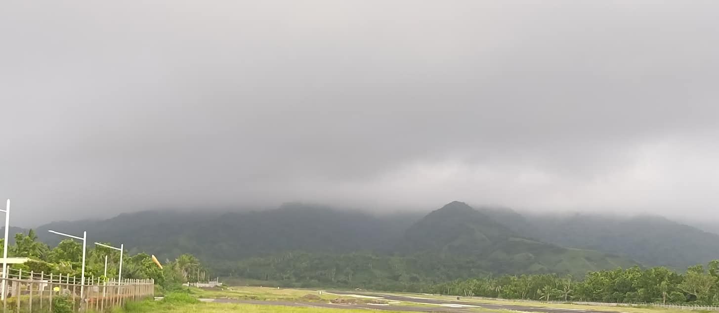
Remote Batanes braces for Super Typhoon Henry
September 2, 2022 – 5:08AM
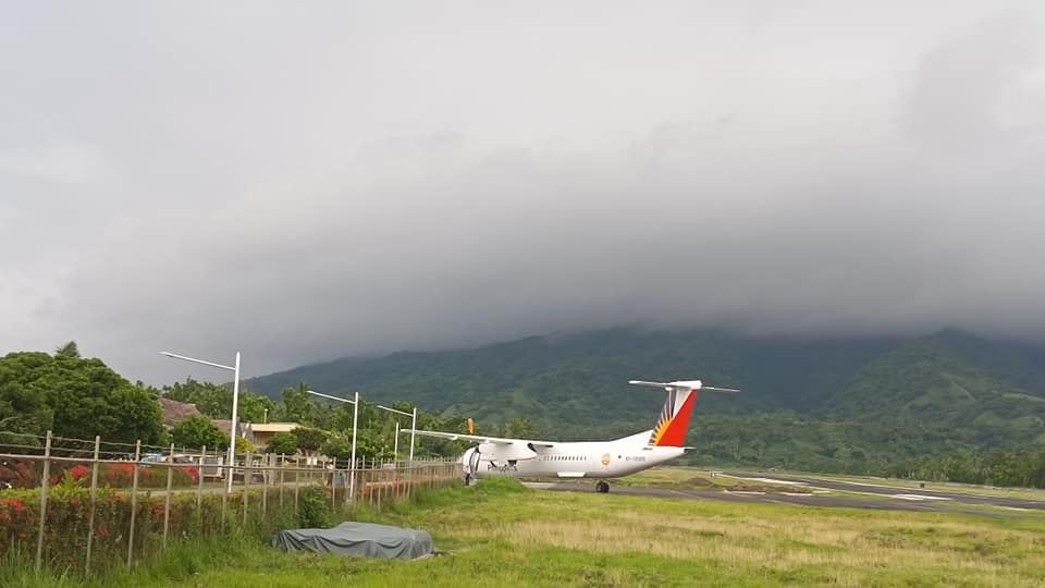
Dark clouds signal the arrival of Super Typhoon Henry in Batanes. Image from PIA Batanes / Facebook
Using fishing nets and bamboo trellis, residents in this northernmost province continued securing their roofs and windows as strong to gale-force winds associated with Super Typhoon Henry (international name: Hinnamnor) were expected on Thursday.
Light rains were already experienced in the island province on Thursday afternoon, and local officials barred fishing boats and other small seacraft from venturing out into the sea.
In this town, classes at all levels were suspended hours before tropical cyclone wind Signal No. 1 was hoisted over the entire province and the northeastern portion of the Babuyan Islands around 5 p.m. on Thursday.
Read more.
Pagasa says may hoist Signal No. 2 as Henry to become ‘almost stationary’ by Friday
September 2, 2022 – 12:31 AM
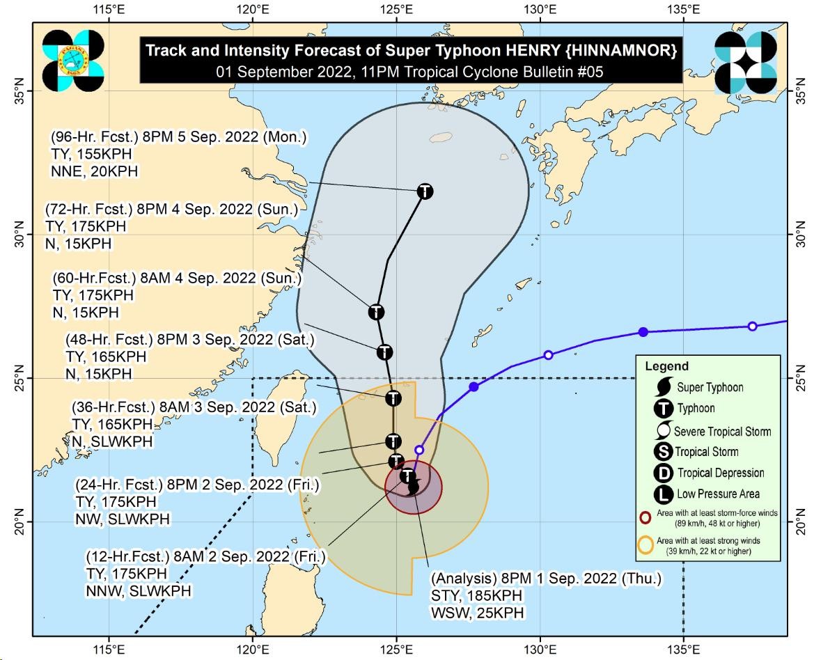
True to earlier forecast, Super Typhoon Henry (international name: Hinnamnor) was seen to be “almost stationary” over the Philippine Sea in the east of Batanes on Friday, and state meteorologists are not ruling out raising the storm signal to Number 2.
The center of the eye of Henry was last located 380 kilometers east of Itbayat, Batanes, packing maximum sustained winds of 185 kilometers per hour (kph), with gustiness of up to 230 kph.
Read more
Pagasa raises Signal No. 1 over Batanes, Babuyan Island due to Super Typhoon Henry
September 1, 2022 – 05:53 PM
The Philippine Atmospheric Geophysical and Astronomical Services Administration on Thursday raised Tropical Wind Signal No. 1 over Batanes and Babuyan Island due to Super Typhoon Henry (international name: Hinnamnor).
Batanes and Babuyan Island will experience strong winds prevailing or expected within the next 36 hours, causing minimal threat to life and property. The areas will also experience moderate to heavy rains on Friday.
Read more
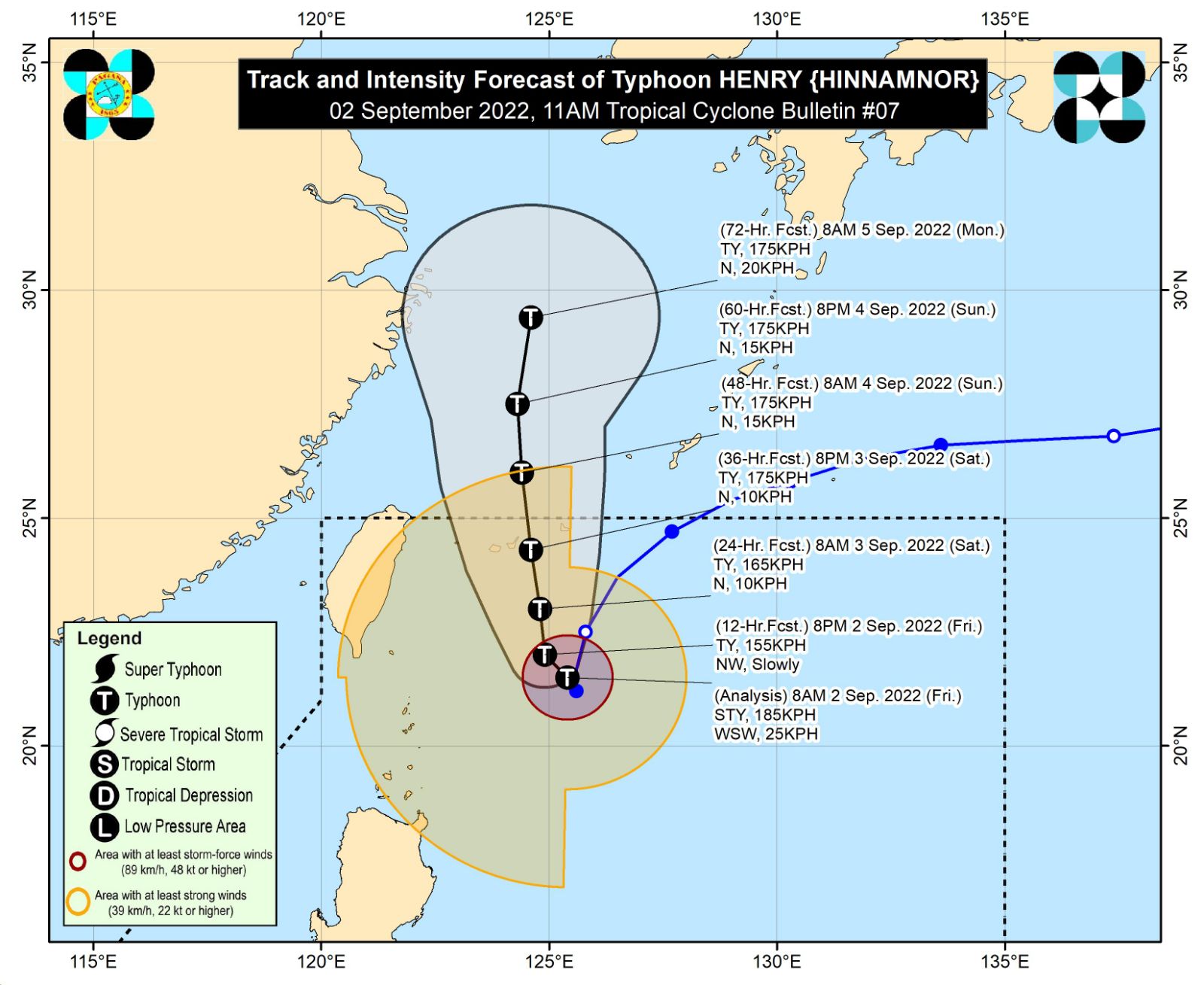
Super Typhoon Henry intensifies, swells after overwhelming LPA
September 1, 2022 – 12:24 PM
Super Typhoon Henry (international name Hinnamnor) gained strength on Thursday, with maximum sustained winds of 195 kilometers per hour and a gustiness of up to 240 kilometers per hour, according to state meteorologists.
Henry, plotted 430 kilometers east-northeast of Itbayat, Batanes, has overwhelmed former Tropical Depression Gardo, now downgraded to a low-pressure system. The low-pressure area did not dampen Super Typhoon Henry’s force, but the storm’s radius vastly expanded.
Read more
Rainy weekend in parts of Luzon, Western Visayas as Henry nears
September 1, 2022 – 6:42 AM
Moderate to heavy rainfall is expected in Batanes and the Babuyan Islands on Thursday as Super Typhoon Henry nd Tropical Depression Gardo maintained their strength while swirling over the Philippine Sea, the state weather bureau said in its 5:00 a.m. update.
Pagasa said “Henry” was spotted some 530 kilometers east – northeast of Itbayat, Batanes, moving southwest at 25 kilometers per hour and packing maximum sustained winds of 185 kph near the center and gustiness of up to 230 kph.
Read more
#INQToday: Henry moves southwestward as it slows down
September 1, 2022
Gardo to weaken and be absorbed by Super Typhoon Henry
September 1, 2022 – 12:24 AM
 Tropical Depression Gardo may weaken within the next 12 hours as Super Typhoon Henry “begins to assimilate its circulation.”
Henry is “unlikely” to directly affect the weather in the country within the forecast period.
Although neither of the two disturbances is expected to make landfall, their combined effects may enhance the southwest monsoon, or habagat.
Read More
Food packs on standby in Central Luzon as Henry enters PH
August 31, 2022 – 9:04 PM
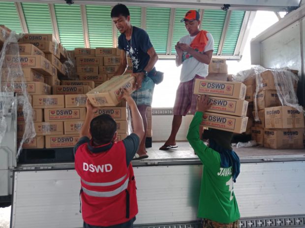
The Department of Social Welfare and Development on Wednesday prepared 450 family food packs worth P361,642 in anticipation of the impact of Tropical Depression Gardo and Super Typhoon Henry in Zambales.
The food packs will be distributed to residents in Subic town, which is expected to experience rain-induced flooding once the two weather systems affect the country.
The DSWD said 500 more family food packs and 50 family kits worth P349,100 were also prepared for residents of Aliaga town in Nueva Ecija province.
Read More
Hinnamnor roars into PAR and is now named Henry
August 31, 2022 – 6:47 PM

Super Typhoon Hinnamnor is now inside the Philippine area of responsibility and will be called Henry
Henry has maximum sustained winds of 195 kilometers per hour near the center and gusts of up to 240 kilometers per hour.
Read More
BREAKING: Super Typhoon Hinnamnor enters the Philippine Area of Responsibility (PAR) at 5:30 p.m. today and is given the domestic name #HenryPH, according to Pagasa. | @JEMendozaINQ pic.twitter.com/vLTHNnun3L
— Inquirer (@inquirerdotnet) August 31, 2022
Super Typhoon Hinnamnor to enter PAR between 6 p.m. and 8 p.m.
August 31, 2022 – 5:46 PM
Super Typhoon Hinnamnor is currently located 870 kilometers northeast of Extreme Northern Luzon, packing maximum sustained winds of 195 kilometers per hour (kph) with gustiness of up to 240 kph.
It will enter PAR between 6 p.m. and 8 p.m. on Wednesday.
Read More
Super Typhoon Hinnamnor to enter PAR Wednesday night
August 31, 2022 – 9:50 AM
Super Typhoon Hinnamnor is likely to enter the Philippine area of responsibility Wednesday evening or early Thursday morning. It will be named “Henry” once it reaches PAR.
Pagasa in its advisory said that Hinnamnor may reach a peak intensity of 205 kph within 24 hours before gradually weakening as it enters its quasi-stationary phase. This tropical cyclone may be downgraded to typhoon category by Friday.”
This means that the weather disturbance will have a bigger diameter in Pagasa’s monitoring instruments, and will have an effect of increased possibility of raising a tropical cyclone wind signal over the area of extreme northern Luzon, such as Batanes and Babuyan Islands.
Read More
Tropical Depression Gardo affects Luzon; super typhoon looms
August 31, 2022 – 5:15AM
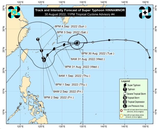
The low pressure area spotted east of extreme northern Luzon has developed into a tropical depression as the Pagasa said that a super typhoon with a possible “peak intensity” of 195 kilometers per hour may enter the country’s area of responsibility by Wednesday evening.
Based on Pagasa’s 4 p.m. update on Tuesday, Tropical Depression Gardo was located at 1,195 kilometers east of extreme northern Luzon.
It was expected to bring cloudy skies with scattered rain showers and thunderstorms to Aurora, Camarines Norte and the Calabarzon region composed of the provinces of Cavite, Laguna, Batangas, Rizal and Quezon.
Read More
Gardo, Hinnamnor likely to merge, strengthen in coming days
August 30, 2022 – 8:17PM
Tropical Depression Gardo and Super Typhoon Hinnamnor may interact, a phenomenon that could enlarge the storm and whip up the southwest monsoon, which is expected to continue during the next few days.
Gardo, formerly a low-pressure area off extreme Northern Luzon, was sitting 1,185 kilometers east of the area on Tuesday evening and bringing winds of 55 kph with gusts of 70 kph.
Super Typhoon Hinnamnor, on the other hand, was still outside the Philippine area of responsibility. It was located 1,485 kilometers east-northeast of extreme Northern Luzon with maximum sustained winds of 185 kph and gustiness of up to 230 kph.
Read More
As super typhoon threatens PH, LPA becomes tropical depression
August 30, 2022 – 6:46PM
The low-pressure area off northern Luzon has strengthened into tropical depression Gardo, adding to the country’s woes as Super Typhoon Hinnamnor threatens to enter the Philippine Area of Responsibility on Wednesday.
Pagasa on Tuesday afternoon said the center of TD Gardo was last plotted 1,195 kilometers east of extreme northern Luzon with maximum sustained winds of 55 kilometers per hour near the center and gustiness of up to 70 kph.
Typhoon Hinnamnor may enter PH on Wednesday night, says Pagasa
August 30, 2022 – 2:01PM
Typhoon Hinnamnor may enter the Philippine area of responsibility on Wednesday night and will be assigned the domestic name “Henry”, Pagasa said.
The center of the eye of Hinnamnor was last located 1,655 kilometers east-northeast of extreme Northern Luzon, packing maximum sustained winds of 165 kilometers per hour (kph) near the center and gustiness of up to 205 kph.
Pagasa also said the typhoon exhibits strong typhoon-force winds that extend for up to 320 kilometers from its center.
Read More
LPA emerges; easterlies to bring fair weather nationwide
August 30, 2022 – 6:00AM
While a low pressure areahas emerged east of extreme Northern Luzon, fair weather will still prevail across the archipelago due to the easterlies, said the state weather bureau.
An early morning forecast Pagasa showed that the LPA may either develop into a storm or be absorbed by the intensified typhoon being monitored outside the Philippine area of responsibility.
Read More
Click here for more weather related news.


Subscribe to INQUIRER PLUS to get access to The Philippine Daily Inquirer & other 70+ titles, share up to 5 gadgets, listen to the news, download as early as 4am & share articles on social media. Call 896 6000.


