Tropical Depression Gardo affects Luzon; super typhoon looms
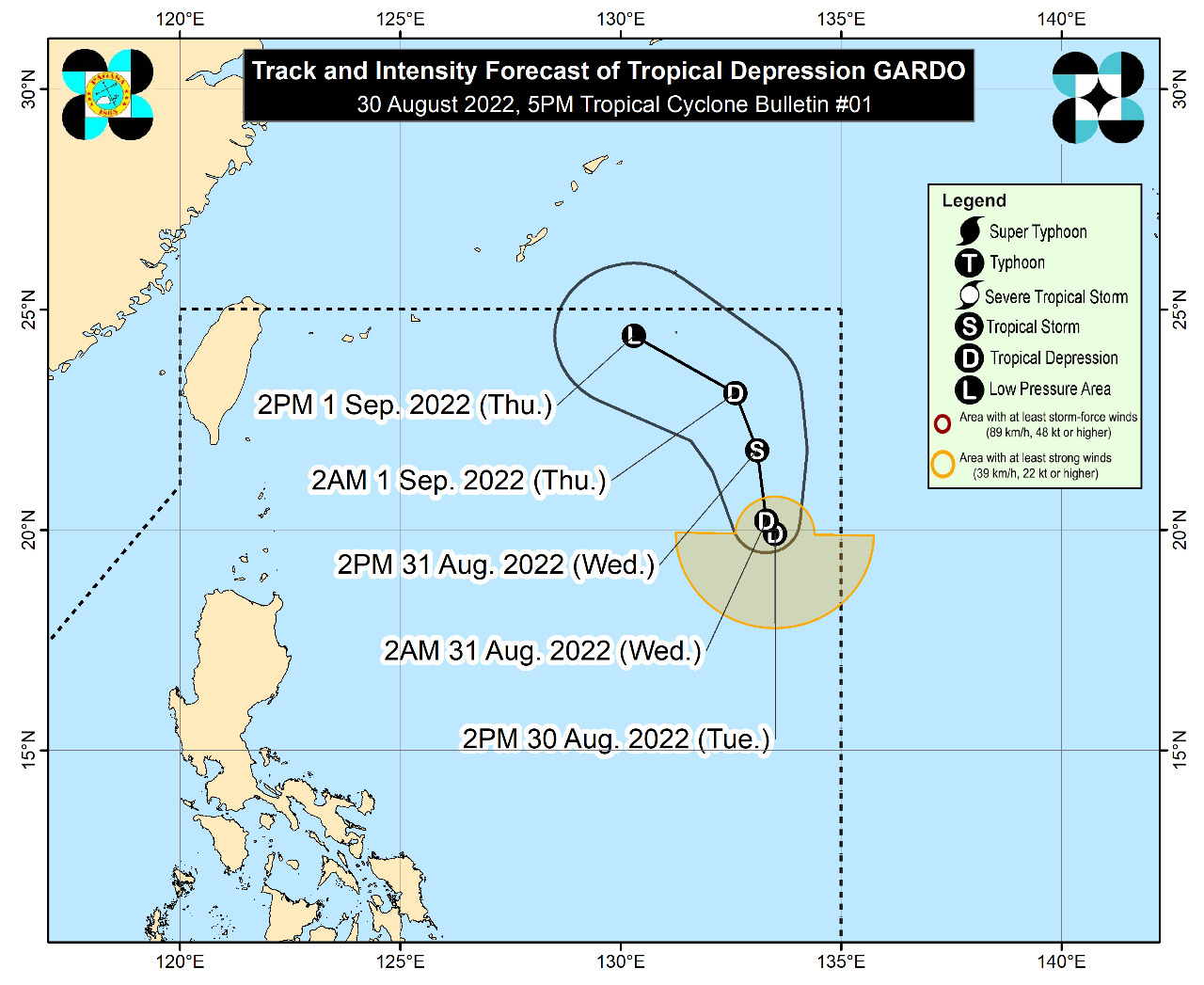 MANILA, Philippines — The low pressure area (LPA) spotted east of extreme northern Luzon has developed into a tropical depression as the Philippine Atmospheric, Geophysical and Astronomical Services Administration (Pagasa) said that a supertyphoon with a possible “peak intensity” of 195 kilometers per hour (kph) may enter the country’s area of responsibility by Wednesday evening.
Based on Pagasa’s 4 p.m. update on Tuesday, Tropical Depression Gardo was located at 1,195 kilometers east of extreme northern Luzon.
It was expected to bring cloudy skies with scattered rain showers and thunderstorms to Aurora, Camarines Norte and the Calabarzon region composed of the provinces of Cavite, Laguna, Batangas, Rizal and Quezon.
Pagasa also alerted residents in those areas to possible flash floods or landslides “due to scattered light to moderate to at times heavy rains.”
“Gardo” is packing maximum sustained winds of 55 kph, with gustiness of up to 70 kph. It is moving west-southwestward at 15 kph, the state weather bureau said.
It added that Supertyphoon “Hinnamnor” was last monitored 1,485 km east northeast of extreme northern Luzon, almost near Gardo’s location. It moved generally westward over the sea south of Japan and by Wednesday, it was forecast to move west-southwestward “while decelerating over the sea southeast” of Ryukyu Islands.
Pagasa said that “Hinnamnor” might enter the country’s area of responsibility and would be named “Henry.” “It turns more southwestward in the northern Philippine Sea. By Friday (Sept. 2) through Saturday (Sept. 3), ‘Hinnamnor’ may become almost stationary,” it added.
Initially categorized by Pagasa as a storm, “Hinnamnor” intensified into a supertyphoon on Tuesday afternoon. It may continue to intensify over the sea south of Japan and could reach its “peak intensity” of 195 kph.
It may also continue to expand “in the coming days” as it moves in the direction of the northern Philippine Sea.
RELATED STORY
As supertyphoon threatens PH, LPA becomes tropical depression