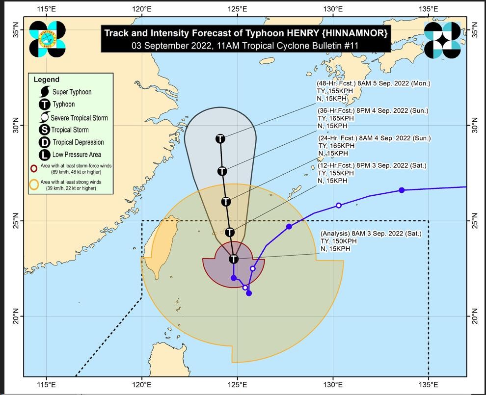
‘Henry’ to exit PAR Saturday night, but will still bring rains over Luzon
MANILA, Philippines (Updated) — Typhoon “Henry” (international name: Hinnamnor) will exit the Philippine Area of Responsibility on Saturday night, but its effects combined with the southwest monsoon or “habagat” will bring rains over many parts of Luzon, the state meteorologist said.
Henry and the habagat will bring moderate to heavy with at times intense rains over Metro Manila, Ilocos Region, Cordillera Administrative Region, Zambales, and Bataan in the next 24 hours, according to the Philippine Atmospheric Geophysical and Astronomical Services Administration (Pagasa) weather bulletin issued at 11 am.
The rest of Central Luzon, Calabarzon, Cagayan, Isabela, Quirino, and Nueva Vizcaya will also experience light to moderate with at time heavy rains.
Henry was last spotted 405 kilometers northeast of Itbayat, Batanes, packing maximum sustained winds of 150 kilometers per hour (kph) near the center and gustiness of up to 185 kph.
“Typhoon ‘Henry’ will continue moving generally northward throughout the weekend,” Pagasa said in its advisory.
Article continues after this advertisement“On the track forecast, the typhoon may pass very close or make landfall in the southern islands of the Ryukyu Archipelago tonight and exit the Philippine Area of Responsibility tonight,” it added.
Article continues after this advertisementBatanes remains under Tropical Cyclone Wind Signal No. 2, where gale-force winds are now prevailing or expected within 24 hours.
Babuyan Islands and the northeastern portion of mainland Cagayan are under TCWS No. 1, where strong winds now prevail or are expected within 36 hours.
Pagasa also said that Batanes and Babuyan Islands will experience moderate to heavy rains for the entire Saturday.
RELATED STORY
Typhoon Henry moving away from PH; Rainy, cloudy Saturday expected
