‘Yolanda’ weakens as it moves away from PH

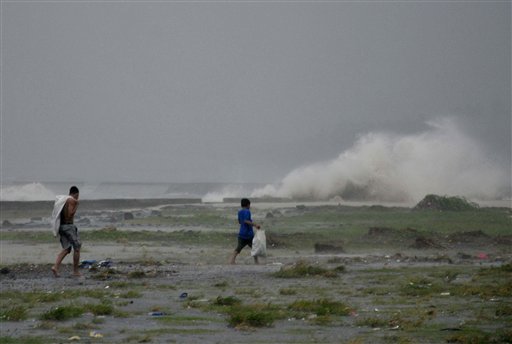
Residents sift through the shoreline amidst a storm surge brought about by powerful typhoon Haiyan (Philippine name: Yolanda) at Legazpi city, Albay province about 520 kilometers ( 325 miles) south of Manila, Philippines Friday Nov. 8, 2013. AP
MANILA, Philippines—Supertyphoon “Yolanda” continued to weaken as it moved into the West Philippine Sea and made its way out of the country Saturday morning.
The typhoon also slowed down and was moving west northwest at 35 kilometers per hour over the West Philippine Sea, the name the Philippines has given to that part of the South China Sea within its exclusive economic zone.
At 12:00 noon, the eye of typhoon was located 615 kilometers west of San Jose, Occidental Mindoro, the Philippine Atmospheric, Geophysical and Astronomical Services Administration said.
The typhoon had sustained winds of 250 kph near the center and gusts of up to 275 kph when it made the first of its six landfalls in Eastern Samar Friday morning.
The typhoon made first landfall on Guiauan, Eastern Samar, at around 4:40 a.m. Friday. It hit land again between the towns of Dulag and Tolosa in Leyte, then in Daanbantayan in Cebu, again on Bantayan Island, also in Cebu, and in Concepcion in iloilo later Friday morning. Friday night at around 8 p.m, the typhoon made a sixth landfall on Busuanga, Palawan.
Article continues after this advertisementThe state weather bureau said all storm warnings had been lowered in the Visayas and Mindanao by 11 a.m. Saturday and public storm signal No. 1 remained hoisted over northern Palawan, including Puerto Princesa City.