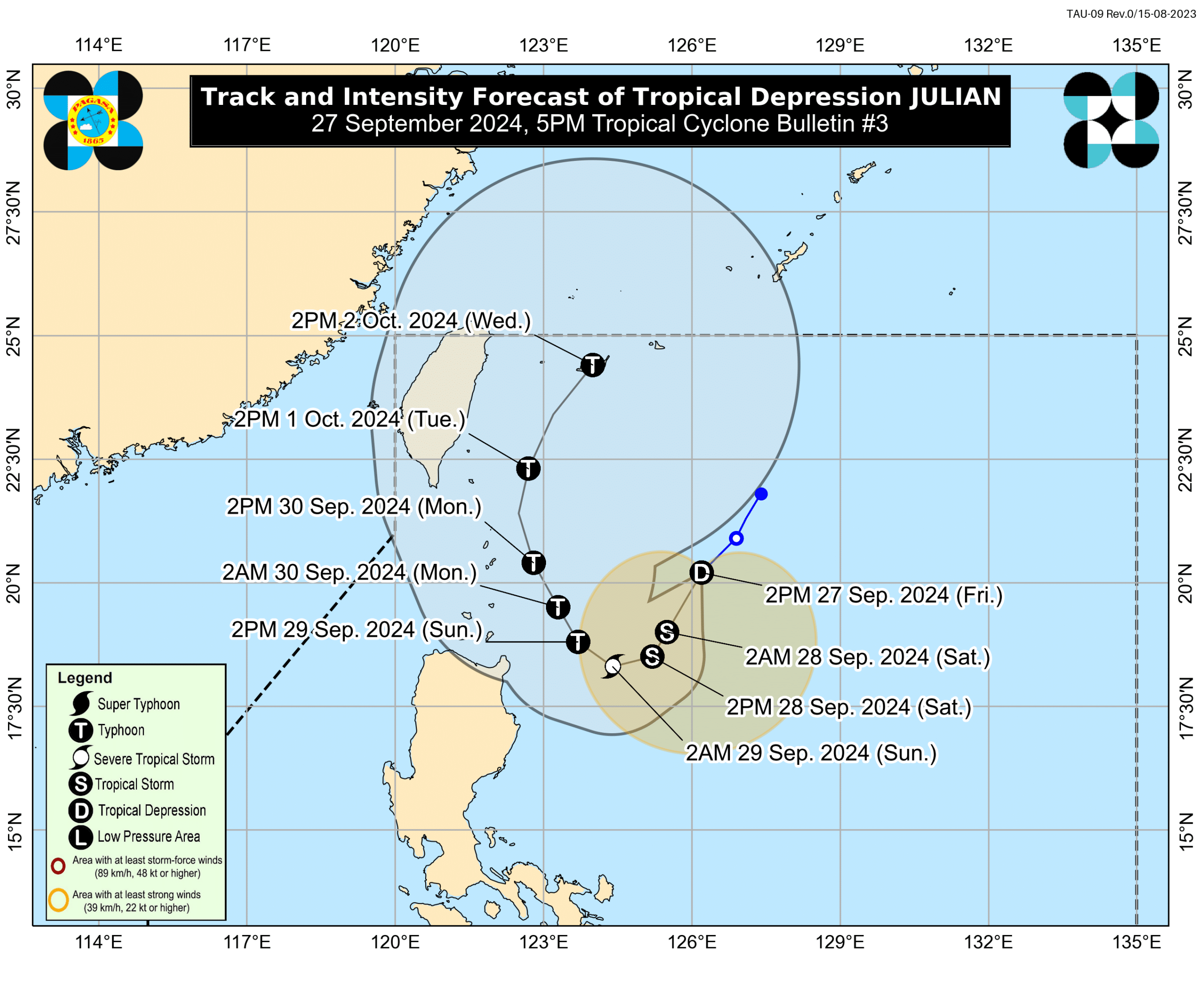

MANILA, Philippines — Tropical Depression Julian maintained its strength as it moved over east of Batanes on Friday afternoon, the Philippine Atmospheric, Geophysics, and Astronomical Services Administration (Pagasa) said.
In its 5 p.m. weather advisory, Pagasa said that Tropical Cyclone Wind Signal (TCWS) No. 1 was raised over Babuyan Islands as well as over the eastern portion of mainland Cagayan (Santa Ana, Gonzaga, Gattaran, Lal-lo, Baggao, Buguey, Aparri, Santa Teresita, Camalaniugan, Peñablanca, and Ballesteros).
Pagasa said that areas under TCWS No. 1 may experience minimal to minor impacts of strong winds. It added that the highest wind signal that may be hoisted as Julian lingers is TCWS No. 3 or 4.
READ: LPA inside PAR turns into Tropical Depression Julian
The weather bureau also forecast that Julian will further intensify and may develop into a tropical storm and typhoon category in the coming days.
“The tropical depression will continuously intensify throughout the forecast period and may reach tropical storm category tonight or tomorrow morning. Furthermore, it may become a typhoon on Sunday. Rapid intensification is increasingly likely,” Pagasa said.
The projected path of Julian may be closer to Extreme Northern Luzon as “there is an increasing chance that the track forecast will shift westward in the succeeding bulletins.”
Furthermore, the wind flow towards Julian may also bring strong to gale-force gusts over the following areas:
- For Saturday, September 28: Aurora and the northern portion of Quezon
- For Sunday, September 29: Aurora, Calabarzon (Cavite, Laguna, Batangas, Rizal, and Quezon), Romblon, Marinduque, Bicol Region, Aklan, and the northern portion of Antique
Meanwhile, Pagasa’s thunderstorm advisory said that Zambales, Bataan, Batangas, Cavite, Metro Manila, Laguna, Rizal, Quezon, Tarlac, and Nueva Ecija will experience moderate to heavy rain showers within the next two hours.
Pampanga (Porac, Floridablanca, Lubao, Sasmuan, Macabebe, and Masantol) and Bulacan (Hagonoy, Paombong, Bulakan, Malolos) are experiencing heavy to intense rain showers with lightning and strong winds and may persist within two hours.
Julian was last spotted east southeast of Itbayat, Batanes, or east of Basco, Batanes, packing up maximum sustained winds of 55 kilometers per hour (km/h) and gustiness of up to 70 km/h. It is moving southwestward at 20 km/h.
Pagasa in its early morning forecast said that Julian, the 10th tropical cyclone to affect the country this year and the sixth in September, was expected to put Cagayan Valley under TCWS No.1 later Friday.
READ: Pagasa: LPA may form inside PAR and become a storm by weekend