Pagasa: LPA may form inside PAR and become a storm by weekend
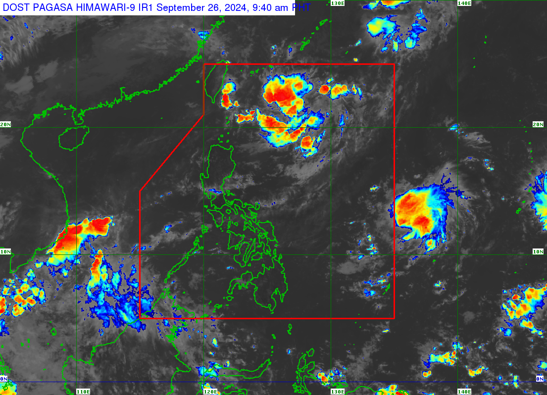
The Philippine Atmospheric, Geophysical and Astronomical Services Administration (Pagasa) is monitoring two weather disturbances, including a low-pressure area (LPA), inside and outside the Philippine area of responsibility (PAR). Weather satellite image from Pagasa
MANILA, Philippines — The Philippine Atmospheric, Geophysical and Astronomical Services Administration (Pagasa) is monitoring two weather disturbances inside and outside the Philippine area of responsibility (PAR).
One is a low-pressure area (LPA) outside the PAR and cloud clusters, which may become an LPA inside the country’s jurisdiction.
The state meteorologist said the cloud clusters forming north of Luzon are likely to develop into an LPA within Thursday or by Friday, and may strengthen into a tropical cyclone over the weekend – which may then be given the name “Julian” as the 10th cyclone to affect the Philippines since January.
“Possible LPA for today or tomorrow. And over the weekend, posible itong maging bagyo at mananatili lamang po sa may northern Luzon, dito sa silangan po ng Batanes,” explained Pagasa specialist Benison Estareja during an early morning weather report.
(A possible LPA may be expected from the cloud clusters today or tomorrow. And over the weekend, it may develop into a tropical cyclone. However, it will likely remain near northern Luzon, specifically east of Batanes.)
Article continues after this advertisement“Kung saka-sakaling makaapekto po ito, more on mga areas lamang po sa Northern Luzon. At kung sakaling magiging bagyo ay bibigyan natin ito ng pangalan na ‘Julian’ na siyang magiging pang-sampung bagyo na for this year 2024 at pang-anim naman po for the month of September,” Estareja added.
Article continues after this advertisement(If it affects any areas, it will mainly impact Northern Luzon. And should it develop into a tropical cyclone, it will be named “Julian,” making it the 10th tropical cyclone of the year 2024 and the sixth for September.)
READ: LPA may form or enter PAR by weekend, says Pagasa
As for the LPA outside PAR, Pagasa said its last available data showed its location at 2,750 kilometers (km) east of Central Luzon. This LPA, the state weather agency noted, is “less likely” to enter PAR as it is expected to move toward the North Pacific Ocean and may turn into a light storm within Thursday or Friday.
Pagasa also reported that for Thursday’s weather forecast, Palawan and areas in Visayas and Mindanao would see cloudy skies and rain due to the intertropical convergence zone (ITCZ).
“Itong ITCZ ang siyang linya kung saan nagkakasalubong ang hangin from the northern and southern hemispheres, kaya mataas po ang tyansa ng kaulapan doon,” Estareja explained.
(The ITCZ is the zone where winds from the northern and southern hemispheres converge, leading to a high chance of cloud formation in the affected area.)
READ: Pagasa monitors 2 LPAs in and outside PH area of responsibility
Easterlies, or the winds coming from the Pacific Ocean, will also continue to influence the country’s weather on Thursday, Estareja further said.
In Metro Manila and the rest of Luzon, a generally warm Thursday could be expected, Pagasa said.
“Ang ating weather conditions halos katulad po ng yesterday, bahagyang maulap at mas magiging maulap ang kalangitan, at pagsapit ng hapon o gabi may mga biglaang pag-ulan o localized thunderstorm na nagtatagal lamang po ng hanggang dalawa o tatlong oras,” according to Pagasa.
(Our weather conditions will be similar to yesterday, with partly cloudy to cloudy skies. Localized thunderstorms may be experienced in the afternoon or evening, which will last for only two to three hours.)
No gale warning was raised over any seaboard of the country for Thursday, September 26.