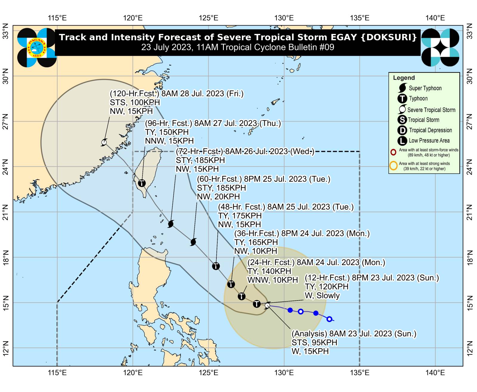
Pagasa monitors Egay was last monitored 610 kilometers east of Daet, Camarines Norte, moving 15 kilometers per hour and carrying maximum sustained winds of 95 kph and gusts of up to 115 kph. (Photo courtesy of Pagasa)
MANILA, Philippines — Tropical storm Egay (international name: Doksuri) has intensified into a severe tropical storm while moving westward over the Philippine Sea, according to the state weather bureau.
According to the Philippine Atmospheric, Geophysical and Astronomical Services Administration’s (Pagasa) 11 a.m. weather bulletin, Egay was last monitored 610 kilometers (km) east of Daet, Camarines Norte, moving 15 kilometers per hour (kph) and carrying maximum sustained winds of 95 kph and gusts of up to 115 kph.
“Egay is forecast to move slowly in the next 12 hours and accelerate west-northwestward or westward until tomorrow morning. Afterward, it will turn generally northwestward for the remainder of the forecast period,” the state weather bureau said.
Moreover, Pagasa said that wind signals may be raised in some parts of the Bicol Region and Eastern Visayas within the day due to the effects of Egay.
“Current forecast scenario shows that the highest wind signal that may be hoisted will be Wind Signal No. 3 or 4, potentially over Extreme Northern Luzon,” the agency said.
It added that the severe tropical storm is expected to reach the typhoon category within 24 hours and may strengthen into a super typhoon by Tuesday.
Pagasa said that Egay may move close or make landfall near extreme Northern Luzon by Wednesday (June 26) and make landfall over the east coast of Taiwan on Thursday morning (July 27).
RELATED STORIES
Pagasa: Egay may develop into typhoon in 24 hours, super typhoon by Tuesday
Egay may become a super typhoon by Monday, threatening Sona