Egay may become a super typhoon by Monday, threatening Sona

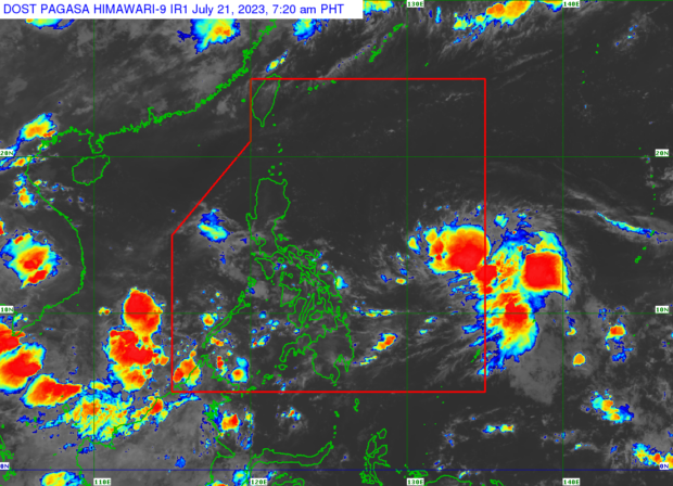
Pagasa monitors the potential cyclone within the Philippine area of responsibility. The low-pressure area was located 950 kilometers east of Southeastern Luzon, based on the state weather bureau’s 4 a.m., July 21, 2023 bulletin. (Satellite image from Pagasa’s website)
MANILA, Philippines – The low-pressure area (LPA) monitored by the state weather bureau east of Southeastern Luzon has now developed into Tropical Depression Egay.
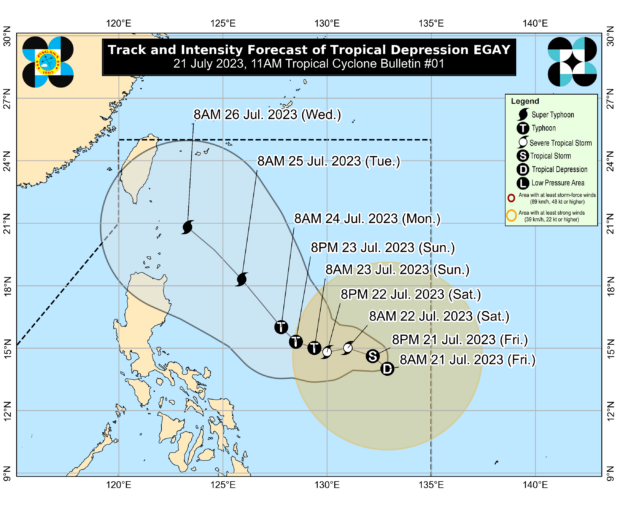
Egay, which has maintained its strength as of Friday afternoon, is the fifth tropical cyclone to hit the Philippines in 2023 and the second in July.
A super typhoon may develop from Tropical Depression Egay by Monday, July 24, forecasters said.
President Ferdinand “Bongbong” Marcos Jr. is set to deliver his second State of the Nation Address on this day.
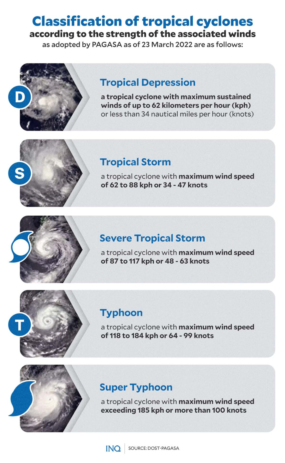
A super typhoon is a powerful storm with gusts of at least 240 kph and may cause damage to coastal towns and buildings.
Article continues after this advertisementOn Friday afternoon, the Philippine Atmospheric, Geophysical and Astronomical Services Administration (Pagasa) said the center of Egay was last plotted 835 kilometers east of southeastern Luzon.
Article continues after this advertisementIt has maximum sustained winds of 55 kilometers per hour (kph) near the center and a gustiness of up to 70 kph.
Currently, is moving north-northwest at 20 kph.

Egay’s trajectory and intensity movement: North-Northwest at a slow pace
Ana Clauren-Jorda, a Pagasa weather specialist, forecast that Egay might become a tropical storm in 12 hours.
It might become a super typhoon by Monday, July 24, while in the Philippines.
“Egay is forecast to move slowly in the next 24 hours and will [generally track] west-northwestward until late Sunday before turning northwestward over the Philippine Sea east of Luzon for the remainder of the forecast period,” said the state weather bureau in its 11 a.m. bulletin.
Pagasa said Egay might make landfall in eastern mainland Cagayan and Batanes.
From July 23, Egay will bring 50-100mm of rain to Catanduanes and Northern Samar.
“In areas that will not be directly affected by Egay, monsoon rains from the enhanced southwest monsoon are possible over the western sections of Mimaropa and Visayas on Sunday,” said Clauren-Jorda.
“On Monday and Tuesday, monsoon rains are likely over the western sections of Southern Luzon and Western Visayas,” she added.
Egay may prompt Pagasa to raise wind signals in Bicol and Eastern Visayas on July 22 or 23.
“Considering these developments, the public and disaster risk reduction and management offices concerned are advised to take all necessary measures to protect life and property. Persons living in areas identified to be highly or very highly susceptible to these hazards are advised to follow evacuation and other instructions from local officials,” Pagasa said in its Friday afternoon bulletin.
Rain alert
“In areas that will not be directly affected by Egay, monsoon rains from the enhanced southwest monsoon are possible over the western section of Minaropa (Mindoro, Marinduque, Romblon, Palawan) and Visayas on Sunday. On Monday and Tuesday, monsoon rains are likely over the western section of Southern Luzon and Western Visayas,” Pagasa said.
“Under these conditions, flooding and rain-induced landslides are possible, especially in areas that are highly or very highly susceptible to these hazard as identified in hazard maps and in localities that experienced considerable amounts of rainfall for the past several days,” it added.


