LIVE UPDATES: Typhoon Chedeng
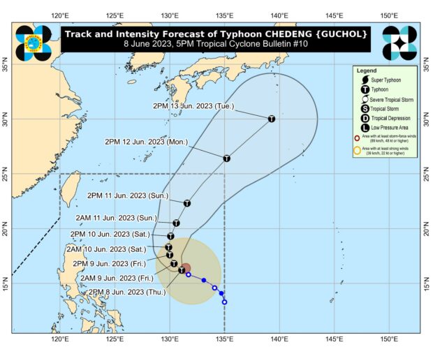
Chedeng weakens to severe tropical storm, to exit PAR on Monday
June 11, 2023 – 05:18 PM
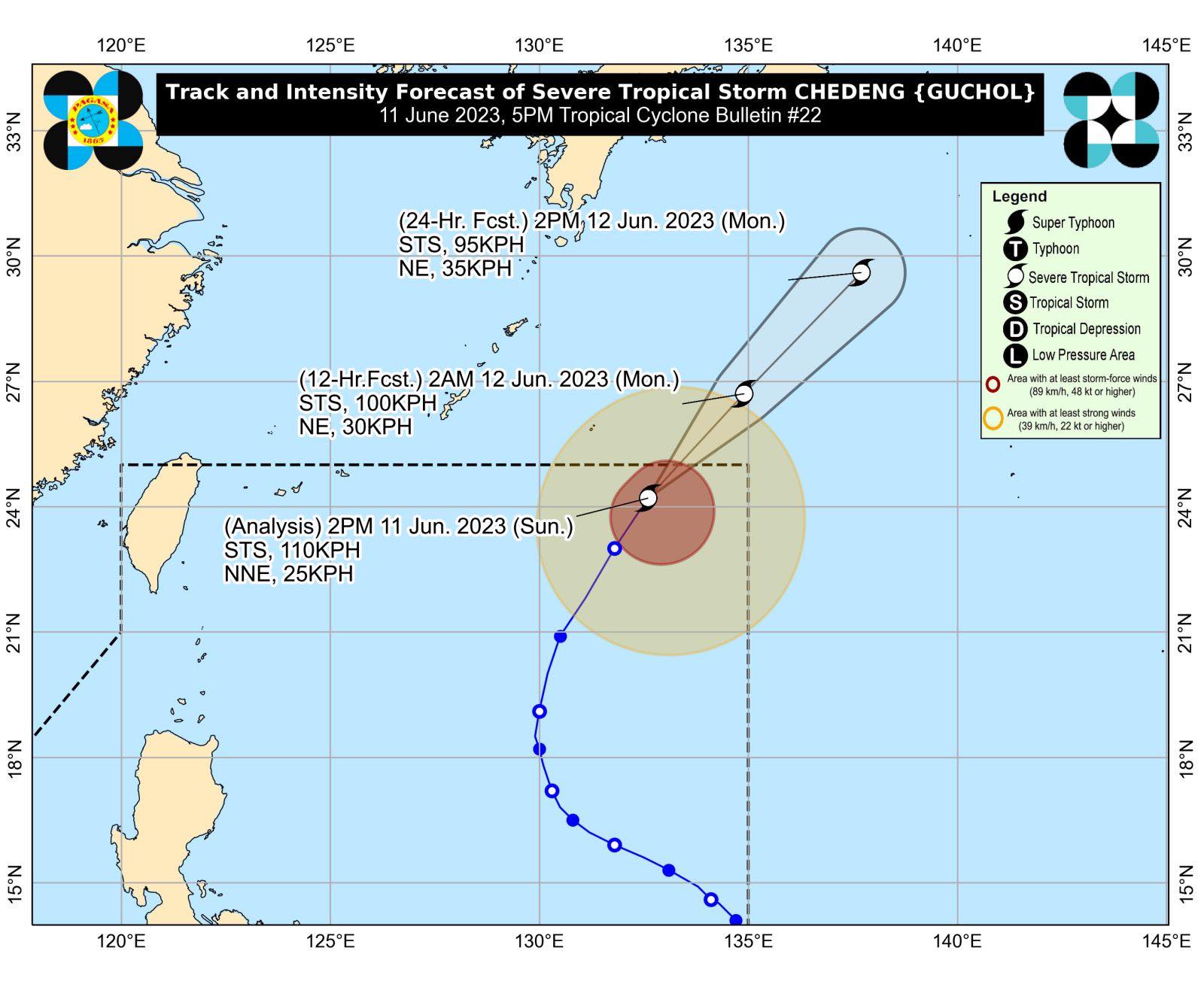
Chedeng (International name: Guchol) has weakened into a severe tropical storm as it continues to move north-northwestward over the Philippine Sea, according to the Philippine Atmospheric, Geophysical and Astronomical Services Administration (Pagasa).
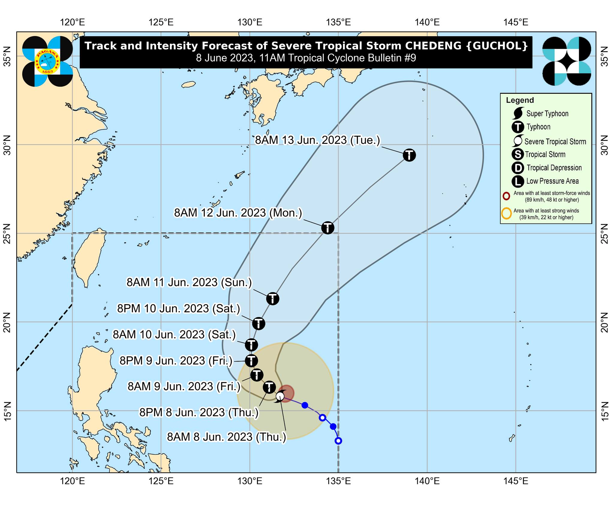
Typhoon Chedeng further weakens, accelerates away from Philippine landmass
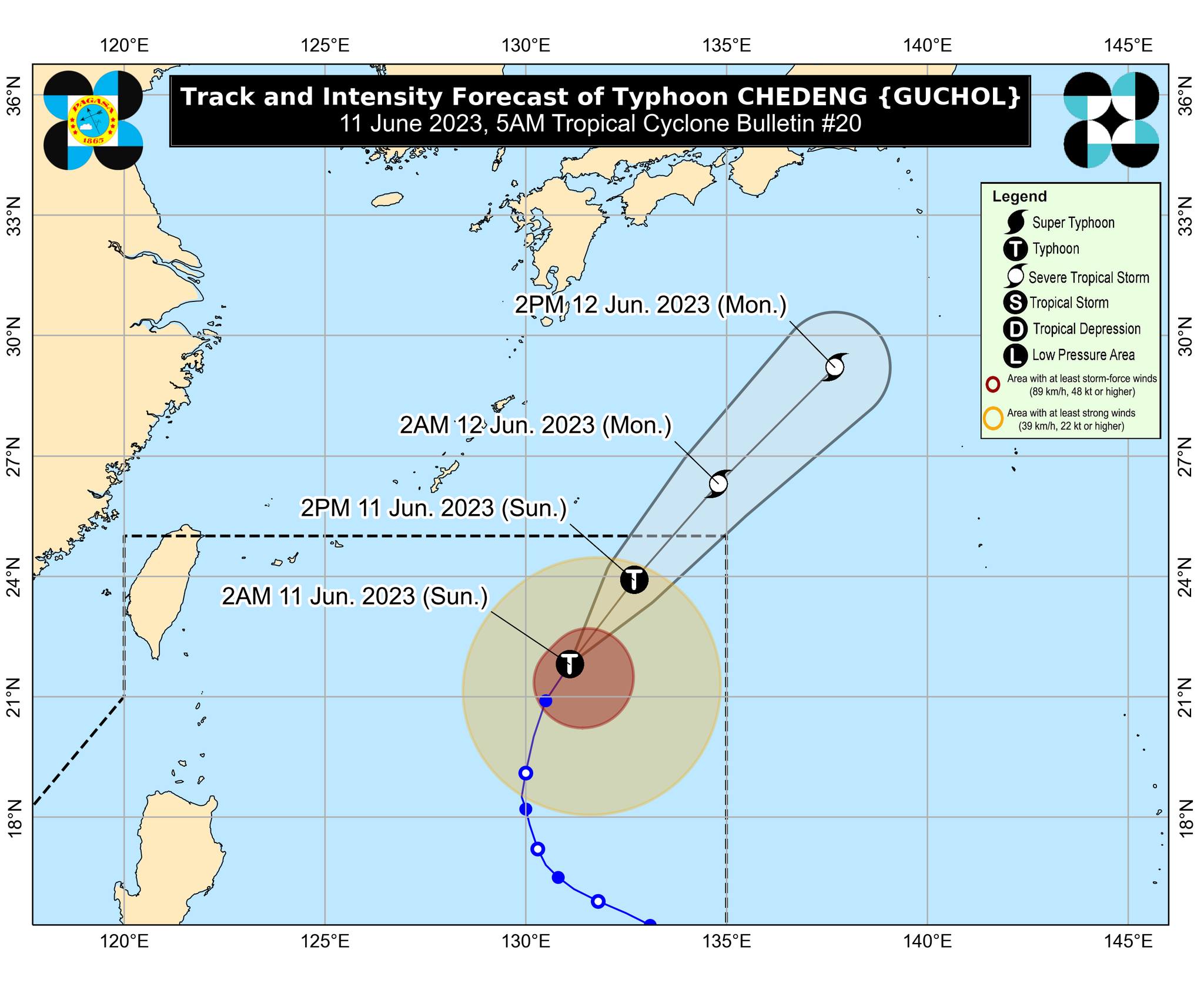
June 11, 2023 – 09:16 AM
Courtesy of Pagasa
Typhoon Chedeng (international name: Guchol) has further weakened as it accelerated over the Philippine Sea east of extreme northern Luzon, the Philippine Atmospheric, Geophysical and Astronomical Services Administration (Pagasa) said on Sunday.
Based on Pagasa’s 5 a.m. bulletin, Chedeng was last monitored 990 kilometers (km) east of extreme northern Luzon, moving north-northeastward at 20 kilometers per hour (kph) with maximum sustained winds of 130 kph and gusts of up to 160 kph.
Pagasa: Chedeng to exit PAR within next 2 days but habagat may still bring rain
June 10, 2023 – 09:41 AM

Weather update. Graphics by INQUIRER.net
The southwest monsoon will bring cloudy skies with scattered rain, thunder, and lightning to western parts of the country on Saturday, according to the Philippine Atmospheric, Geophysical and Astronomical Services Administration (Pagasa).
These overcast skies and scattered disturbances will affect southern Luzon, and western sections of Visayas and Mindanao— bringing high chances of rain to Metro Manila and western areas of Luzon and Visayas in particular, said weather specialist Daniel Villamil in a morning forecast.
Monsoon rains enhanced by Chedeng to prevail in Visayas, other areas
June 9, 2023 – 5:50PM
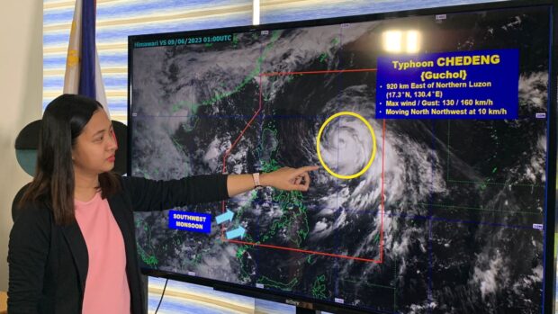
Pagasa’s weather specialist Ana Clauren-Jorda showing the satellite image of typhoon Chedeng during the 11 a.m. press briefing on Friday, June 9, 2023 in Quezon City. | Photo by INQUIRER.net / NOY MORCOSO
While state meteorologists are unlikely to raise a wind signal due to Typhoon Chedeng (international name Guchol), Visayas and several areas can expect rains due to the southwest monsoon or “habagat,” which was strengthened by Chedeng.
According to the Philippine Atmospheric, Geophysical and Astronomical Services Administration (Pagasa) on Friday, Chedeng is currently 885 kilometers east of northern Luzon.
Chedeng to enhance ‘habagat’, rain expected in parts of Luzon – Pagasa
June 9, 2023 – 7:38AM
Typhoon Chedeng (international name: Guchol) is forecast to reach peak intensity on Friday and trigger rain in parts of Luzon by enhancing the southwest monsoon or “habagat”, state meteorologists said.
“Chedeng is likely reaching its peak intensity within the next 24 to 36 hours due to marginally favorable environmental conditions,” the Philippine Atmospheric, Geophysical and Astronomical Services Administration (Pagasa) said in its 5:00 am update.
Read more.
Typhoon Chedeng to exit PAR on Sunday evening at the earliest — Pagasa
June 8, 2023 – 11:19 PM
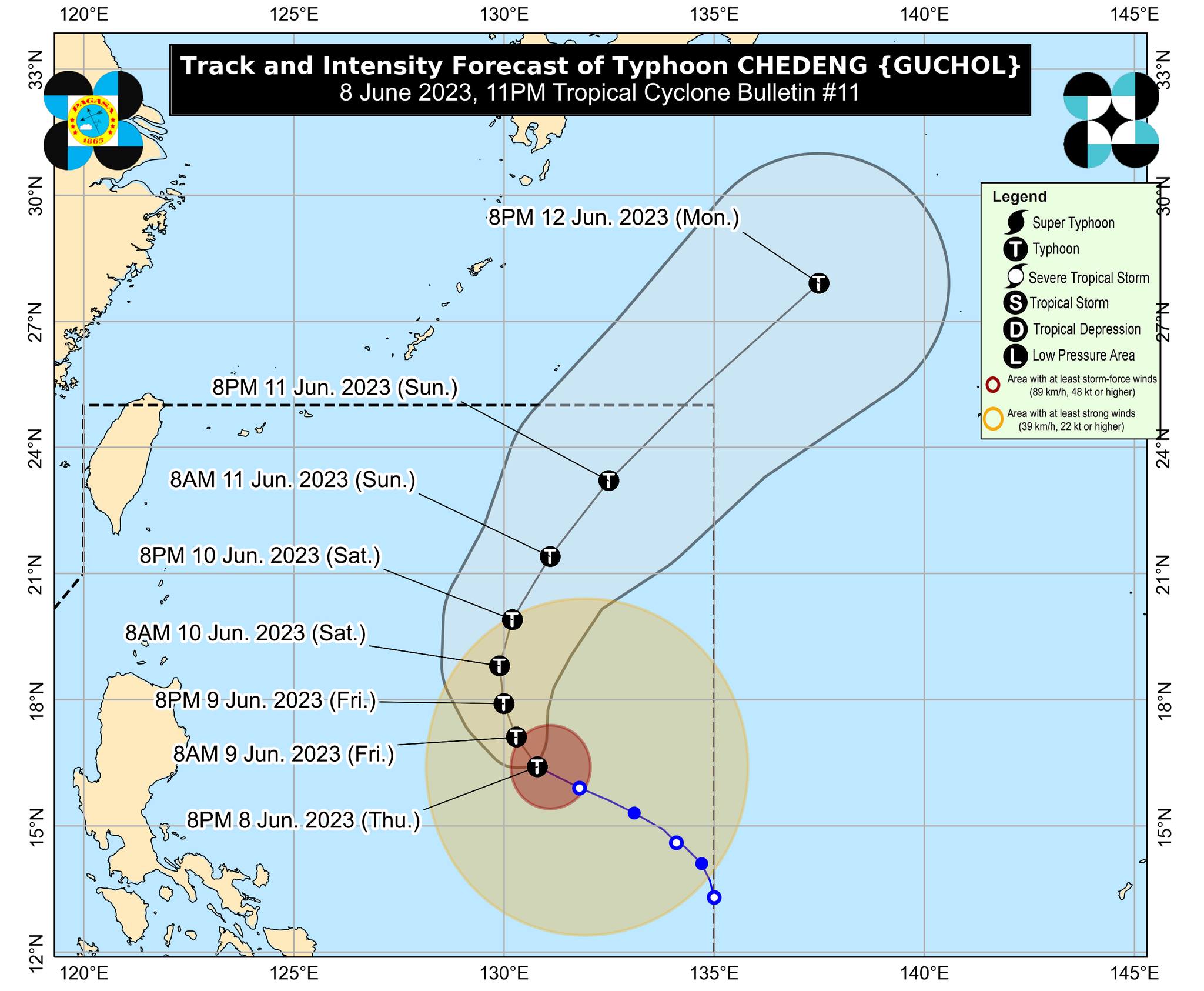
Typhoon Chedeng will exit the Philippine area of responsibility on Sunday evening at the earliest, state meteorologists said.
“On the track forecast, the tropical cyclone will leave the Philippine Area of Responsibility on Sunday evening or Monday morning,” the Philippine Atmospheric, Geophysical and Astronomical Services Administration (Pagasa) said in its 11:00 p.m. update on Thursday.
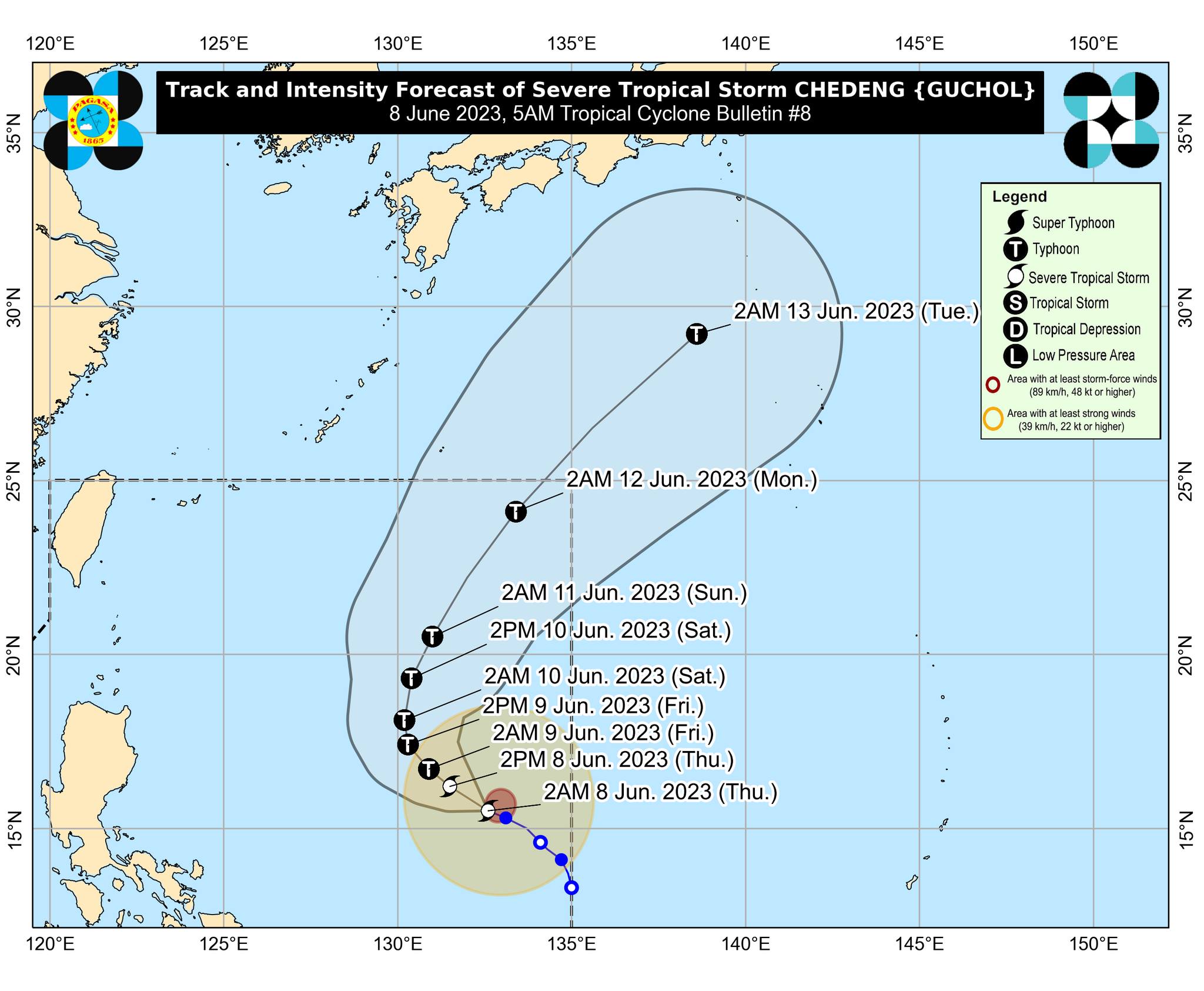
Chedeng now a typhoon–Pagasa
June 8, 2023 – 05:14 PM
Path of Typhoon Chedeng
Tropical Cyclone Chedeng intensified into a typhoon on Thursday, according to state meteorologists.
Chedeng was located 935 kilometers east of Central Luzon carrying maximum sustained winds of 120 kilometers per hour (kph) with gustiness reaching up to 150 kph, the Philippine Atmospheric, Geophysical and Astronomical Services Administration (Pagasa) said.
Pagasa: Mostly fair Thursday weather with chance of rain amid distant Severe Tropical Storm Chedeng
June 8, 2023 – 12:03PM
Generally fair weather with possible rain showers are expected on Thursday even as severe tropical storm Chedeng (international name: Guchol) slowly moves over the Philippine Sea east of Central Luzon, according to the Philippine Atmospheric, Geophysical and Astronomical Services Administration (Pagasa).
In its 11 a.m. bulletin, the state weather bureau said Chedeng slightly intensified, carrying maximum sustained winds of 100 kilometers per hour (kph) and gustiness of up to 125 kph.
Read more.
Pagasa: Storm Chedeng maintains strength, may intensify into typhoon
june 8, 2023 – 7:12AM
Severe tropical storm Chedeng (International name: Guchol) has maintained its strength over the Philippine Sea east of Central Luzon and may intensify into a typhoon by Friday, the Philippine Atmospheric, Geophysical and Astronomical Services Administration (Pagasa) said Thursday morning.
Pagasa weather specialist Benison Estareja said Chedeng was last monitored some 1,190 kilometers (km) east of Central Luzon with maximum sustained winds of 95 kilometers per hour (kph) and gustiness of up to 115 kph.
Read more.
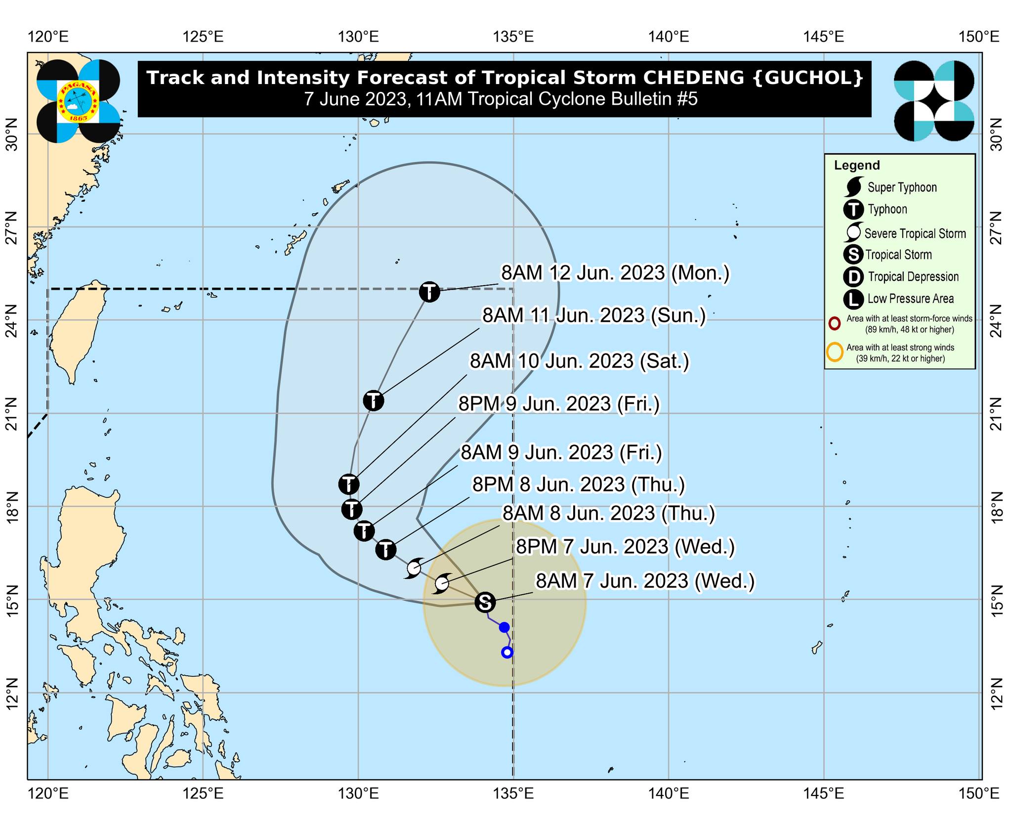
Chedeng now a severe tropical storm but still no direct effect on PH
june 7, 2023 – 11:50PM
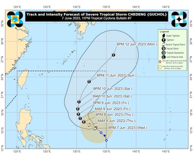
The track of Severe Tropical Storm Chedeng (international name: Guchol) in a map posted by Pagasa in its 11 p.m. bulletin on Wednesday, June 7, 2023.
Chedeng (International name: Guchol) has intensified into a severe tropical storm late Wednesday night but is still not directly affecting the country, the state weather bureau said in its 11 p.m. bulletin.
The eye of the storm was last sighted 1,220 kilometers east of Southeastern Luzon, according to the Philippine Atmospheric, Geophysical and Astronomical Services Administration (Pagasa).
Read more.
Tropical Storm Chedeng slightly intensifies while slowly heading west
June 7, 2023 – 5:34PM
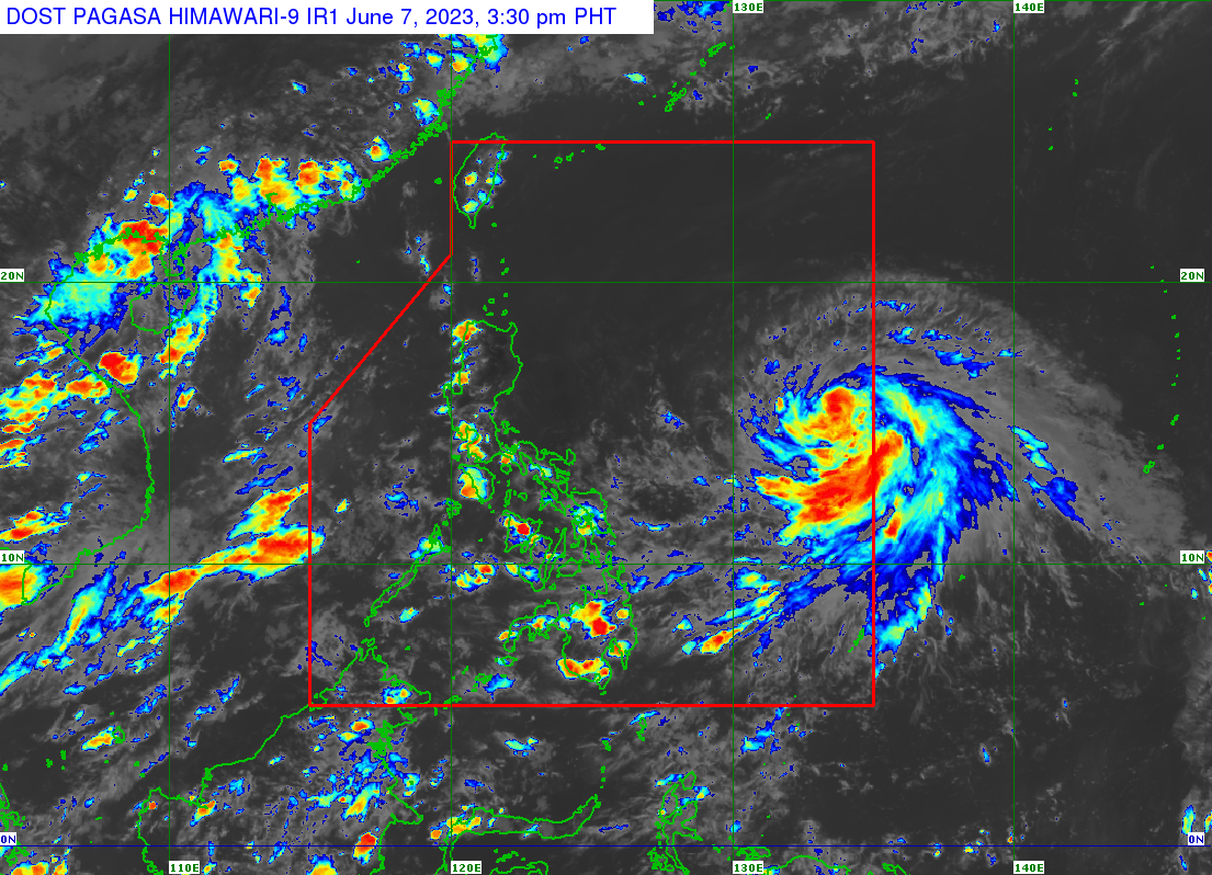
PAGASA SATELLITE
Tropical storm Chedeng (International name: Guchol) has picked up strength while heading west-northwestward over the Philippine Sea on Wednesday afternoon, said the state weather bureau.
Chedeng’s maximum sustained winds rose from 75 to 85 kilometers per hour and gustiness of up to 105 kph, according to the Philippine Atmospheric, Geophysical and Astronomical Services Administration (Pagasa).
Read more.
Chedeng maintains strength, moves slowly northward over Philippine Sea
June 7, 2023 – 12:08 PM
Tropical storm ‘Chedeng’ (international name ‘Guchol’) has maintained its strength as it moves northward of the Philippine Sea, the Philippine Atmospheric, Geophysical and Astronomical Administration (Pagasa) said on Wednesday.
Citing Pagasa’s 11 a.m. bulletin, assistant weather services chief Chris Perez said Chedeng maintained its strength with maximum sustained winds of 75 kilometers per hour (kph) and gusts of up to 90 kph.
Tropical Storm Chedeng intensifies further; may leave PAR Monday
June 7, 2023 – 07:45 AM
Tropical storm ‘Chedeng’ (international name ‘Guchol’) further intensified on Wednesday, but is still not expected to affect the country directly, said the Philippine Atmospheric, Geophysical and Astronomical Administration (Pagasa).
Chedeng strengthened from a tropical depression into a tropical storm on Tuesday night and is expected to leave the Philippine area of responsibility (PAR) by Monday or Tuesday next week.
TD Chedeng slightly intensifies as it slowly moves over eastern Visayas
June 6, 2023 – 06:58 PM
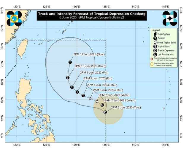
Drawing courtesy of Pagasa
Tropical Depression Chedeng slightly intensified as it hovered inside the Philippine area of Responsibility east of Eastern Visayas, the Philippine Atmospheric, Geophysical and Astronomical Services Administration (Pagasa) said on Tuesday.
According to the 5 p.m. bulletin of Pagasa, Chedeng is almost stationary at 1,150 kilometers (km) east of Southeastern Luzon, with maximum sustained winds of 55 kilometers per hour (kph) and gustiness of up to 70 kph.
LPA east of Eastern Visayas develops into Tropical Depression ‘Chedeng’
June 6, 2023 – 12:27 PM
The low-pressure area formed east of Eastern Visayas strengthened, transforming into a tropical depression named “Chedeng” on Tuesday morning, said the Philippine Atmospheric, Geophysical and Astronomical Administration (Pagasa).
Based on Pagasa’s latest tropical cyclone bulletin, Chedeng was last spotted 1,170 kilometers east of southeastern Luzon, carrying maximum sustained winds of 45 kilometers per hour (kph) and gustiness of up to 55 kph.
Click here for more weather related news.
Subscribe to INQUIRER PLUS to get access to The Philippine Daily Inquirer & other 70+ titles, share up to 5 gadgets, listen to the news, download as early as 4am & share articles on social media. Call 896 6000.