Chedeng further weakens, accelerates away from Philippine landmass
Courtesy of Pagasa
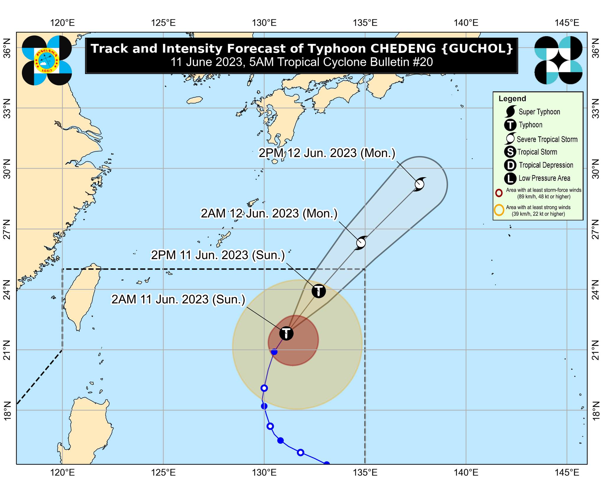
MANILA, Philippines — Typhoon Chedeng (international name: Guchol) has further weakened as it accelerated over the Philippine Sea east of extreme northern Luzon, the Philippine Atmospheric, Geophysical and Astronomical Services Administration (Pagasa) said on Sunday.
Based on Pagasa’s 5 a.m. bulletin, Chedeng was last monitored 990 kilometers (km) east of extreme northern Luzon, moving north-northeastward at 20 kilometers per hour (kph) with maximum sustained winds of 130 kph and gusts of up to 160 kph.
“Patuloy pa ring binabaybay ni bagyong Chedeng ang karagatan at bahagya pa ring bumilis ang pagkilos nito palayo pa yan sa ating kalupaan. Patuloy din itong humihina,” weather specialist Grace Castañeda said in an early morning weather forecast.
(Typhoon Chedeng is over the Philippine Sea, slightly accelerating away from our land. It is also further weakening.)
“Wala itong direct effect sa ating bansa pero patuloy nga nitong ine-enhance ang southwest monsoon o habagat na nagdudulot ng pag-ulan lalong-lalo na ‘yan sa western sections ng Luzon at Visayas,” she added.
(It does not directly affect our country but continues to enhance the southwest monsoon which brings rain, especially in the western sections of Luzon and Visayas.)
Castañade further noted that the enhanced southwest monsoon would particularly affect Zambales, Bataan, Pangasinan, Metro Manila, Bulacan, Occidental Mindoro, the northern portion of Palawan, including Calamian and Cuyo Islands, and Antique.
Chedeng is forecast to downgrade into a severe tropical storm and leave the Philippine area of responsibility by Sunday night or Monday morning.
Meanwhile, no gale warning was hoisted over any of the country’s coastal waters.
Below are Pagasa’s estimated temperature ranges in key cities and areas across the country for Sunday:
Metro Manila: 25 to 30 degrees Celsius Baguio City: 18 to 22 degrees Celsius Laoag City: 26 to 32 degrees Celsius Tuguegarao: 24 to 36 degrees Celsius Legazpi City: 27 to 32 degrees Celsius Puerto Princesa City: 26 to 29 degrees Celsius Tagaytay: 21 to 29 degrees Celsius Kalayaan Islands: 26 to 29 degrees Celsius Iloilo City: 27 to 33 degrees Celsius Cebu: 27 to 32 degrees Celsius Tacloban City: 27 to 32 degrees Celsius Cagayan De Oro City: 26 to 33 degrees Celsius Zamboanga City: 26 to 33 degrees Celsius Davao City: 26 to 34 degrees Celsius
RELATED STORIES: