
PHOTO FROM JTWC
MANILA, Philippines — Severe Tropical Storm “Rolly” may quickly intensify into a super typhoon even before it makes its expected landfall on Sunday, a United States (US) weather agency said on Thursday.
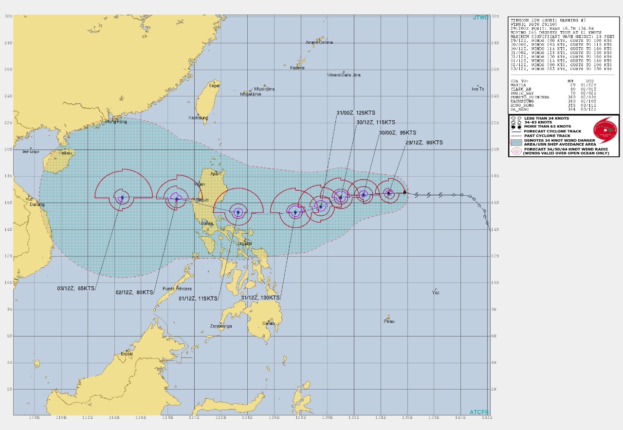
According to the US Navy’s Joint Typhoon Warning Center (JTWC), Rolly (International name: Goni) may reach its peak in 48 hours — Saturday — with maximum sustained winds of 130 knots and gusts of 160 knots, or 240 kilometers per hour (kph) and 296 kph, respectively.
Under the tropical cyclone category from the Philippine Atmospheric, Geophysical and Astronomical Services Administration (Pagasa), cyclones with wind speeds past 220 kph are already considered super typhoons.
If this prediction from the JTWC proves true, Rolly would be the strongest cyclone to enter the Philippine area of responsibility for 2020, and the first super typhoon for this year.
Earlier, Pagasa said that there was a slight change in the predicted track for Rolly, as it is expect to make a southwestern turn, then an eventual northwestern turn which places Central Luzon and Metro Manila along its crosshairs.
Weather updates as of 5:00 p.m. said that Rolly packs maximum sustained winds of 110 kilometers per hour (kph) and gustiness of up to 135 kph — but that may intensify given that it will stay for a longer time above water.
RELATED STORIES
Slight change in Goni’s predicted track puts Central Luzon, Metro Manila in crosshairs
Goni enters PAR, now called Severe Tropical Storm Rolly