Pagasa tracking tropical cyclone outside PAR
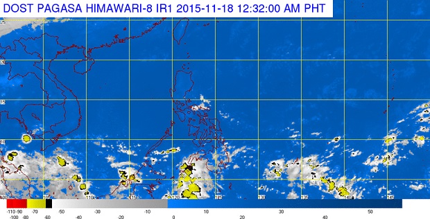
IMAGE FROM PAGASA.DOST.GOV.PH
The state weather bureau is tracking a tropical cyclone which could possibly enter the Philippine area of responsibility.
“There is a small chance that it will enter PAR but we are not discounting the possibility,” Philippine Atmospheric Geophysical and Astronomical Services Administration’s weather forecaster Jun Galang said through Panahon.TV.
The tropical storm was located 3,580 kilometers east of Mindanao and was too far to affect the country. It was moving west northwest at 20 kph.
Mindanao will have cloudy skies with light to moderate rains and isolated thunderstorms due to an intertropical convergence zone.
Metro Manila and the rest of the country will have partly cloudy to cloudy skies with isolated rains.
Article continues after this advertisementREAD: Generally fair weather to prevail during APEC – PAGASA
Article continues after this advertisementThe northeast monsoon, which is responsible for cool weather at this time of the year, is hardly felt because of the prevailing easterlies, explained Galang.
“Sa El Nino mas prevailing ang easterlies kaya hindi makababa ang northeast monsoon at hindi maramdaman lalo na sa Luzon,” he said.
(Easterlies are more prevalent during El Nino so northeast monsoon is not in effect and not felt especially in Luzon.) CDG