Typhoon in Pacific to enter PH Friday afternoon
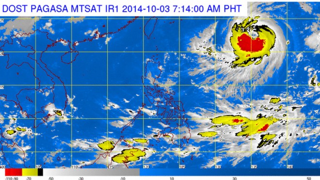
MANILA, Philippines–Typhoon “Phanfone” was spotted over the Pacific Ocean Friday morning and is expected to enter the Philippine area of responsibility by Friday afternoon, the weather bureau said.
As of 4 a.m., it was located 1,514 kilometers east of extreme northern Luzon, with maximum sustained winds of 175 kilometers per hour near the center and gusts of up to 210 kph, the Philippine Atmospheric Geophysical and Astronomical Services Administration said.
The typhoon is forecast to move northwest at 20 kph.
Once it enters PAR, it will be called “Neneng.” It is expected to exit the country Saturday.
Elson Janela of Pagasa said Phanfone will enhance the southwest monsoon in the northern part of Luzon but is not expected to make landfall.
Article continues after this advertisementAn intertropical convergence zone, meanwhile, is affecting Mindanao, and the regions of Bicol, eastern Visayas, Zamboanga Peninsula, Caraga, Davao and ARMM will have cloudy skies with light to moderate rainshowers and thunderstorms, Pagasa said.
Article continues after this advertisementMetro Manila and the rest of the country will be partly cloudy to cloudy with isolated rainshowers or thunderstorms.
Moderate to occasionally strong winds blowing from the northeast to northwest will prevail over the eastern section of Luzon and coming from the west and southwest over the eastern section of Visayas and of Mindanao.
The coastal waters along these areas will be moderate to occasionally rough. Winds will be light to moderate coming from the northeast to northwest over the rest of Luzon and coming from the southwest over the rest of the country with slight to moderate seas
RELATED STORIES
New typhoon to enter PH on Friday
Cyclone spotted; to only skirt PAR
