TD outside PAR may enter next week, to be named ‘Caloy’ – Pagasa
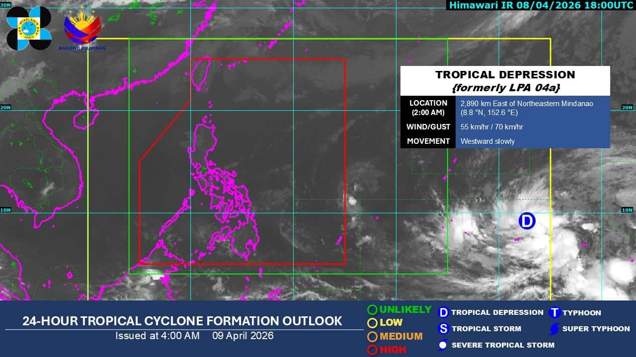
As of 2 a.m. on Thursday, April 9 2026, the Tropical Depression (formerly LPA 04a) is being monitored within the monitoring domain of Pagasa – Photo from DOST-PAGASA / Facebook.
MANILA, Philippines — A tropical depression spotted outside the Philippine Area of Responsibility (PAR) may enter the country’s monitoring area next week and will be named “Caloy,” the state weather bureau said Thursday.
In its latest bulletin, the Philippine Atmospheric, Geophysical and Astronomical Services Administration (Pagasa) said the tropical depression was last located 2,880 kilometers east of Northeastern Mindanao.
It was moving slowly westward, packing maximum sustained winds of 55 kilometers per hour (kph) and gustiness of up to 70 kph.
READ: Pagasa unveils 2026 cyclone names
Pagasa weather specialist Chenel Dominguez noted that while the system is expected to enter PAR, the likelihood of landfall remains low.
“It may enter the PAR next week, and the likelihood of a landfall scenario remains low for this tropical cyclone. Once it enters PAR, it will be named Caloy, and based on its direction, it may move northward, which is why we are not seeing a landfall scenario,” Dominguez explained.
However, Dominguez emphasized that the system’s track remains uncertain and could still intensify. She noted that it may reach typhoon strength and is not ruling out the possibility of it becoming a super typhoon.
Meanwhile, a ridge of high pressure area continues to affect Northern and Central Luzon, bringing generally fair but hot and humid weather across the country this Thursday, Araw ng Kagitingan (Day of Valor).
READ: HEAT INDEX WATCH: Danger level in 2 areas on April 9
Pagasa said Metro Manila and the rest of the country may still experience isolated rain showers or thunderstorms, particularly in the afternoon or evening due to localized thunderstorms.
It also warned of dangerous heat index levels, which may reach up to 42°C in parts of Visayas and Mindanao, while Metro Manila may experience 37°C to 38°C.
“Take precautions as the heat poses risks to our health. Avoid going outside from midday to afternoon,” Dominguez said./dp