LPA outside of PAR develops into tropical depression – Pagasa
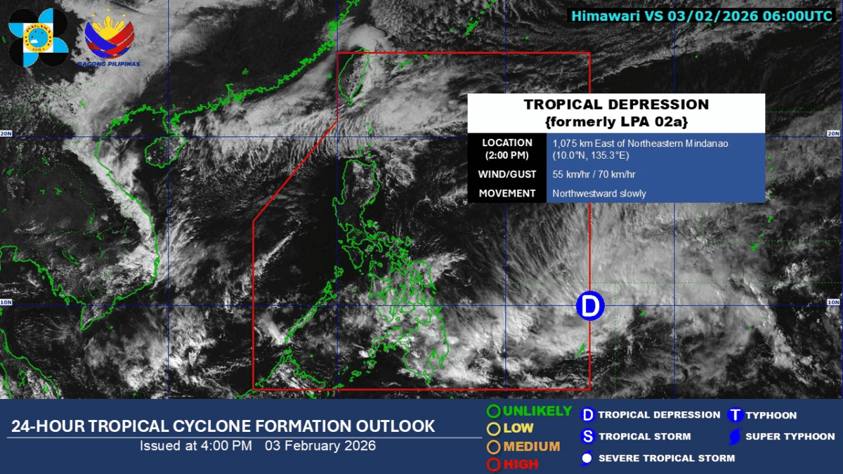
MANILA, Philippines — The low-pressure area (LPA) outside the Philippine Area of Responsibility (PAR) developed into a tropical depression on Tuesday afternoon, the Philippine Atmospheric, Geophysical and Astronomical Services Administration (Pagasa) said.
In its 4 p.m. advisory, Pagasa reported that the tropical depression was last spotted 1,075 kilometers east of Northeastern Mindanao, moving slowly northwestward.
The tropical depression is packing maximum sustained winds of 55 kilometers per hour (kph), with gusts of up to 70 kph.
Upon entering the PAR, the tropical depression will be locally named “Bashang.”
While the cyclone itself is not directly affecting the country, its trough is forecast to bring scattered rains and thunderstorms to Eastern Visayas, Central Visayas, the Negros Island Region, Caraga, Davao Region, Northern Mindanao, and the Zamboanga Peninsula.
Pagasa also warned that the weather conditions caused by the trough may trigger flash floods and landslides in the affected areas.
READ: Pagasa: LPA outside PAR likely to become a tropical depression
Meanwhile, the northeast monsoon, or “amihan,” is affecting other parts of the country.
Pagasa said the monsoon will bring cloudy skies with rains in Batanes and the Babuyan Islands, as well as isolated light rains in Metro Manila and the rest of Luzon.
The rest of the country is expected to experience isolated rain showers due to localized thunderstorms. /jpv