Scattered thunderstorms expected in parts of PH on Saturday due to ITCZ
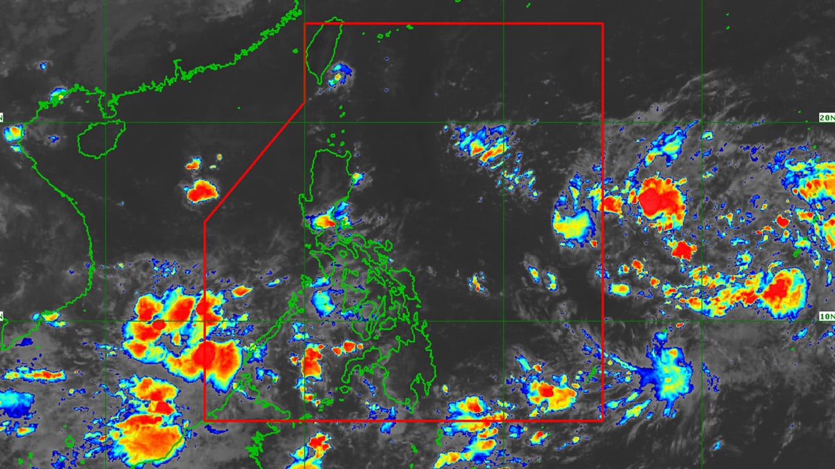
(Satellite photo from Pagasa)
MANILA, Philippines – Chances of scattered thunderstorms are high on Saturday in Palawan province and parts of Mindanao due to the inter-tropical convergence zone (ITCZ).
Philippine Atmospheric, Geophysical and Astronomical Services Administration (Pagasa) on Saturday morning said scattered thunderstorms are expected in Palawan, Zamboanga Peninsula, Bangsamoro, Soccsksargen and Davao Occidental.
ITCZ is defined as an area where winds from the northern and the southern hemispheres meet.
Meanwhile, Luzon, including Metro Manila, Visayas and the rest of Mindanao will experience generally fair weather throughout the day.
People in these areas can expect localized thunderstorms in afternoon and evening, according to Pagasa specialist Daniel James Villamil.
Article continues after this advertisementREAD: PH to have fair weather on Saturday, but LPA likely to enter PAR
Article continues after this advertisementVillamil added, “Pero itong easterlies, posibleng magdulot ng isolated thunderstorms dito sa eastern section ng ating bansa, partikular sa areas ng Cagayan Valley sa bahagi ng Isabela, Quezon at ilang bahagi ng Bicol Region.”
(But these easterlies can possibly bring isolated thunderstorms in the country’s eastern section, particularly in the areas of Cagayan Valley in Isabela, Quezon and some parts of Bicol Region.)
Easterlies are warm winds from the Pacific Ocean.
The low pressure area just outside the Philippine area of responsibility was last spotted 1,455 kilometers east of southeastern Luzon at 3 a.m. on Saturday.
“Medium chance yung scenario nating nakikita para sa low pressure area na ito. Ibig sabihin nito, posible itong maging isang ganap na bagyo within the next 24 to 48 hours,” Villamil noted.
(The scenarios we are seeing for this low pressure area have a medium chance. This means, this will possibly develop into a typhoon within the next 24 to 48 hours.)