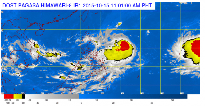
This satellite image from Pagasa shows the location of tropical depression Lando on the morning of October 15.
Tropical storm “Lando” (international name: Koppu) slightly intensified as it continued the same westward track midday Thursday.
Lando packed maximum sustained winds of 75 kilometers per hour and gusts of up to 90 kph.
In an advisory, the Philippine Atmospheric, Geophysical and Astronomical Services Administration said it was 1,055 kilometers east of Baler, Aurora.
READ: Tropical storm ‘Lando’ enters PAR
The storm moved slower at 17 kph westward.
No public storm signals were raised but moderate to heavy rains are seen within the 500 kilometer radius of Lando.
The storm might hit land in Isabela-Cagayan area over the weekend.
Fishermen were also advised by Pagasa not to venture out over the seaboards of Northern Luzon and over the eastern seaboard of Central and Southern Luzon. IDL