Hurricane Dolores expected to weaken in Pacific
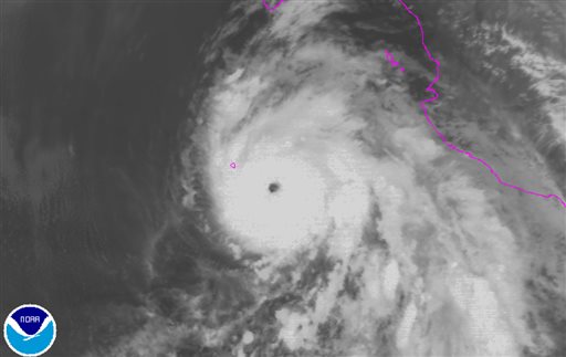
This satellite image taken, Wednesday, July 15, 2015, at 1:00 a.m. EDT, and released by the National Oceanic and Atmospheric Administration (NOAA) , Hurricane Dolores is moving west-northwest near 7 mph (11 kph) off the coast of Mexico. (NOAA via AP)
MIAMI — Hurricane Dolores remains a major Category 3 storm in the Pacific but is expected to start weakening.
The storm’s maximum sustained winds early Thursday are near 115 mph (185 kph) but the US National Hurricane Center says gradual weakening is expected to begin later in the day or Thursday night.
Dolores is centered about 255 miles (410 kilometers) south-southwest of Cabo San Lucas, Mexico, and is moving west-northwest near 7 mph (11 kph).
Swells generated by the hurricane are affecting parts of Mexico’s southwestern coast along with the southern coast of the Baja California peninsula. The swells could cause life-threatening surf and rip current conditions.