‘Chedeng’ to be felt by Friday–Pagasa
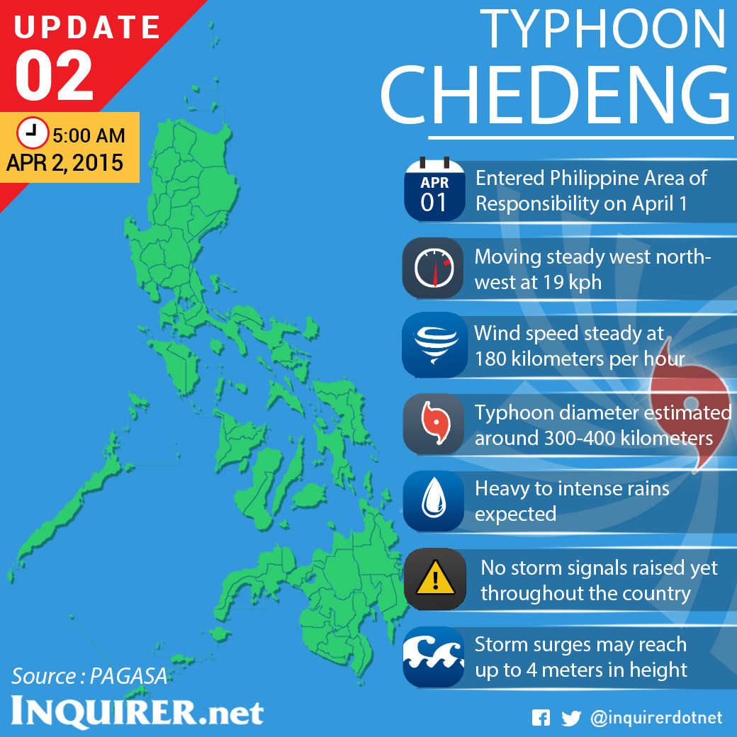
Typhoon Chedeng (international name Maysak) maintained slightly weaker wind speeds of 180 kph early Thursday as its outer bands moved closer to Samar and the Bicol area.
Chedeng, which entered Wednesday night, continued to move west northwest at 19 kph, the Philippine Atmospheric, Geophysical and Astronomical Services Administration (Pagasa) said.
The effects of Chedeng won’t be felt until Friday, according to Pagasa.
The whole archipelago will experience partly cloudy to cloudy skies with isolated rains or thunderstorms.
Moderate to strong winds coming from the northeast to north will prevail over the eastern section of Southern Luzon, the Visayas and Mindanao. The coastal waters along these areas will be moderate to rough.
Article continues after this advertisementElsewhere, winds will be light to moderate coming from the northeast to east with slight to moderate seas, Pagasa said.
Article continues after this advertisementIn Pagasa’s gale warning, strong to gale force winds is expected to affect the eastern seaboard of Southern Luzon.
The areas under gale warning include Camarines provinces, Catanduanes, eastern coast of Sorsogon and eastern coast of Quezon including Polilo.
FIshing boats and other small seacraft are advised not to venture out into the sea while larger sea vessels are alerted against big waves.