Another winter storm hits US East Coast, cold temps coming

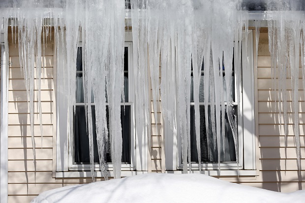
Icicles hang from the roof of a house in Quincy., Mass., Friday, Feb. 20, 2015. With a wintry mix on the way this weekend and another larger storm possibly on the horizon, “ice dams” are a growing concern for New England homeowners. Massachusetts Gov. Charlie Baker and other state leaders have been urging residents to clear off excess snow from roofs or hire professionals to do it. AP
The latest in an unending parade of winter storms moved over the U.S. East Coast on Saturday, dropping a wintry mix as far south as northern Georgia and potentially causing more headaches for the snow-weary northeastern New England states.
The National Weather Service said the storm was expected to bring a six inches (15 centimeters) or more of snow to some areas in the Northeast by Sunday morning. And once it leaves, another round of bitter cold temperatures will cover the region for most of the upcoming work week.
The storm caused hassles all over: Rain and above-freezing temperatures in Tennessee prompted state emergency officials to warm of possible flash flooding from melting snow. Officials in the Washington area, where 3 to 8 inches (7.5 to 20 centimeters) was expected, urged drivers to avoid unnecessary travel. Blowing snow swirled through the streets of Philadelphia and New York City.

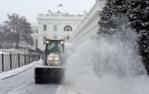
Snow is cleared on the North side of the White House in Washington, Saturday, Feb. 21, 2015. The National Weather Service is calling for 3 to 6 inches of snow and then a trace to a small amount of ice in the area. The cold ground is allowing snow to stick faster, making it difficult for road crews to keep up. AP
“The arctic air mass we’ve been dealing with means this storm will overachieve,” said Lance Franck, a meteorologist with the National Weather Service office in Mount Holly, New Jersey.
The Federal Aviation Administration briefly issued a ground stop on Saturday to keep flights from taking off for Philadelphia International Airport because of reduced visibility and high winds, airport spokeswoman Mary Flannery said.
Article continues after this advertisementShe said about 20 percent of the flights into and out of the airport were canceled, and many others were delayed. The FAA was reporting that Logan International Airport in Boston, John F. Kennedy International Airport in New York and Memphis International Airport in Tennessee also were experiencing significant delays because of the weather.
Article continues after this advertisementAs much as eight inches (20 centimeters) of snow was possible in some inland areas of the Northeast, while areas farther south and closer to the coast were expecting a wintry mix of snow, sleet, freezing rain and rain.
The eastern United States did not have the market cornered on misery, however: A winter storm is threatening to bring 2 feet (60 centimeters) or more of snow to parts of Colorado by the beginning of the work week. Heavy snow up to 3 inches (7.5 centimeters) an hour began falling Saturday on the Front Range, while in Wyoming, a 50-mile (80-kilometer) stretch of Interstate 80 between Cheyenne and Laramie was closed.
The wintry precipitation could create more issues in New England, which has been slammed by several strong storms in recent weeks — Boston has seen more than 8 feet (2.4 meters) of snow. Three to 6 inches (7.5 to 15 centimeters) of snow was forecast for much of New England, as well as a wintry mix including rain as temperatures climb.
Kim Buttrick, a National Weather Service meteorologist in Taunton, Massachusetts, said existing snowpack will become heavier as it absorbs any rain that does fall and endanger strained roofs.
The higher temperatures won’t last, either.
“We have a little teaser with this warmup,” Buttrick said, “but temperatures are going to go back to being below normal on Monday and Tuesday.”
RELATED STORIES
More cold, snow on the way in merciless US winter
Kim Kardashian, sis Khloe safe after Montana traffic accident