Hagupit grows stronger; still headed for PH

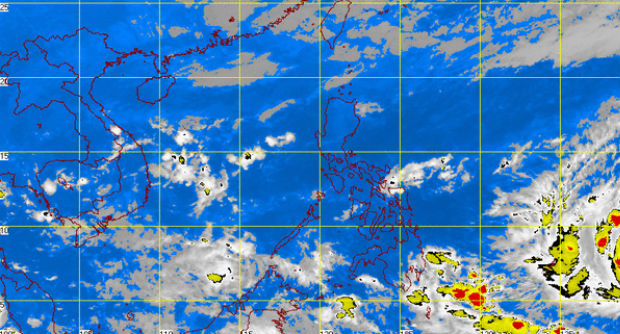
MT Satellite image December 3, 2014 6:01 a.m. Screengrab from https://www.pagasa.dost.gov.ph/weather
MANILA, Philippines — Hagupit, the cyclone expected to enter the Philippine area of responsibility (PAR) on Thursday, has intensified into a typhoon.
Hagupit was last observed 1,670 km east of Mindanao with maximum sustained winds of 130 kilometers per hour near the center and gustiness of up to 160 kph.
It is forecast to move west northwest at 30 kph, the Philippine Atmospheric Geophysical and Astronomical Services Administration (Pagasa) said Wednesday morning.
Pagasa has not seen any signs of Hagupit changing course as it continues on a path towards the Philippines, similar to that taken by Supertyphoon “Yolanda in 2013.
With winds of 295 kph to 360 kph, Yolanda struck Eastern Visayas and the Central Visayan region on November 8. It killed more than 6,000 and caused widespread devastation in the Visayas and parts of Southern Luzon.
Article continues after this advertisementMeanwhile, the northeast monsoon, or amihan, continues to affect Northern and Central Luzon.
Article continues after this advertisement“Eastern Visayas can experience cloudy skies with light to moderate rainshowers and thunderstorms. Cagayan Valley will have cloudy skies with light rains,” Pagasa said.
The regions of Cordillera, Ilocos, and Central Luzon will experience partly cloudy to cloudy skies with isolated light rain.
Metro Manila and the rest of the country will be partly cloudy to cloudy with isolated rainshowers or thunderstorms.
Moderate to strong winds blowing from the northeast to east will prevail over Luzon and the eastern section of Visayas and the coastal waters along these areas will be moderate to rough.
Elsewhere, winds will be light to moderate coming from the northeast with slight to moderate seas.
RELATED STORIES
‘Yolanda’-like ‘Ruby’ heads for PH