Signal No. 2 up in 9 areas as ‘Mario’ intensifies
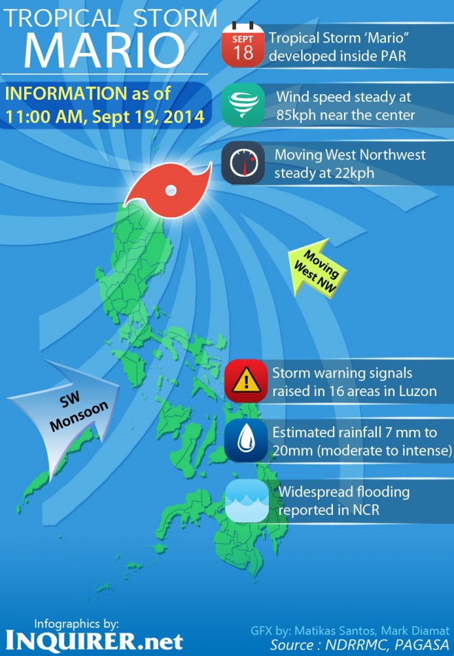
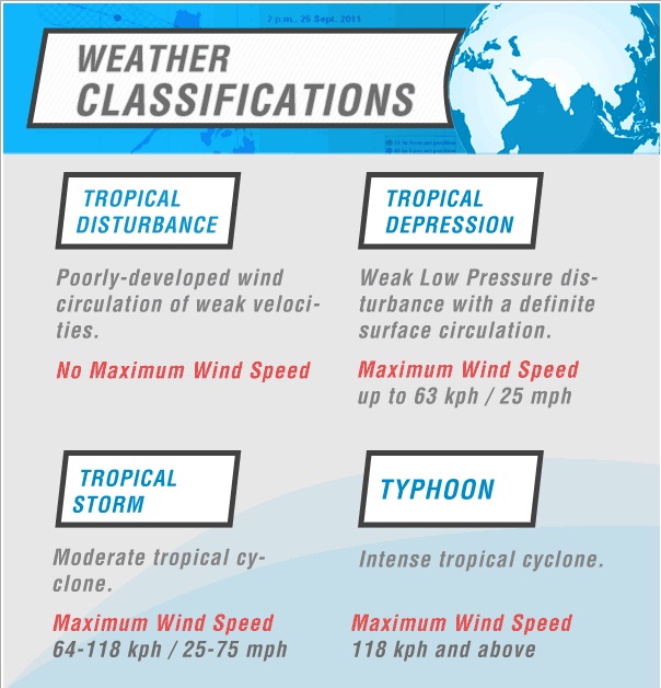
MANILA, Philippines—Tropical Storm “Mario” intensified and slowed down as it continued to hover over Northern Luzon, the state weather bureau said early Friday.
In its latest advisory, Philippine Atmospheric, Geophysical and Astronomical Services Administration said the center of “Mario” was spotted at 212 kilometer east of Casiguran, Aurora.
It packs maximum sustained winds of 85 kilometers per hour and gusts of up to 100 kph.
Article continues after this advertisementIt is forecast to move west northwest at 22 kph.
Article continues after this advertisementPagasa said the estimated rainfall amount of “Mario” is from 7 – 20 mm per hour, or moderate to intense, within the 350 km diameter of the tropical storm.
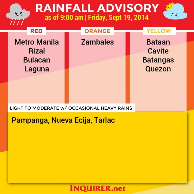
“The combined effect of southwest monsoon and “Mario” will bring moderate to heavy rains and thunderstorms in Metro Manila and the rest of Luzon which may trigger flashfloods and landslides,” it said.
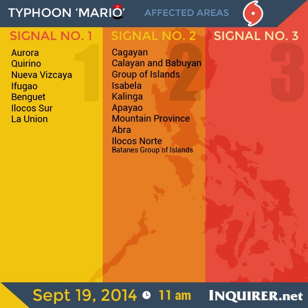
As of Friday, Signal no. 2 remains in Cagayan including Calayan and Babuyan Group of Islands, Isabela, Kalinga, Apayao, Mt. Province, Abra and Ilocos Norte
While Signal no. 1 is still up over Aurora, Quirino, Nueva Vizcaya, Ifugao, Benguet, Ilocos Sur, La Union and Batanes Group of Islands.
In Catanduanes and Mountain Province, public storm warning signals have been lifted.
But Pagasa warned residents in areas under signals No. 2 and 1 for possible flashflood and landslides.
By Saturday morning, “Mario” is expected to be at 91 km north northeast of Laoag City in Ilocos Norte.
It will leave the Philippine Area of Responsibility on Monday morning. At 643 km north northeast of Basco, Batanes.
“Fisherfolks and those with small seacrafts are advised not to venture out over the western seaboard of central Luzon, seaboards of southern Luzon and Visayas and eastern seaboard of Mindanao,” the bulletin added.
RELATED STORIES


