Pepito may become super typhoon before landfall in Catanduanes
Super Typhoon Pepito Live Updates
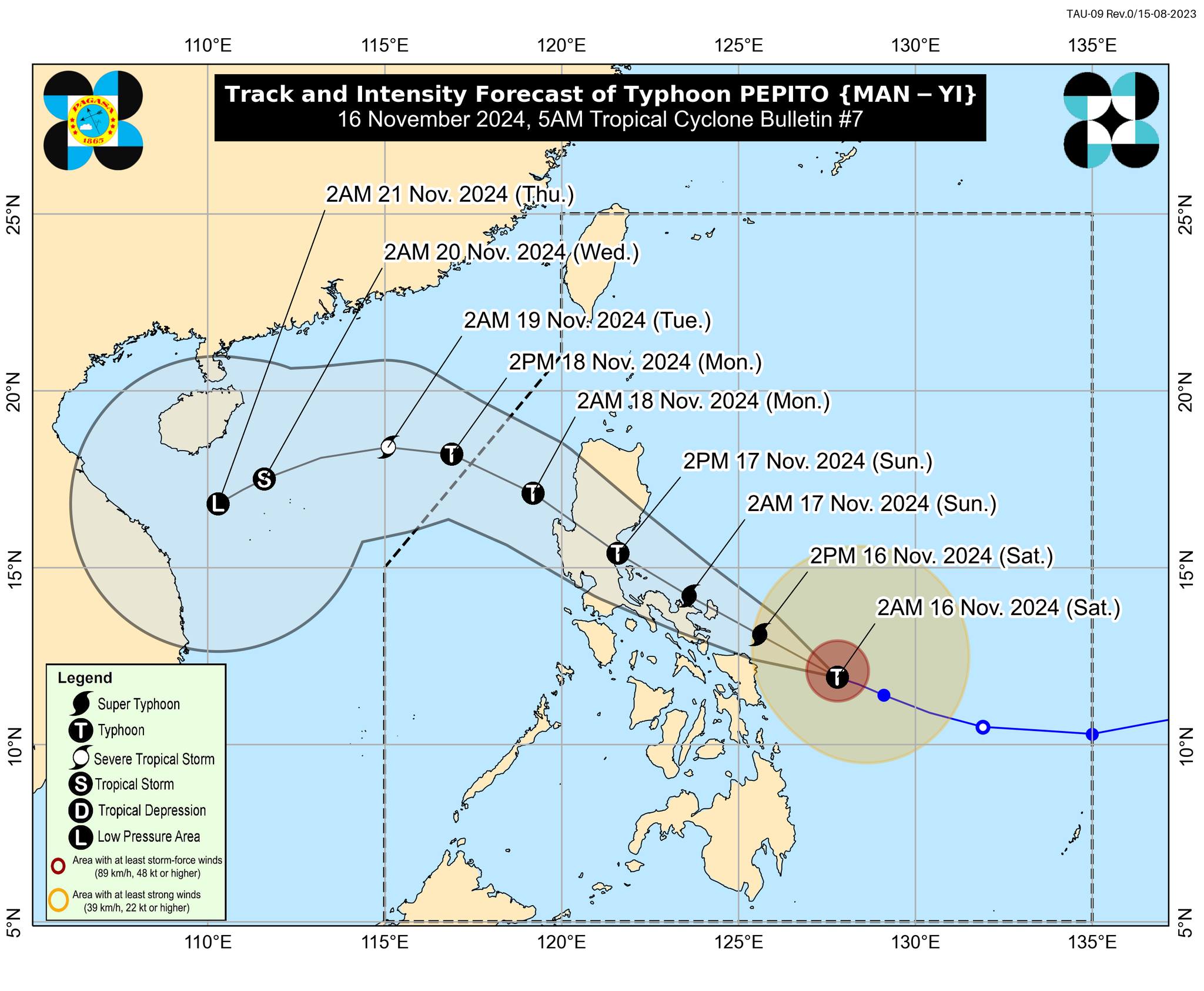
MANILA, Philippines — Pepito is expected to intensify into a super typhoon on Saturday before making landfall in Catanduanes, state meteorologists said.
“Pepito will continue to intensify today and may reach super typhoon category within the next hours prior to its landfall tonight or tomorrow early morning,” said Philippine Atmospheric, Geophysical and Astronomical Services Administration (Pagasa) in its 5:00 a.m. update.
READ: Pepito rapidly intensifies, may become super typhoon on Saturday
As of this writing, Pepito was last spotted 220 kilometers (km) east northeast of Borongan City, Eastern Samar, or 305 km east of Catarman, Northern Samar, with maximum sustained winds of 175 kilometers per hour (kph) near the center and gusts of up to 215 kph.
Article continues after this advertisementPepito, which is moving west northwestward at 25 kph, will likely make landfall in the vicinity of Catanduanes on Saturday night or early Sunday morning.
However, due to the limits of the forecast confidence cone, Pagasa said that “landfall over the eastern coast of Camarines Sur, Albay, or Sorsogon during the same time frame, or along the eastern coast of Quezon or Aurora tomorrow afternoon or evening, cannot be ruled out.”
Upon landfall, Pepito may experience a bit of weakening, but will remain strong nonetheless.
“It will traverse the country as a typhoon and will likely be downgraded into a severe tropical storm once it is over the West Philippine Sea on Monday,” Pagasa said.
The state weather bureau said it may hoist TCWS No. 5, the highest wind signal, due to Pepito.
