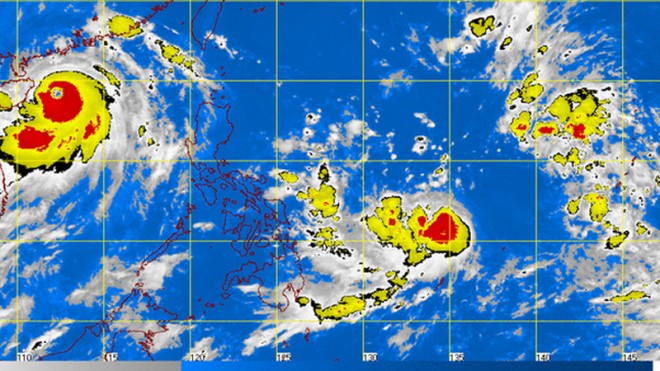
New tropical storm expected to enter PH Saturday
MANILA, Philippines–The tropical depression that is forecast to enter the Philippine area of responsibility (PAR) on Saturday has intensified into a tropical storm, the state weather bureau said Friday.
Matmo, its international name, was last observed 1,000 kilometers of east of Northern Mindanao, the Philippine Atmospheric Geophysical and Astronomical Services Administration said.
Matmo means “heavy rain” in Chamorro language, which is spoken on Saipan and Guam islands in the Pacific. It packed maximum sustained winds of 65 kilometers per hour and gusts of up to 80 kph. It is forecast to move north northwest slowly.
The storm will be called Henry once it enters PAR.
The southwest monsoon, meanwhile, continued to affect western section of Luzon.
Article continues after this advertisement“Metro Manila, Central Luzon, Calabarzon and the provinces of Mindoro and Palawan will have occasional rains,” Pagasa said.
Article continues after this advertisementThe rest of the country will be partly cloudy to cloudy with isolated rainshowers and thunderstorms.
Moderate to strong winds blowing from the southwest to southeast will prevail over luzon and coming from the southwest will prevail over the rest of the country with moderate to rough seas.
RELATED STORIES
Southwest monsoon to bring rains, ‘Glenda’ lingers out of PAR
