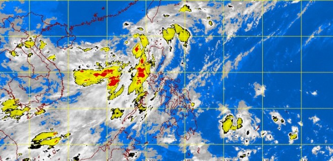
Potential tropical depression in northern PH to be named Florita
MANILA, Philippines–A low pressure area near the Ilocos region may develop into a tropical cyclone that would affect extreme northern Luzon, the weather bureau said Friday.
The Philippine Atmospheric Geophysical and Astronomical Services Administration (Pagasa) said the LPA was last observed 430 kilometers northwest of Sinait, Ilocos Sur.
If it intensifies into a tropical depression within the Philippine area of responsibility (PAR), it will be locally named Florita.
Jori Loiz of Pagasa cited two weather scenarios including the LPA moving toward southeastern China, in which case it will not enter the PAR.
But if the LPA goes south of Taiwan, it will enter the PAR and affect extreme northern Luzon. It would follow the same path as Tropical Depression Ester.
Article continues after this advertisementLoiz told INQUIRER.net that the direction of the LPA would be dictated by the high pressure area. Depending on its movement, the LPA has chances of becoming stationary, he said.
Article continues after this advertisementBecause the LPA is not yet within the PAR, it is not yet directly affecting the country.
Meanwhile, the southwest monsoon is prevailing over Luzon and will bring rains to the island, including Metro Manila.
“Batanes, Calayan and Babuyan group of islands, the regions of Ilocos, Cordillera and Central Luzon will experience monsoon rains,” Pagasa said, adding Metro Manila and the rest of Luzon will have occasional rains.
The rest of the country will be partly cloudy to cloudy with isolated rainshowers or thunderstorms.
Moderate to strong winds coming from the southwest will prevail over Luzon and its coastal waters will be moderate to rough.
Light to moderate winds coming from the southwest will prevail over the Visayas and from the south to southwest over Mindanao with slight to moderate sea, Pagasa said.
RELATED STORIES
LPA to enhance southwest monsoon, rains seen until Saturday
