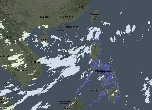
LPA to enhance southwest monsoon, rains seen until Saturday
MANILA, Philippines—The weather bureau is closely monitoring a potential tropical cyclone west of the country.
Although the low pressure area (LPA) could enhance the habagat (southwest monsoon) and bring rains over parts of Luzon, including Metro Manila, it is only anticipated to graze the country’s area of responsibility on its way to Taiwan or China, according to the Philippine Atmospheric, Geophysical and Astronomical Services Administration (Pagasa).
Weather forecaster Alvin Pura said the LPA could intensify into a tropical depression while still over the West Philippine Sea and enter the PAR but would only briefly pass through on its north-northeasterly path.
Pura told the Inquirer that even then the LPA, which was estimated at 4 p.m. to be at 560 kilometers west of Sinait in Ilocos Sur well outside the PAR, would enhance the habagat, which would spawn rains over portions of Luzon until the weekend.
He said that monsoon rains would continue over the Batanes group of Islands, the Calayan and Babuyan group of Islands, and the regions of Ilocos, the Cordillera and Central Luzon.
Article continues after this advertisementThe forecaster advised residents and local disaster risk reduction management councils in the areas to take the necessary precautions against possible flashfloods and landslides.
Article continues after this advertisementPagasa likewise cautioned fishing boats and other small vessels against venturing into the northern and western seaboards of Luzon due to strong to gale force winds caused by the southwest monsoon surge and alerted big ships to waves that could reach 4.5 meters. Sea conditions in the areas are expected to be rough to very rough.
Metro Manila and the rest of Luzon will experience occasional rains while the Visayas and Mindanao will be partly cloudy to cloudy with isolated rainshowers or thunderstorms.
RELATED STORIES
Southwest monsoon continues to induce rains
Rains to mar Independence Day parade
