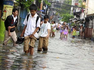
MANILA, Philippines — The summer heat will soon be gone as the weather bureau expects temperatures to drop gradually with the looming onset of the rainy season.
The forecasters of the Philippine Atmospheric, Geophysical and Astronomical Services Administration (Pagasa) could declare the start of the rainy season this week provided that all the criteria are met, although the habagat (southwest monsoon) has set in.
Forecaster Fernando Cada said that people could anticipate days to grow cooler with the start of the rainy season expected to be declared anytime within this week.
“The Pagasa cannot yet say that the wet season has started because not all of the criteria have been met,” he said on Sunday.
The habagat is only one criterion and that the amount of rainfall is also taken very much into consideration, according to Cada.
There should be at least one millimeter of accumulated rain measured in at least five of the bureau’s type 1 climate stations in Laoag City; Vigan in Ilocos Sur; Dagupan City; Iba, Zambales; San Jose, Mindoro Occidental; Metro Manila; Ambulong in Batangas; and Iloilo City. Type 1 climate areas have two seasons: dry and wet.
In Metro Manila, the one millimeter-accumulated rainfall should be simultaneously recorded in weather stations at the Pagasa Science Garden, the Port Area in Manila; and in Sangley Point, Cavite.
Cada said that Sunday’s highest temperature in Metro Manila was at 34.3 degrees Celsius at around 1:50 pm. In other areas, temperatures measured at around 2 p.m. were: 35.5 degrees in Tuguegarao City; 36 degrees in Cabanatuan City; 34.9 degrees in Sangley Point, Cavite; 33.4 degrees in Mactan, Cebu; and 35 degrees in General Santos City.
The highest temperature recorded this year was at 40.4 degrees in Tuguegarao City, located at the northeasternmost tip of Luzon, on June 1. Metro Manila was hottest at 36.7 degrees on May 24.
“We can observe that temperatures are starting to go down because of the increasing cloudiness,” the Pagasa forecaster told the Philippine Daily Inquirer, adding that it was among the usually observed weather conditions before the start of the rainy season. Other indicators are the increased humidity and the daily occurrence of rainshowers and thunderstorms in the afternoon or early evening.
The trough of a low pressure area (LPA) affecting extreme Northern Luzon has also been bringing rain although there is little chance for the potential tropical cyclone to enter the country’s area of responsibility. The LPA is somewhere near Taiwan.
In Pagasa’s forecast for Monday, the regions of Ilocos, Cordillera, Cagayan Valley and Central Luzon will have cloudy skies with light to moderate rains and thunderstorms while Metro Manila and the rest of the country will be partly cloudy to cloudy with isolated rainshowers or thunderstorms.
Light to moderate winds coming from the southwest will prevail over Luzon and the Western Visayas and from the south to southwest over the rest of the archipelago where coastal waters will be slight to moderate.
RELATED STORIES
LPA northeast of Batanes to bring rains to parts of northern Luzon
Pagasa: June to offer nice view of starry ‘Summer Triangle’
