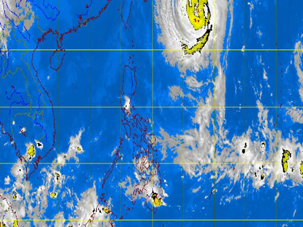
MT Satellite image October 23, 2013, Wednesday, 1:30 PM. Screengrab from https://www.pagasa.dost.gov.ph/
MANILA, Philippines -Typhoon “Urduja” (international name Francisco) slightly weakened as it moved in a west northwest direction midday Wednesday, the state weather bureau said.
It was last observed 920 kilometers east northeast of Itbayat, Batanes, packing maximum sustained winds of 150 kilometers per hour near the center and gustiness of up to 185 kph, the Philippine Atmospheric Geophysical and Astronomical Services Administration said.
It was moving west northwest at 15 kph.
It is expected to exit the Philippine area of responsibility or 190 km east northeast of Okinawa, Japan by Thursday morning.
Urduja is not forecast to affect any part of the country, but will bring heavy to intense rains within its 700 kilometer-diameter, Pagasa said.
Sea travel is risky over the seaboards of Northern Luzon and the eastern seaboards of Central and Southern Luzon.
Related Stories
‘Urduja’ enters but won’t affect PH—Pagasa
Pagasa expects fair weather despite approaching typhoon