‘Urduja’ enters but won’t affect PH—Pagasa

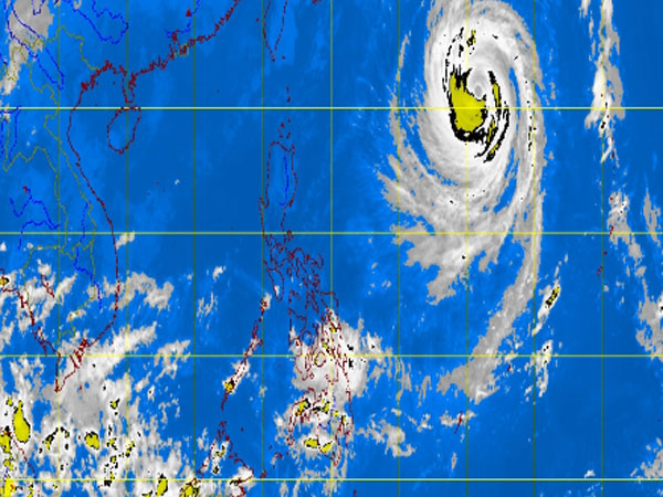
MT Satellite image October 22, 2013, Tuesday, 7:32 AM. Screengrab from https://www.pagasa.dost.gov.ph/
MANILA, Philippines —Typhoon Urduja (international name Francisco) entered the Philippine area of responsibility early Tuesday but is not expected to affect the country.
The typhoon was last observed 1,200 kilometers east northeast of Itbayat, Batanes, packing maximum sustained winds of 160 kilometers per hour near the center and gusts of up to 195 kph, the Philippine Atmospheric Geophysical and Astronomical Services Administration said.
It was forecast to move north-northwest at 3 kph.
Urduja is on its way to Japan, and is expected to be within its PAR until Thursday morning.
Pagasa still warned that heavy to intense rains are seen within the 900 kilometer-diameter of the typhoon.
Article continues after this advertisementSea travel is risky over the seaboards of Northern Luzon and the eastern seaboards of Central and Southern Luzon.
Article continues after this advertisementMeanwhile, Mindanao will experience cloudy skies with scattered light to moderate rainshowers and thunderstorms.
Metro Manila and the regions of Ilocos, Cordillera, Cagayan Valley, Central Luzon and Bicol region will be partly cloudy to cloudy with isolated light rains.
The rest of Luzon and Visayas will have partly cloudy to cloudy skies with isolated rainshowers or thunderstorms.
Moderate to strong winds blowing from the northeast will prevail over Luzon and its coastal waters will be moderate to rough. Elsewhere, winds will be light to moderate coming from the northeast to northwest with slight to moderate seas.