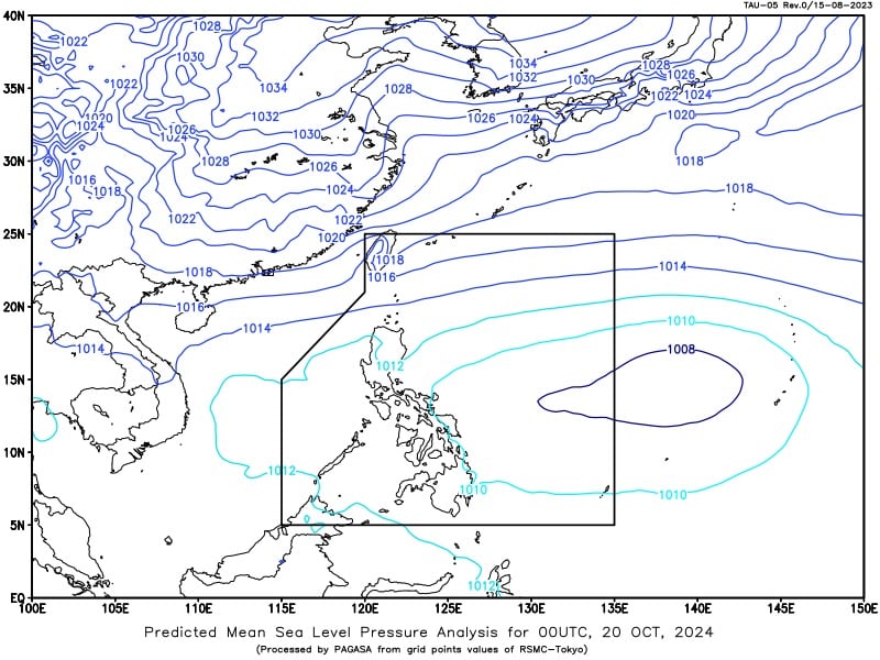
A low-pressure area (LPA) is forecast to enter the Philippine area of responsibility (PAR) by Sunday afternoon or evening (October 20, 2024) and develop into a tropical cyclone in the next 24 hours, according to the Philippine Atmospheric, Geophysical, and Astronomical Services Administration (Pagasa). Pagasa weather specialist Grace Castañeda said the LPA would possibly become a storm by Sunday afternoon or Monday, October 21, and be given the local name Kristine. Photo from Pagasa
MANILA, Philippines — A low-pressure area (LPA) is forecast to enter the Philippine area of responsibility (PAR) by Sunday afternoon or evening and develop into a tropical cyclone in the next 24 hours.
The Philippine Atmospheric, Geophysical, and Astronomical Services Administration (Pagasa) said in a weathercast that the LPA was last located 1,395 kilometers east of southeastern Luzon.
Pagasa weather specialist Grace Castañeda said the LPA would possibly become a storm by Sunday afternoon or Monday, October 21, and be given the local name Kristine.

READ: Pagasa: LPA may enter PAR Sunday or Monday
She also said that once the LPA enters PAR, it is projected to pass near the eastern and northern portions of Central Luzon and that the potential storm may make landfall in this region.
Castañeda, however, likewise noted since the LPA has not intensified into a tropical cyclone yet, its track remains uncertain and may still change.
READ: Scattered thunderstorms expected in parts of PH Oct 19 due to ITCZ
For now, the Pagasa expert said the LPA has no direct effect on any part of the country although its trough currently affects the eastern and northern sections of Central Luzon, bringing high chances of rain in the areas.
The state weather agency did not raise any gale warning over any seaboards nationwide despite the anticipated arrival of the LPA inside PAR on Sunday.