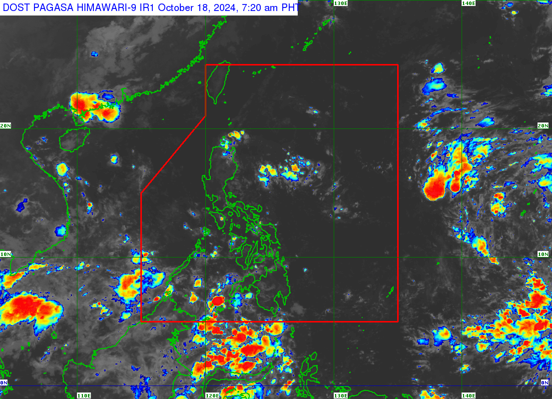
The Philippine Atmospheric, Geophysical and Astronomical Services Administration (Pagasa) says a low-pressure area (LPA) formed off Visayas early Friday morning (October 18, 2024). But Pagasa weather specialist Benison Estareja noted that this LPA is neither expected to enter the Philippine area of responsibility nor become a tropical cyclone in the next 24 hours. Weather satellite image from Pagasa
MANILA, Philippines — A low-pressure area (LPA) formed off Visayas early Friday morning, the Philippine Atmospheric, Geophysical and Astronomical Services Administration (Pagasa) said.
As of 3:00 a.m., the LPA was located 2,040 kilometers east of Eastern Visayas, according to Pagasa weather specialist Benison Estareja.
“Within the next 24 hours, it is not expected to enter the Philippine area of responsibility, has no expected effect [in the country], and is not expected to become a tropical cyclone in the next 24 hours,” Estareja said in a weathercast Friday.
READ: LPA inside PAR turns into Tropical Depression Julian
Estareja also disclosed the possible “circulations” that may form inside the Intertropical Convergence Zone (ITCZ).
ITCZ is a belt near the equator where the trade winds of the Northern Hemisphere and Southern Hemisphere meet and is considered a breeding ground for tropical cyclones.
For now, according to Estareja, the ITCZ was expected to cause cloudy skies and scattered rain showers and thunderstorms in Zamboanga Peninsula, Soccsksargen (South Cotabato, Cotabato, Sultan Kudarat, Sarangani, and General Santos City), Bangsamoro Autonomous Region in Muslim Mindanao, Davao Oriental, Davao Occidental, and Davao del Sur.
On the other hand, Metro Manila and the rest of the country were forecast to experience partly cloudy to cloudy skies with isolated rain showers and thunderstorms on Friday, October 18.