Pagasa: Two weather systems to bring rain to PH on Tuesday

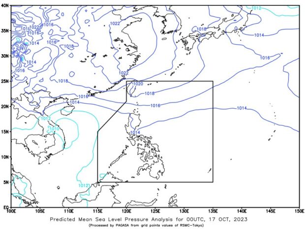
Cloudy skies with isolated rain showers brought by localized thunderstorms will prevail over a large portion of the country, the Philippine Atmospheric, Geophysical, and Astronomical Services Administration said on October 17, 2023. (Photo courtesy of Pagasa)
MANILA, Philippines — The low-pressure area (LPA) outside the Philippine area of responsibility (PAR) is no longer affecting the country’s weather conditions, but localized thunderstorms and northeasterly surface wind flow will bring rains over a large portion of the archipelago.
According to the Philippine Atmospheric, Geophysical, and Astronomical Services Administration’s (Pagasa’s) Tuesday bulletin, the trough or extension of the LPA outside the PAR boundary will no longer bring rain to the country.
“‘Yung LPA sa labas ng ating area of responsibility, sa kanluran ‘yan ng Luzon, itong LPA na ito maging ‘’yung trough nito ay wala nang idinudulot na pag-ulan sa ano mang bahagi ng ating bansa,” state weather specialist Grace Castañeda said.
(The LPA outside the Philippine area of responsibility, in the west of Luzon, will not cause rain in any part of our country.)
However, Pagasa said partly cloudy to cloudy skies with rain showers are expected over Visayas and Mindanao brought by localized thunderstorms.
Castañeda warned those residing in low-lying areas against possible flash floods and landslides.
“During severe thunderstorms maaari pa rin tayong makaranas ng mga katamtaman hanggang sa mga malalakas na pag-ulan na maaaring magdulot ng pagbaha at pagguho ng lupa, so pag-iingat pa rin po para sa ating mga kababayan,” Castañeda said.
(During severe thunderstorms, we can still experience moderate to heavy rains that can cause flooding and landslides, so be careful.)
Meanwhile, Batanes, Cagayan, and Isabela were likewise forecast to have rainy weather conditions brought by northeasterly surface wind flow.
The state weather bureau said that Metro Manila and the rest of the country will also see rains caused by the two weather systems.
No gale warning alert was raised in any part of the country’s seaboards, Pagasa said.


