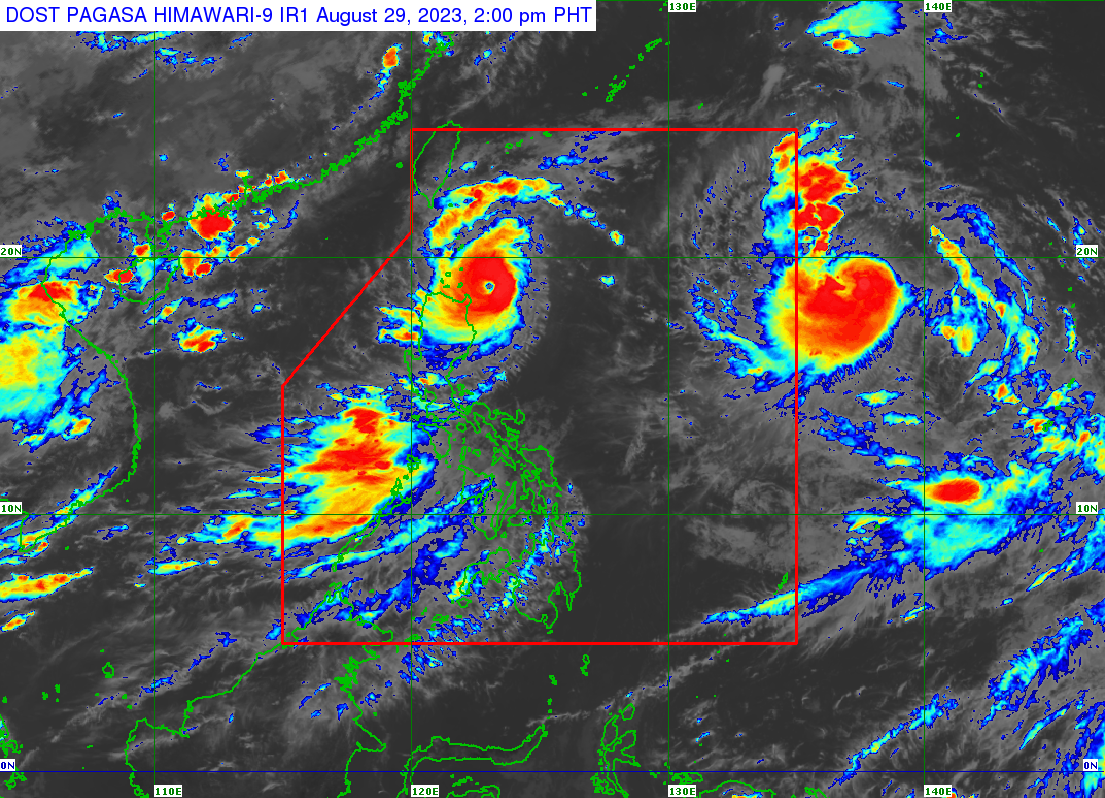
Typhoon Goring maintains strength; Signal No. 3 in two areas

MANILA, Philippines — Typhoon Goring (international name: Saola) maintained its strength as it continued to move towards the Luzon Strait, affecting several parts of Extreme Northern Luzon, said the Philippine Atmospheric, Geophysical, and Astronomical Services Administration (Pagasa) on Tuesday.
Pagasa, in its latest typhoon bulletin, said that Goring was last spotted 175 kilometers (km) east northeast of Aparri, Cagayan, or 190 km east southeast of Calayan, Cagayan, carrying wind speeds of 155 km per hour (kph) and gusts of up to 190 kph.
According to Pagasa, Goring is now moving west-northwestward “slowly.”
Tropical cyclone Wind Signal no. 3 (storm-force winds with moderate threat to life and property) is currently hoisted over the southern portion of Batanes (Sabtang, Uyugan, Ivana, Mahatao, Basco) and the northeastern part of Babuyan Islands.
Signal No. 2 (gale-force winds with minor to moderate threat to life and property) is currently raised in the rest of Batanes and Babuyan Islands, as well as in the extreme northeastern portion of mainland Cagayan (Santa Ana, Gonzaga, Santa Plaxedes, Claveria, Sanchez Mira, Pamplona, Abulug, Ballesteros, Aparri, Buguey, Camalunlugan, Santa Teresita).
On the other hand, Signal No. 1 (strong winds with minimal to a minor threat to life and property) prevails over the following areas:
- The northern and eastern portions of mainland Cagayan (Baggao, Lasam, Peñablanca, Iguig, Amulung, Gattaran, Alcala, Santo Niño, Allacapan, Lal-Lo)
- The eastern portion of Isabela (Dinapigue, San Mariano, Ilagan City, Tumauini, San Pablo, Cabagan, Maconacon, Divilacan, Palanan)
- The northern part of Apayao (Flora, Calanasan, Luna, Pudtol, Santa Marcela)
- The northern part of Ilocos Norte (Vintar, Pasuquin, Burgos, Dumalneg, Adams, Pagudpud, Bangui)
Based on the latest forecast track, Pagasa said Goring may make a close approach or landfall in Batanes between Wednesday morning and afternoon.
The typhoon is then expected to exit the Philippine Area of Responsibility by Wednesday evening or Thursday morning.
Pagasa also warned of heavy rainfall ranging from 100 to 200 millimeters in the northeastern portion of Babuyan Islands.
Meanwhile, rainfall from 50 to 100 mm may persist in Batanes, Babuyan Islands, Ilocos Norte, the northern portion of Abra, the northern portion of Apayao, and the northern and eastern portions of mainland Cagayan until Tuesday.
RELATED STORIES
Goring maintains strength, may cause Signal No. 4 in extreme northern Luzon – Pagasa
Almost 8,000 people affected by Goring — NDRRMC


