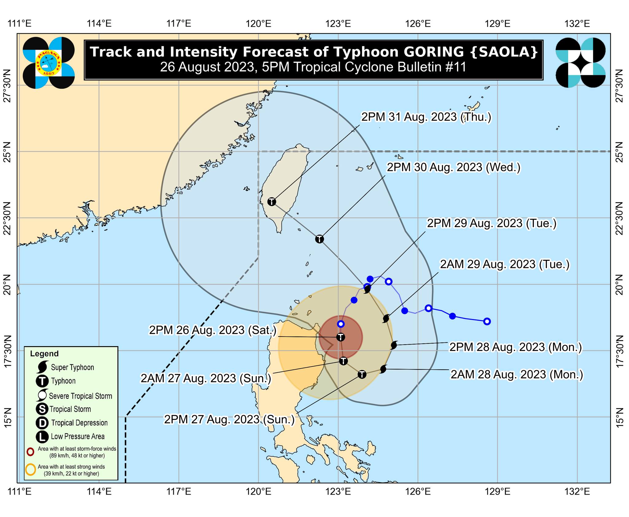
Typhoon Goring continues to intensify; wind signals still up in Luzon areas

(Photo courtesy of Pagasa)
MANILA, Philippines — Typhoon Goring (international name: Saola) continues to intensify as it moves southwestward over the sea east of Cagayan, said the Philippine Atmospheric, Geophysical and Astronomical Services Administration (Pagasa) on Saturday afternoon.
According to Pagasa’s 5 p.m. cyclone update, Goring was last spotted 145 kilometers east of northeast Tuguegarao City, Cagayan. It is moving 10 kilometers per hour (kph), carrying sustained winds of 155 kph and gusts of up to 190 kph.
Due to the typhoon’s slight increase in strength, the state weather bureau said wind signals remain hoisted in the following areas:
Tropical Cyclone Wind Signal (TCWS) No. 3
- The northeastern portion of Cagayan (Santa Ana)
- the extreme eastern portion of Isabela (Divilacan, Palanan)
TCWS No. 2
- The eastern portion of Isabela (Dinapigue, San Mariano, Ilagan City, Maconacon, Cabagan, Tumauini, San Pablo)
- The eastern portion of Cagayan (Peñablanca, Baggao, Gattaran, Lal-Lo, Gonzaga, Santa Teresita, Buguey)
- The northern portion of Aurora (Dilasag, Casiguran)
TCWS No. 1
- Batanes
- The rest of Cagayan, including Babuyan Islands
- northern and central portion of Aurora (Dinalungan, Dipaculao, Baler, Maria Aurora, San Luis)
- Quirino
- The rest of Isabela
- Apayao
- Nueva Vizcaya
- Ifugao
- Mountain Province
- Kalinga
- Abra
- The eastern portion of Ilocos Norte (Pagudpud, Adams, Vintar, Carasi, Nueva Era, Banna, Marcos, Dingras, Solsona, Piddig, Dumalneg, Bangui)
- Polillo Islands
- The eastern portion of Benguet (Bokod, Buguias, Kabayan, Mankayan)
- The eastern portion of Nueva Ecija (Carranglan, Pantabangan, Bongabon, Gabaldon, Laur, Rizal)
- Calaguas Islands
Based on Pagasa’s bulletin, Goring is forecast to bring 100 to 200 millimeters (mm) of rainfall in Mainland Cagayan and Isabela and 50 to 100 mm of rainfall in Babuyan Islands, Aurora, Cordillera Administrative Region, Ilocos Region, and northern Quezon including Polillo Islands tonight until Sunday morning.
The typhoon is expected to intensify into a super typhoon category by Monday (August 28). It would also continue to enhance the southwest monsoon or “habagat” which will affect western portions of Central Luzon, Southern Luzon, and Visayas over the next three days.
RELATED STORIES
Goring now a severe tropical storm, may become typhoon by Saturday — Pagasa
Promising ways to catch and store rainwater


