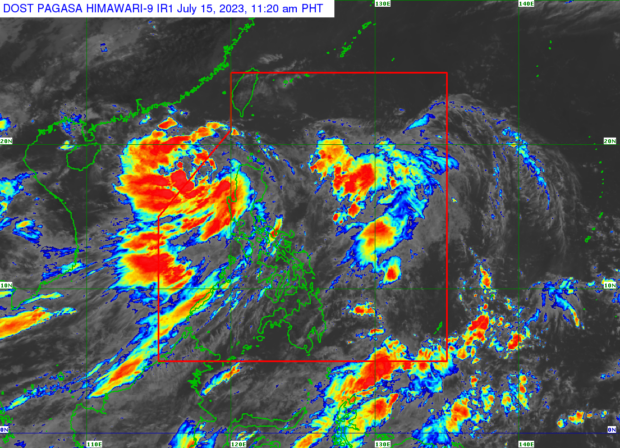
Weather satellite image from Pagasa’s website
MANILA, Philippines — The Philippine Atmospheric, Geophysical and Astronomical Services Administration (Pagasa) on Saturday said Tropical Depression Dodong has intensified into a tropical storm.
Pagasa’s 11 a.m. weather bulletin indicated that Dodong was on his way out of the Philippine area of responsibility, moving north-northwestward at 10 kilometers per hour. It was last located 305 kilometers west of Sinait, Ilocos Sur.
Pagasa also said that Dodong has maximum sustained winds of 65 kph and gustiness of up to 80 kph.
READ: LIVE UPDATES: Tropical Depression Dodong
“Dodong is forecast to move generally northwestward today before turning west-northwestward for the remainder of the forecast period. It may exit the Philippine Area of Responsibility between this morning or [in] the afternoon,” the weather bulletin states.
Pagasa said Dodong is no longer directly affecting any part of the country although it continues to enhance the southwest monsoon, locally termed habagat, dumping rain and causing gusty conditions over Metro Manila, Calabarzon, Mimaropa, Bicol Region, Western Visayas, Ilocos Region, Cordillera Administrative Region, Cordillera Administrative Region, Batanes, the eastern portion of Isabela, Quirino, Nueva Vizcaya, Zambales, Bataan, Bulacan, Pampanga, and Aurora.
Earlier on Saturday, the state weather bureau removed all Tropical Cyclone Wind Signals as Dodong cut across the West Philippine Sea.
READ: Pagasa lifts all wind signals as Tropical Depression Dodong crosses West PH Sea
But even if all TCWS were lifted, Pagasa weather specialist Benison Estareja said windy conditions and moderate to heavy rain may still be experienced in parts of Luzon because of the cyclone-enhanced southwest monsoon.
Dodong is the fourth cyclone to hit the country this year.
RELATED STORY
Dodong maintains strength, may intensify into severe tropical storm once outside PAR