Rocks in Arayat creek threaten Pampanga folk
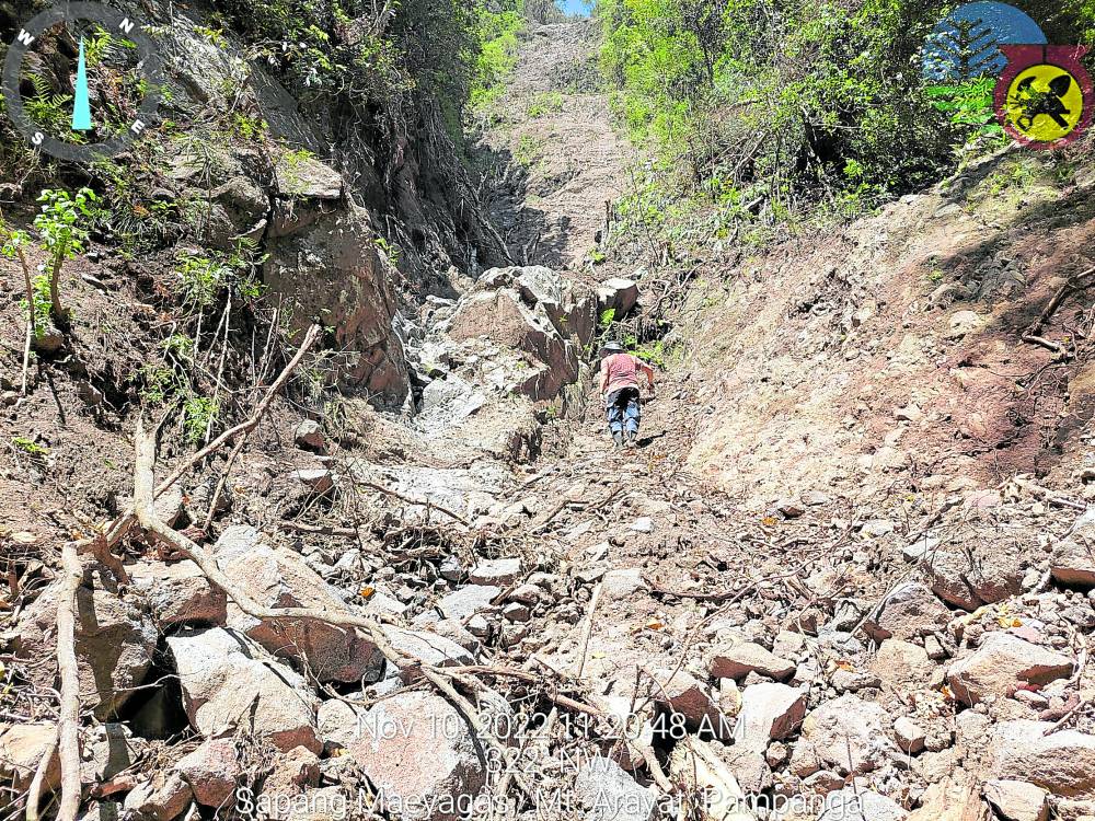
IMMINENT DANGER | Boulders and rocks fill the trail of Sapang Maeyagas as confirmed by this photo taken on Nov. 10 from a ground survey that began at Barangay San Juan Baño in Arayat, Pampanga. The rocks, soil, and other debris may be loosened once a strong typhoon hits and dump heavy rains on the area. (Photo from the Pampanga Provincial Disaster Risk Reduction and Management Office)
CITY OF SAN FERNANDO, Pampanga, Philippines — Rocks, the volume of which is equivalent to almost 4,000 truckloads, have accumulated along a creek that flows down to four subvillages at the foothills of Mt. Arayat where more than 1,000 households are situated, Pampanga Gov. Dennis Pineda confirmed on Tuesday.
Citing results of aerial and ground surveys done on Nov. 10, Pineda said the risks to human lives had increased as the volume of rocks along Sapang Maeyagas at Barangay San Juan Baño in Arayat town reached an estimated 71,350.60 cubic meters. Pineda said this volume would fit at least 3,963 trucks, with each carrying 18 cu. m.
At the height of Supertyphoon Karding (international name: Noru) on Sept. 25, about 4,120 cu. m. of rocks cascaded from the mountain’s summit, while 1,125 cu. m. rolled down during the onslaught of Severe Tropical Storm Paeng (Nalgae) starting Oct. 31, government data showed.
The assessment was based on a joint report of the Mines and Geosciences Bureau (MGB) in Central Luzon, the Department of Public Works and Highways, and the Provincial Disaster Risk Reduction and Management Office (PDRRMO).
According to a 2014 survey done by a team led by Noel Lacadin, chief geologist of the regional MGB, the rockslides and landslides began during Tropical Storm “Ondoy” (Ketsana) in 2009 and three more strong typhoons up to 2013 racked up the volume to 66,105.60 cu. m.
Interventions
Those were rocks displaced by previous eruptions of Mt. Arayat, now classified as an inactive volcano.“The estimated volume shall be considered by the concerned government agencies for the construction or establishment of appropriate engineering interventions like debris flow barriers in Sapang Maeyagas,” the MGB recommended during a meeting of the Mt. Arayat Community Safety Task Force at the provincial capitol on Monday.
Aerial footage showed grounds exposed by many plots cultivated by “kaingin” (slash-and-burn farming) below the protected area, where two large scars occurred.
Arayat Mayor Maria Lourdes Alejandrino said community meetings had been scheduled to regulate, if not stop, kaingin.
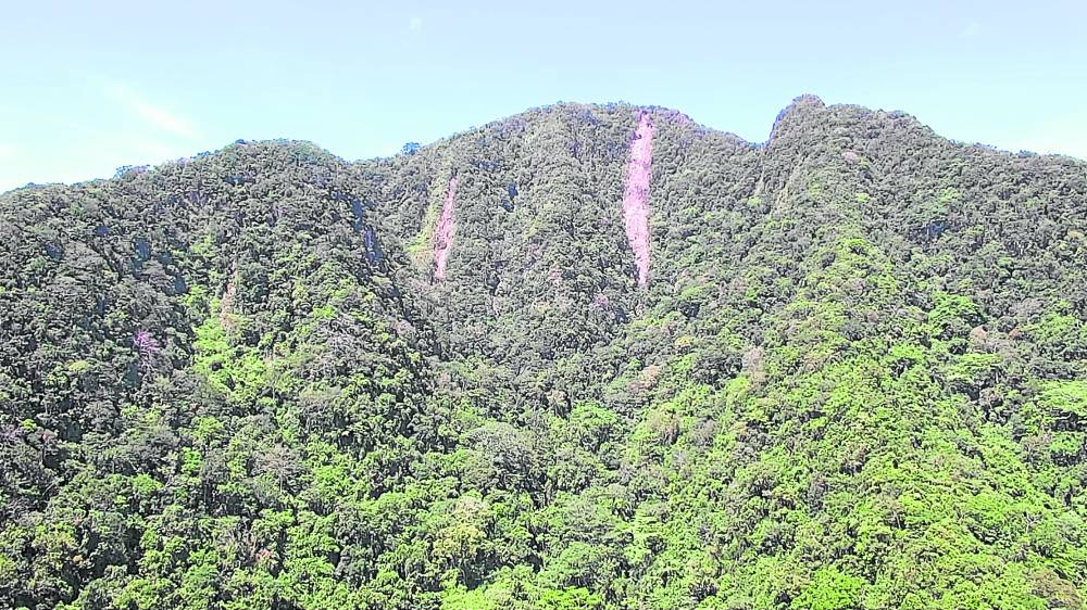
SCARRED | This aerial shot of the summit of Mt. Arayat on Nov. 10 shows two gashes left by landslides that struck the Pampanga mountain’s protected area. (Photo from the Mines and Geosciences Bureau)
Pineda said the provincial government would help fund the local government’s massive planting of bamboo to slow down the debris flow.
He said Pampanga Rep. Aurelio Gonzales and Vice Gov. Lilia Pineda were scheduled to meet Public Works Secretary Manuel Bonoan on Nov. 21 to request for engineering measures and funding for these.
Relocation
San Juan Baño village chief Froilan Soriano pushed for the permanent relocation of 570 families in Purok 7.
A previous relocation in a hectare of land donated by Gonzales failed because some dwellers sold their units or returned to Purok 7 for lack of land to till for food and cash crops, Vice Mayor Emmanuel Bonifacio Alejandrino said at the meeting.
The governor said that with four to six typhoons usually hitting the country up to December, the villagers would have to rely on warnings based on data gathered by sensors installed on the slopes by the Mt. Arayat Early Warning System for rainfall, earthquakes, and landslides.
The PDRRMO has tagged almost 1,000 houses as priorities for support and distributed “emergency go bags,” where essentials are stored, to families needing to evacuate.