Super Typhoon Hinnamnor roars into PAR and is now named Henry
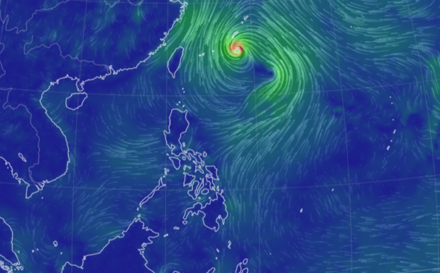
Track of Super Typhoon Hinnamnor, locally named in the Philippines as “Henry.”
MANILA, Philippines — Super Typhoon Hinnamnor is now inside the Philippine area of responsibility and will be called Super Typhoon Henry, the Philippine Atmospheric Geophysical and Astronomical Services Administration (Pagasa) said.
“Super Typhoon HINNAMNOR entered the Philippine Area of Responsibility at 5:30 PM today and was given the domestic name #HenryPH,” Pagasa announced on its Facebook page.
LIVE UPDATES: Weather disturbances Hinnamnor, Gardo latest news
The super typhoon was last located 870 kilometers northeast of extreme Northern Luzon, packing maximum sustained winds of 195 kilometers per hour (kph) and gustiness of up to 240 kph, Pagasa said.
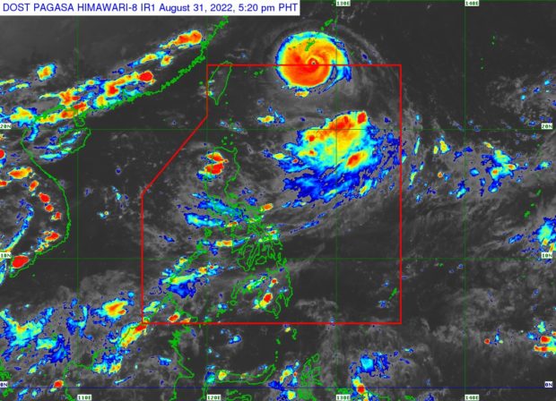
Weather satellite image from Pagasa
Pagasa earlier said the ninth typhoon that entered the country this year would become “almost stationary,” and it may reach a peak of 205 kph before gradually downgrading to a typhoon category by Friday.
The state meteorologists’ forecast track earlier showed that the typhoon was not expected to make landfall in the country.
Pagasa weather specialist Raymond Ordinario said Henry is not currently affecting the weather condition in the country.
Thursday weather
However, the trough of tropical depression Gardo, along with the southwest monsoon or habagat, will bring overcast skies and rains in most parts of Luzon.
Pagasa said Metro Manila, Calabarzon, Mimaropa, Bicol Region, Ilocos Region, Cordillera Administrative Region, Zambales and Bataan will experience cloudy skies with scattered rain showers and thunderstorms due to “Gardo.”
Tropical depression Gardo was last seen 1,065 kilometers east of extreme Northern Luzon, packing 55 kph with gustiness of 70 kph, according to the government weather service.

RELATED STORIES
Super Typhoon Hinnamnor to enter PAR Wednesday night
TD Gardo, Super Typhoon Hinnamnor likely to merge, strengthen in coming days – Pagasa