Super Typhoon Hinnamnor to enter PAR Wednesday night

MANILA, Philippines — Super Typhoon Hinnamnor will enter the Philippine Area of Responsibility (PAR) on Wednesday night as it maintains its strength, the state weather bureau said.
Once inside the PAR, the Philippine Atmospheric Geophysical and Astronomical Services Administration (Pagasa) the super typhoon will be locally named “Henry.”
Hinnamnor is currently located 980 kilometers northeast of extreme Northern Luzon, packing maximum sustained winds of 195 kilometers per hour (kph) with gustiness up to 240 kph.
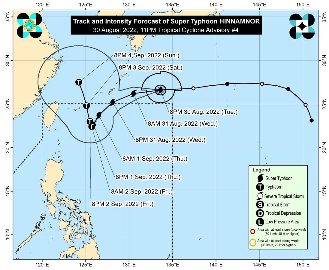
“Today through tomorrow evening, the super typhoon is forecast to decelerate while tracking generally west southwestward over the sea southwest of the Ryukyu Islands [in Japan],” Pagasa said in its latest advisory.
Article continues after this advertisement“On the track forecast, Hinnamnor may enter the PAR region tonight,” the government weather service added.
Article continues after this advertisement
Hinnamnor “may become almost stationary” by late Thursday through Friday, said Pagasa.
A tropical cyclone wind signal may be hoisted over extreme Northern Luzon as the extent of “Hinnamnor” continues to expand.
RELATED STORY:
Typhoon Hinnamnor to enter PAR Thursday, may become ‘almost stationary’ in northern Luzon