LPA east of Luzon may intensify into tropical cyclone
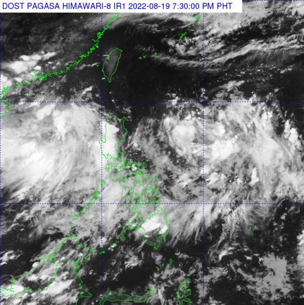
Thick clouds can be seen on the country’s eastern side, where the low-pressure area (LPA) – which Pagasa says may develop into a tropical cyclone – is currently located. Cloud bands on the western side, meanwhile are brought by the southwest monsoon (Satellite image from Pagasa)
MANILA, Philippines — A low-pressure area (LPA) east of Luzon, which causes cloudy skies over the Bicol Region and Eastern Visayas, is being monitored by the state weather bureau as it may intensify into a tropical cyclone.
Weather updates from the Philippine Atmospheric, Geophysical, and Astronomical Services Administration (Pagasa) on Friday afternoon showed that the LPA was last spotted 1,210 kilometers east of Central Luzon.
As of now, the trough of the LPA brings rains over Bicol and Eastern Visayas, while the southwest monsoon or habagat is responsible for the isolated showers and thunderstorms over the western parts of Luzon like Central Luzon and Metro Manila.
“Sa ngayon itong low pressure area natin ay ating patuloy na binabantayan dahil base sa ating analysis, may posibilidad na maging bagyo ito sa susunod na araw,” weather specialist Raymond Ordinario said.
However, the weather over Central Luzon and Metro Manila is expected to improve over the weekend, with only Calabarzon being affected by the cloudy skies.
Due to the cloud bands, Legazpi would have colder temperatures on Saturday compared to the rest of Luzon, at 24 to 30 degrees Celsius. Meanwhile, Tuguegarao would have temperature between 24 to 33 degrees, Laoag and Puerto Princesa with 25 to 31 degrees, Tagaytay with 22 to 31 degrees, and Metro Manila with 25 to 33 degrees.
Similarly, in Visayas, the eastern side of the island groups would have colder weather. For example, Tacloban and Davao would have temperatures of 24 to 30 degrees Celsius, Cagayan de Oro with 22 to 30 degrees, Cebu with 26 to 31 degrees, Iloilo with 24 to 33 degrees, and Zamboanga with 24 to 31 degrees.
Overall, Pagasa’s three-day forecast showed that weather in Metro Manila would generally be fair for Sunday and Monday, but rain showers and thunderstorms may resume by Tuesday as the southwest monsoon gets intensified by the LPA.
Similar scenarios are expected over Baguio City, while Legazpi and Cebu would still experience rains from Sunday to Tuesday due to the LPA.
But as of now, Pagasa said that no gale warning had been raised in any part of the country, as sea conditions remain slightly moderate.