

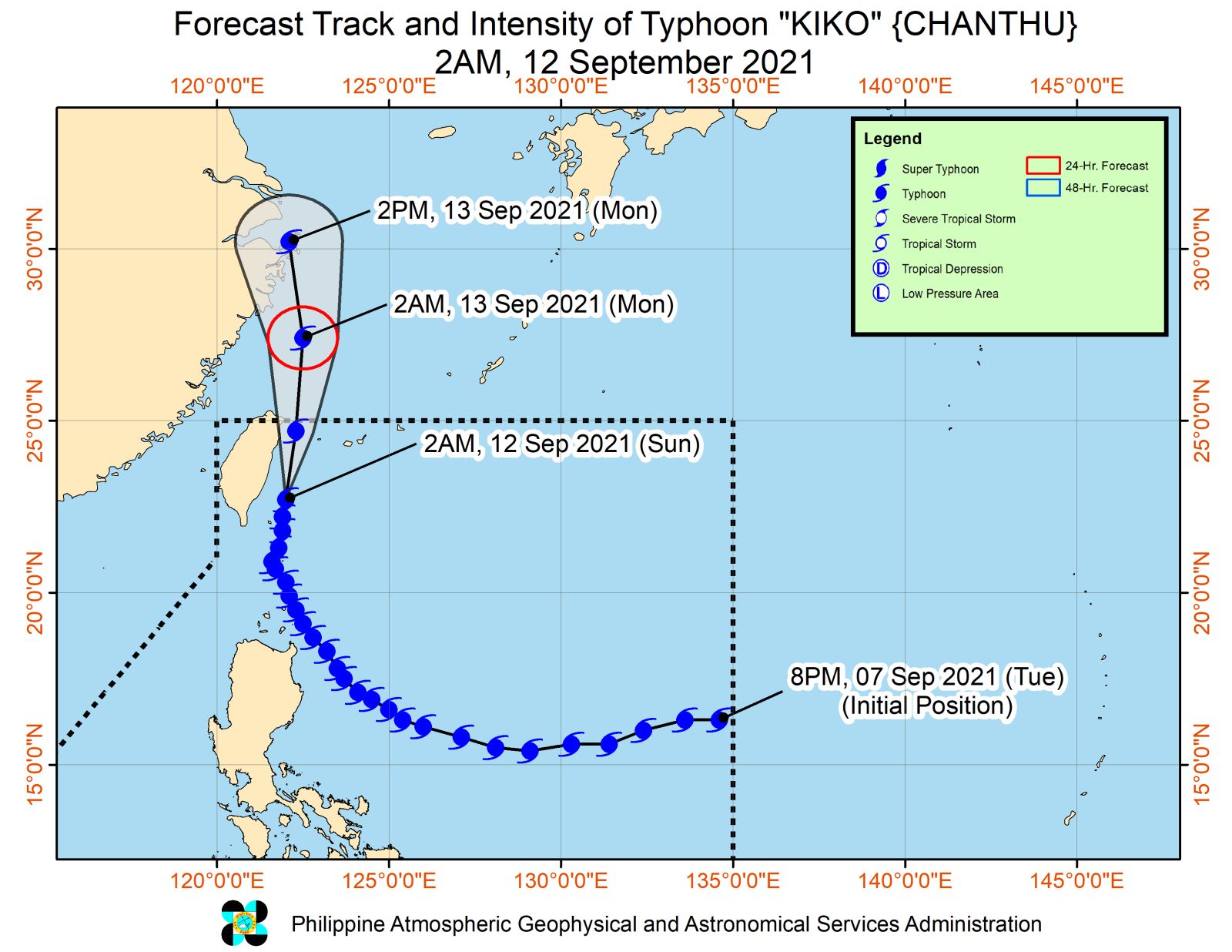

MANILA, Philippines — Typhoon Kiko has slightly weakened and was spotted over the sea east of Central Taiwan, the Philippine Atmospheric, Geophysical, and Astronomical Services Administration (Pagasa) reported on Sunday.
Based on Pagasa’s 5 a.m. bulletin, Kiko was monitored 245 kilometers north of Itbayat, Batanes.
Moving northward at 15 kilometers per hour (kph), Kiko has maximum sustained winds of 175 kph near the center and gusts of up to 215 kph.
Tropical Cyclone Wind Signal No. 2 is still raised over Itbayat while Signal No. 1 is hoisted over Babuyan, Calayan, and Panuitan Islands and the rest of Batanes.
Batanes will experience heavy to intense with at times torrential rains in the next 24 hours.
Babuyan Islands, meanwhile, may have moderate to heavy with at times intense rains.
Typhoon Kiko will likewise enhance the southwest monsoon or habagat which brings monsoon rains over Ilocos Region, Cordillera Administrative Region, Zambales, and Bataan.
The habagat will also cause cloudy skies with scattered rain showers and thunderstorms over Metro Manila, Laguna, Rizal, and the rest of Cagayan Valley and Central Luzon.
Moreover, the rest of the country will have partly cloudy to cloudy skies with isolated rain showers and thunderstorms due to the habagat and localized thunderstorms.
Kiko is forecast to leave the Philippine area of responsibility Sunday afternoon or evening.
RELATED STORY:
Fair weather seen as Typhoon Kiko heads for Taiwan