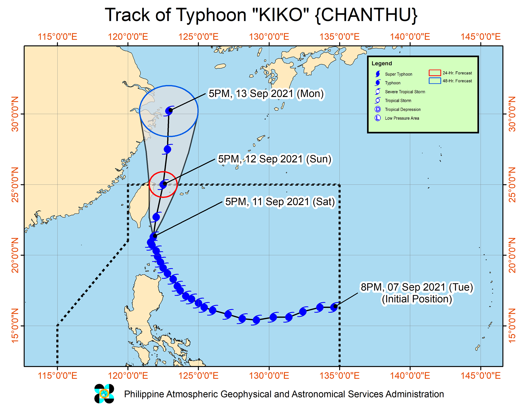
Signal No.3 in Batanes as Typhoon Kiko moves northwestward
MANILA, Philippines — Typhoon Kiko continues to weaken as it moves northwestward on Saturday over the Bashi Channel, the state weather service said.
In its 8 p.m. bulletin, Philippine Atmospheric, Geophysical and Astronomical Services Administration (Pagasa) said the center of the eye of the typhoon is at 100 kilometers north of Itbayat, Batanes, packing maximum sustained winds of 185 kilometers per hour (kph) near the center with a gustiness of up to 230 kph.
The whole of Batanes is now under TCWS No. 3 with destructive typhoon-force winds to prevail within the next 18 hours.
Typhoon Kiko will also dump heavy to intense, or even torrential rains at times in Batanes over the next 24 hours, according to Pagasa.
Meanwhile, the northern portion of the Babuyan Islands is under TCWS No. 2, with damaging gale-force to storm-force winds to prevail within the next 24 hours, according to Pagasa.
Article continues after this advertisementThe rest of the Babuyan Islands however is under Signal No.1, where strong winds are to be expected within the next 36 hours.
Moderate to heavy with at times intense rains are also likely over the Babuyan Islands, the northern portion of Cagayan, Ilocos Norte, Ilocos Sur, Abra, Apayao, Kalinga, and Benguet in the next 24 hours, according to Pagasa.
Typhoon Kiko is projected to exit the Philippine Area of Responsibility by Sunday afternoon or evening, and will further weaken as it meets the rugged terrain of Taiwan, the state weather said.
