Typhoon Kiko further intensifies, may cause possible storm signals in Northern Luzon
PAGASA
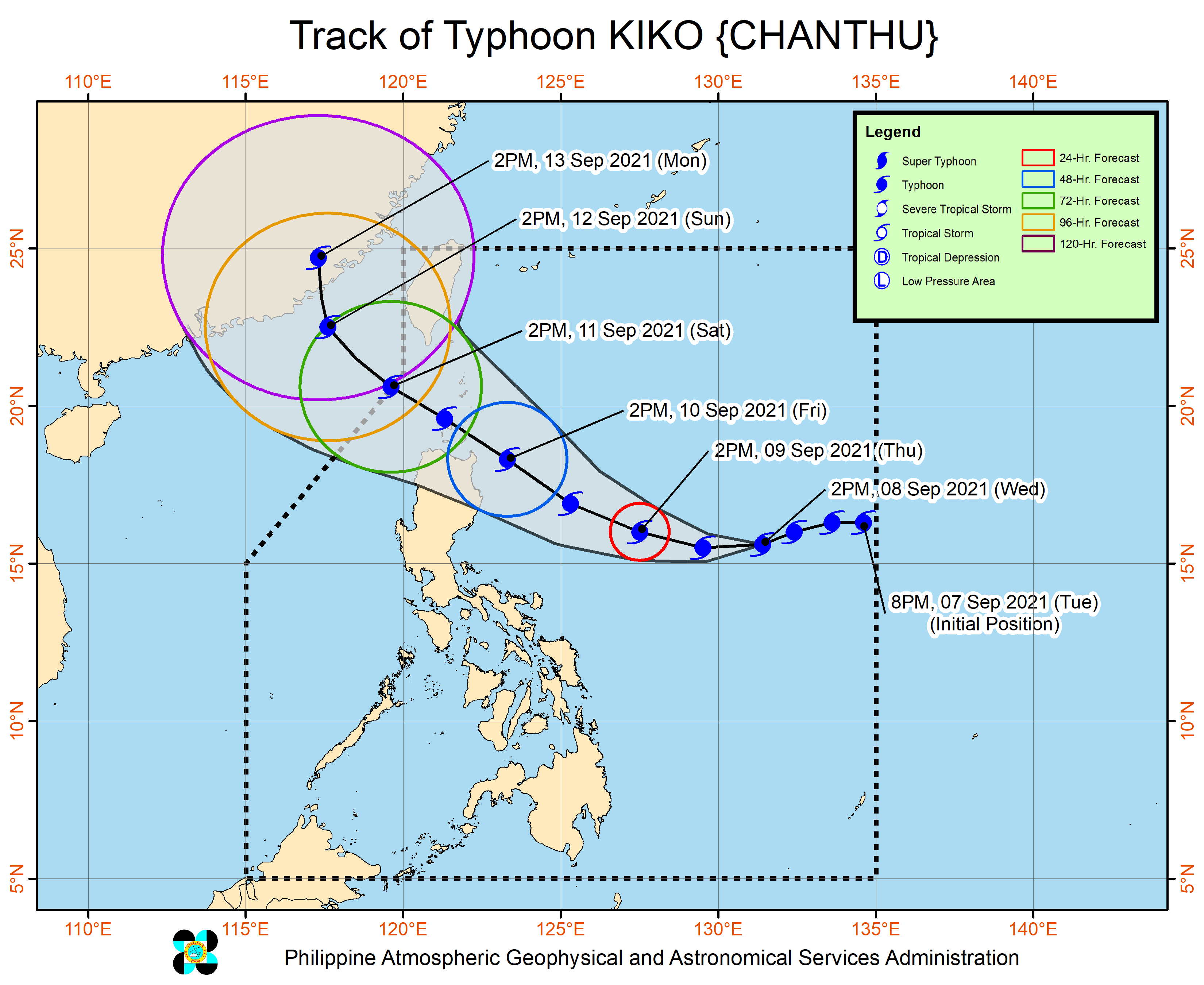
MANILA, Philippines — As Tropical Storm Jolina continues to ravage Luzon, the Philippine Atmospheric, Geophysical and Astronomical Services Administration (Pagasa) warned that it may also hoist warning signals in Northern Luzon starting Wednesday night or Thursday morning due to Typhoon Kiko.
According to Pagasa, heavy rains associated with Kiko may begin affecting the eastern section of Northern Luzon on Friday.
“Posible po tayong magtaas ng mga warning signal sa ilang lugar dito sa Northern Luzon area, either mamayang gabi o bukas ng umaga,” said Pagasa senior weather specialist Chris Perez.
(It’s possible that we would raise warning signals in some places here in the Northern Luzon area, either tonight or tomorrow morning.)
The eye of Kiko was located 1,020 kilometers east of Central Luzon, reaching maximum sustained winds of 175 kilometers per hour (kph) near the center and gustiness of up to 215 kph.
Article continues after this advertisementIt is currently moving west southwestward towards Northern Luzon at 20 kph.
Article continues after this advertisementMeanwhile, tropical storm Jolina is forecasted to leave the Philippine Area of Responsibility by Thursday evening or Friday early morning.
RELATED STORY
Jolina weakens into a tropical storm; Signal No. 2 still up in NCR, parts of Luzon