Storm surge warning raised in Oriental Mindoro, Batangas, Quezon due to ‘Jolina’
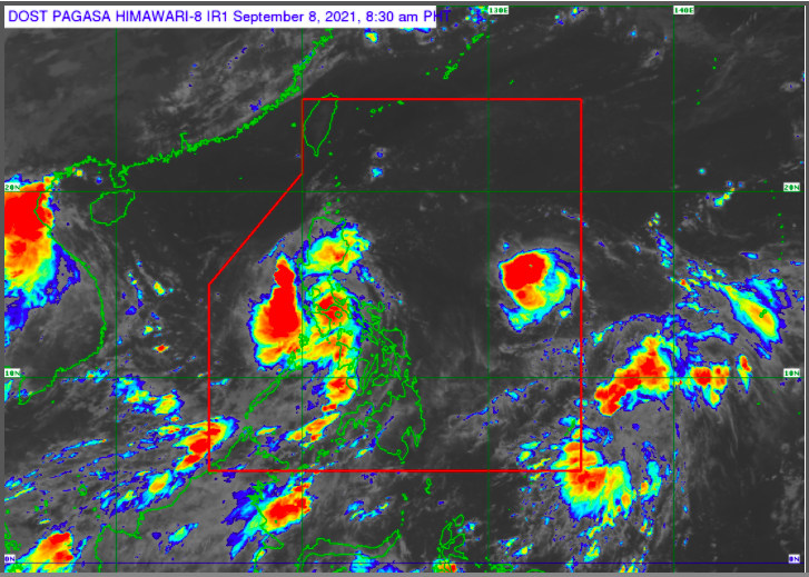
Pagasa weather satellite image as of 8:30 AM.
MANILA, Philippines — A storm surge is expected in coastal areas of Oriental Mindoro, Batangas, and Quezon in the next 24 hours due to severe tropical storm Jolina, the state weather bureau said on Wednesday.
“In the next 24 hours, storm surge of up to 1.0 m (meters) over several coastal areas of Oriental Mindoro, Batangas and Quezon may result in coastal inundation which may pose threat to life and property,” Pagasa said in its 8 am bulletin.
Oriental Mindoro, Batangas and Quezon are under Tropical Cyclone Wind Signal (TCWS) No. 2, according to Pagasa.
The state weather bureau also said that coastal areas of localities under TCWS, especially those at No. 2 may also experience coastal flooding due to hazardous surf conditions.
These are the areas under the TCWS No. 2, where damaging gale-force to storm-force winds are expected in the next 24 hours.
Article continues after this advertisement- Marinduque
- Northern and central portions of Oriental Mindoro (Bansud, Gloria, Pinamalayan, Pola, Socorro, Victoria, Puerto Galera, San Teodoro, Baco, City of Calapan, Naujan)
- Northern and central portions of Occidental Mindoro (Abra de Ilog, Paluan, Mamburao, Santa Cruz, Sablayan) including Lubang Islands
- Central and southern portions of Quezon (General Luna, Macalelon, Sampaloc, Unisan, Pagbilao, Sariaya, Alabat, Pitogo, City of Tayabas, Padre Burgos, Lucban, Gumaca, Agdangan, Plaridel, San Antonio, Candelaria, Atimonan, Quezon, Tiaong, Mauban, Perez, Lucena City, Dolores, Real, Infanta),
- Batangas
- Cavite
- Laguna
- Rizal
- Metro Manila
- Southern portion of Bulacan (Pandi, Bulacan, Marilao, Calumpit, Norzagaray, Plaridel, Santa Maria, Balagtas, Bocaue, Bustos, City of Malolos, Angat, Obando, City of San Jose del Monte, Pulilan, City of Meycauayan, Hagonoy, Paombong, Guiguinto, San Rafael, Baliuag)
- Pampanga
- Bataan
- Zambales
- Tarlac
TCWS No. 1 is raised over the following areas, where strong winds are expected within 36 hours:
Article continues after this advertisement- La Union
- Southern portion of Benguet (Sablan, Tublay, Bokod, La Trinidad, Baguio City, Itogon, Tuba, Kapangan, Atok)
- Southern portion of Nueva Vizcaya (Alfonso Castaneda, Dupax del Norte, Dupax del Sur, Aritao, Santa Fe, Kayapa)
- Southern portion of Aurora (Baler, Maria Aurora, San Luis, Dingalan)
- Pangasinan
- Nueva Ecija
- The rest of Bulacan
- The rest of Quezon including Polillo Islands, Camarines Norte
- Western portion of Camarines Sur (Ragay, Del Gallego, Lupi, Sipocot, Cabusao, Libmanan, Pasacao, Pamplona)
- Western portion of Romblon (Odiongan, Romblon, Banton, Santa Maria, Concepcion, San Andres, San Jose, Looc, Ferrol, Alcantara, San Agustin, Calatrava, Corcuera, Santa Fe)
- The rest of Oriental Mindoro
- The rest of Occidental Mindoro
TCWS No. 1 in other areas is hereby lifted, according to Pagasa.
Jolina will bring rough to very rough sea condition with 2.5 to 5.5 meters of waves over the seaboards of areas under TCWS No. 2, while moderate to rough seas with 1.2 to 2.8 meters of waves will be experienced over the seaboards of areas where TCWS No. 1 is in effect, as well as the remaining seaboards of Southern Luzon and Visayas.
Sea travel in areas under TCWS No. 2 Sea travel is risky for all types of sea crafts, and mariners without the proper experience should immediately seek safe harbor. Mariners of small seacrafts in areas under TCWS No. 1 are advised to take precautionary measures when venturing out to sea.
Jolina, with a maximum sustained winds of 95 kilometers per hour (kph) near the center and gustiness of up to 115 kph, will make a landfall in either San Juan or Lobo in Batangas within 1-2 hours, according to Pagasa.
Afterwards, Jolina will cross the Batangas-Cavite area before emerging over the mouth of Manila Bay by Wednesday afternoon or evening, that will be followed by another landfall in the vicinity of Bataan Peninsula.
Frictional effects during its traverse of mainland Luzon will weaken Jolina down to tropical storm category.
Jolina is expected to exit the Philippine Area of Responsibility on Friday morning.