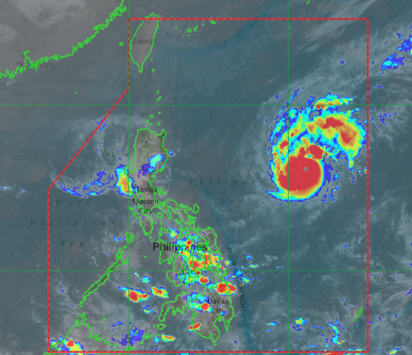
Pagasa assures: Astani won’t have immediate impact even after entering PAR on Sunday

Source: Pagasa / DOST
MANILA, Philippines — On a rare occurrence, two storms will be simultaneously inside the Philippine area of responsibility (PAR) on Sunday, as state meteorologists predicted that tropical storm Astani will enter the country while typhoon Rolly is still inside PAR.
But the Philippine Atmospheric, Geophysical and Astronomical Services Administration assured that even if Astani enters PAR while relatively strong Rolly moves closer to Luzon landmass, Astani would not yet have any effect on the local weather systems.
“Astani will move generally northwestward as it moves towards the eastern boundary of the Philippine Area of Responsibility (PAR). It may enter the PAR on Sunday,” Pagasa said in its tropical cyclone outlook for Astani on Friday.
“This tropical storm is less likely to bring severe weather over any portion of the country over the next 3 days, it added.
As of now, Astani, which will be given the local name “Siony” once it enters PAR, is located 1,865 kilometers east of Visayas. It now has maximum sustained winds of 65 kilometers per hour (kph) and gustiness of up to 80 kph.
Article continues after this advertisementIt may intensify into a severe tropical storm, and eventually as a typhoon,
Article continues after this advertisementPagasa’s forecast shows that Astani’s track would deviate from Rolly’s, and may generally stay over the Philippine sea. Astani’s last predicted track ends 780 kilometers east of Calayan, Cagayan.
Earlier, Pagasa said that there is a slight possibility that Rolly would intensify into a super typhoon by local standards, which means that its maximum sustained winds may go over 220 kph.
