Tropical Storm ‘Enteng’ slightly intensifies ahead of PAR exit
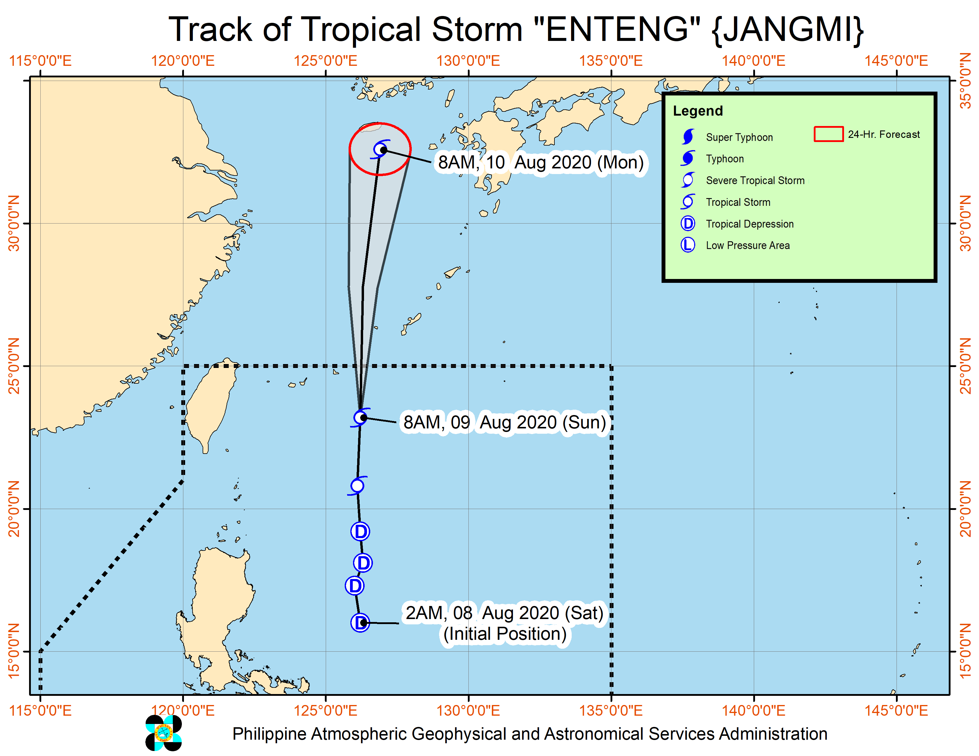
MANILA, Philippines — Ahead of its exit from the Philippine area of responsibility (PAR) Sunday afternoon, Tropical Storm “Enteng” has “slightly” intensified and accelerated as it moves north towards the southern part of Japan’s Ryuku Islands, the state weather bureau said.
In its 11 a.m. weather update Philippine Atmospheric, Geophysical and Astronomical Services Administration (Pagasa) said Enteng was last spotted 540 kilometers (km) northeast of Basco, Batanes with maximum sustained winds 75 kilometers per hour (kph) and a gustiness of up to 90 kph.
It was moving northward at 45 kph.
Meanwhile, a low pressure area (LPA) also being monitored by Pagasa was last traced 210 km west of Iba, Zambales but was “less likely to develop into a tropical depression in the next 24 hours.”
The state weather bureau said the southwest monsoon enhanced by Enteng and the LPA will bring rains over Pangasinan, Benguet, Zambales, Bataan, Pampanga, Tarlac, and MIMAROPA, as well as occasional rains over Metro Manila, Aklan, Antique, and the rest of Luzon.
It added that Pangasinan, Benguet, Nueva Vizcaya, Quirino, Central Luzon, Metro Manila, Calabarzon, Mimaropa, Bicol Region, and Western Visayas are expected to experience gusty conditions associated with the southwest monsoon in the next 24 hours, especially in coastal and mountainous areas.
No tropical cyclone wind signal has been raised.
Nevertheless, Pagasa warned of possible flooding and rain-induced landslide during heavy or prolonged rainfall “especially in areas that are highly or very highly susceptible to these hazards.”
“The public and local disaster risk reduction and management offices concerned are advised to monitor the Rainfall/Thunderstorm Advisories and Heavy Rainfall Warnings from PAGASA Regional Services Divisions and take appropriate measures,” Pagasa said in its weather update.
The state weather bureau also raised gale warnings over the seaboards of Pangasinan, Zambales, Bataan, western coast of Batangas, western coast of Occidental Mindoro including Lubang Island, and western coast of Palawan including Calamian Islands (2.8 to 4.0 m); Batanes, Cagayan including Babuyan Islands, and Isabela (2.8 to 3.4 m).
Sea travel is risky over these areas due to rough to very rough seas, Pagasa said.
“Those with small seacrafts are advised to take precautionary measures while venturing out over the seaboards of Visayas and the rest of Luzon due to moderate to rough seas (1.2 to 2.8 m),” it added.