Typhoon Tisoy makes 4th landfall in Oriental Mindoro
from Pagasa
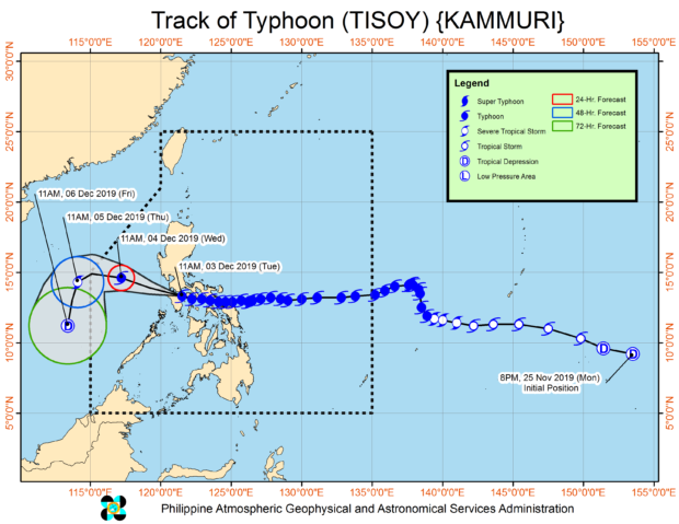
MANILA, Philippines — Typhoon Tisoy further weakened on Tuesday afternoon as it passed over northern portions of Mindoro provinces, the state weather bureau reported.
In its 19th Severe Weather Bulletin issued 2 p.m. Tuesday, the Philippine Atmospheric, Geophysical and Astronomical Services Administration (Pagasa) said the typhoon made its fourth landfall in Naujan, Oriental Mindoro, at 12:30 p.m.
Tisoy first hit land in Gubat, Sorsogon, on Monday night. Its second landfall was in San Pascual, Burias Island in Masbate and its third landfall was in Marinduque – all on Tuesday morning.
Typhoon Tisoy’s eye was spotted at 1 p.m. in the vicinity of Baco, Oriental Mindoro, moving westward at 25 kilometers per hour (kph) as it packed maximum sustained winds of 140 kph and gusts of up to 195 kph.
According to Pagasa, frequently to continuous heavy to intense rains may be expected over Romblon, Marinduque, Mindoro Provinces, and CALABARZON, while occasional to frequent heavy rains may be experienced over the Bicol region, Central Luzon, and Metro Manila until late afternoon Tuesday.
Article continues after this advertisementPagasa also said Aklan, Antique, Capiz, and the northern portions of Negros Provinces will have intermittent heavy rains in the same period.
Article continues after this advertisementBut from late afternoon Tuesday until Wednesday morning, Pagasa said that frequent to continuous heavy (with isolated intense) rains will prevail over Mindoro provinces, Central Luzon, Rizal, Northern Quezon including Polillo Islands, and Metro Manila.
On the other hand, Pagasa said occasional heavy rains may be expected in Cagayan Valley, Cordillera Administrative Region, Marinduque, Romblon, and the rest of Calabarzon, as intermittent heavy rains will occur in the Calamian Islands.
The state weather bureau advised residents of the said areas to take precautionary measures, especially those living in flood-prone and landslide-prone areas. It also advised them to coordinate with their respective local disaster risk reduction and management offices and continue monitoring weather updates.
Moreover, Pagasa said storm surges of up to three meters are likely to happen in several coastal areas in Marinduque, Mindoro provinces, Romblon, Cavite, and Batangas.
And while the Tropical Cyclone Wind Signals (TCWS) over Ilocos Sur, Biliran, rest of Northern Samar, northern Negros Occidental, Guimaras, and Leyte have already been lifted, Pagasa said Signal No. 3 remains in the following areas:
- Southern portion of Quezon (Sampaloc)
- Lucban
- Tayabas
- Pagbilao
- Lucena
- Sariaya
- Candelaria
- Dolores
- Tiaong
- San Antonio
- Marinduque
- Oriental Mindoro
- Occidental Mindoro, including Lubang Island
- Batangas
- Cavite
- Laguna
These areas are forecast to experience 121 kph up to 170 kph winds for at least 18 hours, according to Pagasa.
The state weather bureau likewise said that areas likely to have 61 kph up to 120 kph winds and still under Signal No. 2 are:
Luzon
-
- Burias Island
- Romblon
- northern portion of Camarines Sur ( Cabugao
- Libmanan
- Pamplona
- Pasacao
- Sipocot
- Lupi
- Ragay
- Del Gallego)
- Camarines Norte
- Metro Manila
- Bulacan
- Bataan
- Tarlac
- Pampanga
- Nueva Ecija
- southern Aurora (Dipaculao
- Maria Aurora
- Baler
- San Luis
- Dingalan)
- Rizal
- rest of Quezon including Polillo Islands
- Calamian Islands (Coron
- Busuanga
- Culion
- Linapacan)
- Zambales
- Pangasinan
Visayas
-
- Northen Aklan (Malay)
- Buruanga
- Nabas
- Ibajay and northern Antique (Caluya)
- Libertad
- Pandan
Meanwhile, Pagasa said Signal No. 1 is still raised over the following areas:
Luzon
-
- Southern Isabela (Palanan
- Dinapigue
- San Mariano
- San Guillermo
- Benito Soliven
- Naguilian
- Reina Mercedes
- Luna
- Aurora
- Cabatuan
- San Mateo
- Cauayan City
- Alicia
- Angadanan
- Ramon
- San Isidro
- Echague
- Cordon
- Santiago City
- Jones and San Agustin)
- Benguet
- Nueva Vizcaya
- La Union
- Quirino
- rest of Aurora
- northern portion of Palawan (El Nido
- Taytay
- Araceli
- Dumaran)
- rest of Camarines Sur
- Cuyo Islands (Cuyo
- Magsaysay
- Agutaya)
- Masbate including Ticao Island
- Albay
- Sorsogon
- and Catanduanes
Visayas
-
- Western portion of Northern Samar
- San Antonio
- San Vicente
- Lavezares
- Allen
- Biri
- Rosario
- Victoria
- San Jose
- San Isidro
- Bobon
- Catarman
- Lope de Vega
- northwestern portion of Samar (Calbayog)
- Tagapul-am
- Almagro
- Sto. Niño
- Capiz
- Iloilo
- rest of Aklan
- rest of Antique
Pagasa then warned that traveling by sea is still risky over coasts of areas placed under TCWS, as well as the seaboards of Northern Luzon, western seaboard of Palawan, seaboards of Visayas, and northern and eastern seaboards of Mindanao.
It also said that gusty conditions may occur even in Northern Luzon areas that are not placed under any TCWS (especially in the coastal and mountainous zones) because of the northeast monsoon or amihan.