‘Amang’ maintains strength; Surigao landfall seen
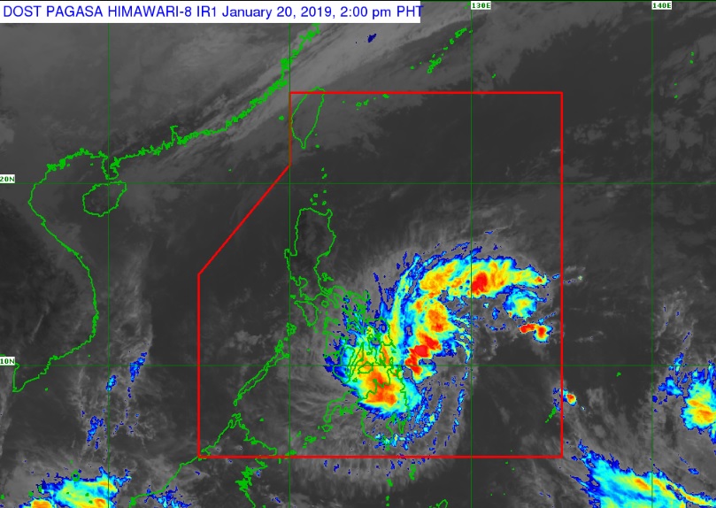
MANILA, Philippines — Tropical Depression “Amang” maintained its strength as it moved west-northwestward towards the Surigao provinces, the Philippine Atmospheric, Geophysical and Astronomical Services Administration (Pagasa) said.
In its 2 p.m. weather update on Sunday, Pagasa said Amang was moving 30 kilometers per hour (kph) in a west-northwest direction.
It was still packing maximum sustained winds of 45 kph near the center and gustiness of up to 60 kph.
The weather bureau said that Amang was last spotted 235 kilometers East Southeast of Surigao City, Surigao del Norte.
Moderate to heavy rain will prevail over Caraga, Northern Mindanao, Eastern Visayas, Davao Oriental, Compostela Valley, Catanduanes, Albay, Sorsogon, Masbate, Northern Negros Provinces, Northern Cebu, and Bohol.
Article continues after this advertisementPagasa advised residents in these areas to take appropriate actions, coordinate with local disaster risk reduction management offices and continue to monitor weather updates as it warned of flooding and landslides.
Article continues after this advertisementPagasa also raised Tropical Cyclone Warning Signal (TCWS) Number 1 over Eastern Samar, Samar, Biliran, Leyte, Southern Leyte, Eastern Bohol and Northern Cebu in the Visayas, and over Agusan del Sur, Agusan del Norte, Surigao del Norte, Dinagat Islands and Camiguin in Mindanao.
The weather bureau warned fisherfolk and those with small seacraft not to venture over the seaboard of areas under TCWS No. 1, the northern seaboard of Northern Luzon, and the eastern seaboards of Luzon, Visayas and Mindanao due to the approaching tropical depression and the surge of northeast monsoon or “Amihan.”
Signal number 1 may also be raised this afternoon or early evening over northern Samar.
Amang is expected to make landfall over the Surigao del Norte – Siargao Islands area between this afternoon and tonight. /cbb
