Typhoon ‘Trami’ to enter PAR on Sunday

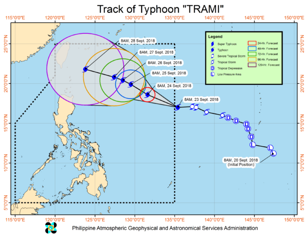
PHOTO FROM PAGASA DOST
Tropical storm “Trami” has intensified into a typhoon and is expected to enter the Philippine Area of Responsibility (PAR) on Sunday afternoon.
In its 11 a.m. advisory, the Philippine Atmospheric, Geophysical and Astronomical Services Administration (Pagasa) said that “Trami” was last spotted 1,260 km east of Central Luzon.
The weather bureau said “Trami’” will be named “Paeng” once it enters PAR Sunday afternoon.
It had maximum sustained winds of 120 kilometers per hour (kph) and gustiness of up to 145 kph. It was moving west northeast at a speed of 25 kph.
According to Pagasa, typhoon “Trami” may affect the extreme Northern Luzon around Friday (Sept. 28). /je
Responding to appeals for help, the Inquirer is extending its relief efforts to the families affected by Typhoon Paeng. Cash donations may be deposited in the Inquirer Foundation Corp. Banco De Oro (BDO) Current Account No.: 007960018860 and through Maya
