Saving Yamashita’s last fortress

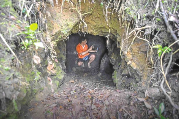
HISTORIC SHELTER Guillermo Dimog inspects a dugout, one of many still remaining at a ridge in Kiangan, Ifugao, which served as a shelter for retreating Japanese soldiers during World War II.
LAGAWE, Ifugao — In the waning days of World War II in 1945, the Imperial Japanese Army made its last stand at a mountain range bordering the towns of Kiangan and Hungduan in Ifugao province.
Over 70 years later, three natives of Kiangan have embarked on a mission to preserve what remains of the once impregnable mountain fortress carved with interconnected trenches, dugouts and hundreds of foxholes.
“This ridge is an important piece of history like the Yamashita Shrine in Poblacion,” said Guillermo Dimog, a banker who always returns home during breaks from work in Manila.
National shrine
The shrine, known as “Bantayog sa Kiangan” (Kiangan National Shrine), marks the place where Gen. Tomoyuki Yamashita surrendered to Filipino-American forces, practically ending the war in the Pacific.
Article continues after this advertisementLocated 1,500 meters above sea level, the ridge created a natural barrier between the American artillery in Poblacion valley at the southeast and Yamashita’s bunker on Mt. Napulawan in Hungduan at the northwest.
Article continues after this advertisementLocal accounts say a majority of the retreating Japanese soldiers guarded this ridge.
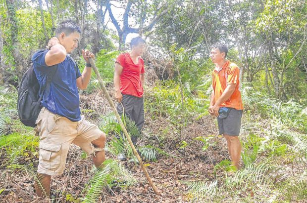
With relatives Robert Tayaban Jr., a civil engineer, and Stephen Tayaban, a seaman, Dimog started clearing the dense undergrowth in March as vegetation naturally took over.

IFUGAO SONS(from left) Ifugao professionals Stephen Tayaban, Robert Tayaban Jr. and Guillermo Dimog banded together to preserve the historic ridge that protected Japanese soldiers during the war. —KARLSTON LAPNITEN
Dimog said the plan was to recreate the forested 3-hectare property, owned by the Tayaban family, into an ecological and reflection park.
“People have been coming to the place because of the refreshing, meditative ambiance,” said Stephen, who left the seas to be at home in the mountains.
Wildlife habitat
He built several bamboo benches at strategic places where visitors can view Kiangan and nearby towns of Asipulo, Hungduan and Lagawe, the capital town.
Clearing has been limited only to historically acknowledged Japanese trails and foxholes since the area is home to diverse wildlife, Dimog said.
Wild pigs and swiftlets have made their home in the only remaining tunnel, as well as in several deep dugouts.
It used to be a grueling half-day climb from Poblacion, but the quickest way up the ridge is a 40-minute hike from the national road, passing by Barangay Nagacadan in Kiangan going to Tinoc town, also in Ifugao.

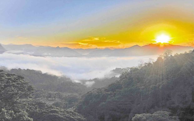
PEACETo younger generations, Kiangan in Ifugao has become a symbol of peace after the scenic town witnessed the end of the war. —EV ESPIRITU
Dimog also said his group planned to put up a small museum to display the war relics, such as mortar shells, soldiers’ gear and swords found in the area over the years.
Local tales and the history of the area will also be posted for children to read, he added.
Place for healing
Aside from its historical significance, the park can be a place of healing for Japanese who lost relatives to the war as well as Filipinos and Americans who suffered at the hands of Japanese soldiers, Dimog said.
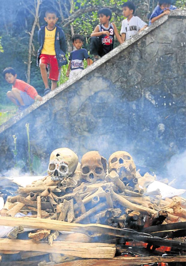
Stephen said elderly folk had been passing down tales about the hundreds of Japanese soldiers who died fighting and were buried at the ridge. The human bones dug by locals foraging for root crops were believed to belong to the soldiers, he said.

CLOSUREIn 2009, the Kiangan local government and Ifugao artists helped a Japanese group reclaim and burn the bones of Japanese soldiers who died in the province during World War II. The ashes were returned to Japan. —EV ESPIRITU
Based on records, over 100 foxholes, locally called “pakhols,” had been found in the area, with half of these still intact.
Overtime, dugouts and tunnels were filled with soil. Bigger foxholes were destroyed by treasure hunters looking for the fabled Yamashita treasure.
Treasure-hunting
In the 1970s, Japanese tourists frequented the ridge as they went to Hungduan, supposedly in search of their relatives’ remains, Dimog said.
But residents believed they were actually looking for buried treasures.
Making the ridge into an open park would stop treasure-hunting activities, which could destroy the historical relics as well as the forest, Stephen said.
He said tourism could give added income to residents of surrounding communities who relied on the annual harvest of “tinawon,” the heirloom rice.
The development of the park would be “slow but sure,” he said, adding that “once our town benefits from it, that would be a good return of investment.”