FLOOD ALERT: List of flooded areas on July 17, 2018
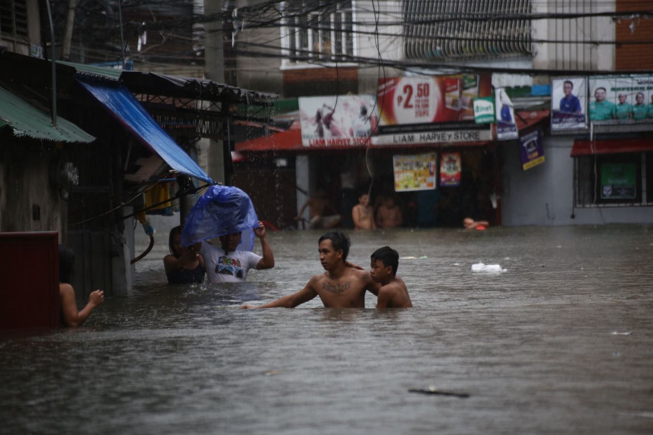
Streets in Barangay Del Monte, Quezon City were flooded on Tuesday due to heavy rain brought by tropical storm Henry. /PHOTO: Jam Sta. Rosa, INQUIRER
Updated 7:40 p.m.
Heavy rainfall caused by southwest monsoon or habagat and tropical storm Henry flooded caused flooding in several areas on Tuesday.
The Philippine Atmospheric, Geophysical and Astronomical Services Administration (Pagasa) said Henry has already exited the Philippine Area of Responsibility but the southwest monsoon will continue to bring rains over Metro Manila and other parts of the country.
Residents of these areas, especially those living in low-lying and mountainous areas, are advised to continue monitoring for updates, coordinate with their local disaster risk reduction and management offices, and take appropriate actions against possible flooding and landslides.
— PAGASA-DOST (@dost_pagasa) July 17, 2018
Not only Metro Manila has been affected by flooding on Tuesday. Several roads in the province of Bulacan have been affected by floods, according to to the Department of Public Works and Highways (DPWH) Region III office.
A post from the DPWH said that segments of the MacArthur Highway or the Manila North Road in Marilao and Meycauayan have been flooded since 1:30 p.m.
Please keep refreshing this page for updates.
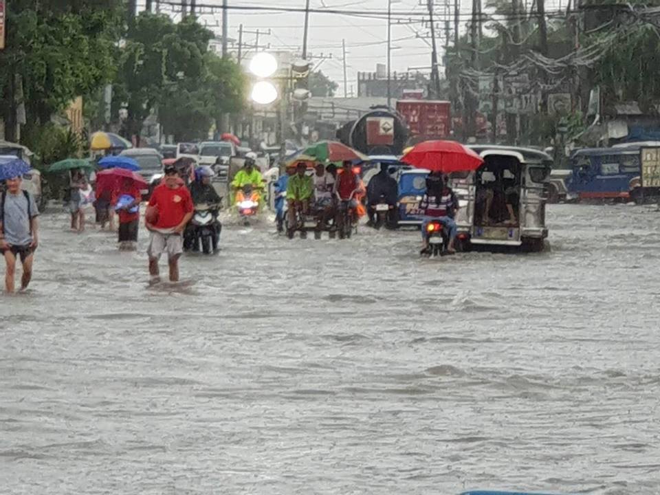
Streets in Banga, Meycauayan were submerged in 10 inch-high floodwaters. /PHOTO Courtesy of DPWH
LIST OF FLOODED AREAS
BULACAN
(1) Part of the highway near Lias Road in front of SM City Marilao: Floodwaters reached 16 inches; not passable to light vehicles
(2) Banga, Meycauayan: Floodwaters 12 inches high; not passable to light vehicles
(3) Marilao, near Abangan Sur: Flooded but passable to all vehicles
(4) Bigte-Ipo Dam Road in the boundary of the National Capital Region and Bulacan in San Jose Del Monte: Floodwaters eight inches deep floodwaters; still passable to all vehicles
QUEZON CITY
(1) Barangay del Monte: Waist-deep; not passable to vehicles (as of 12:40 p.m.)
(2) EDSA Cubao-Aurora tunnel (Northbound/Southbound): Gutter deep; passable to all types of vehicles (as of 7:33 p.m.)
(3) E. Rodriguez (in front of Delos Santos Medical Center; Southbound/Northbound): Knee deep; not passable to all types of vehicles (as of 9:15 a.m.)
(4) Araneta Ave. Victory: Passable to all vehicles (as of 5:00 p.m.)
(5) Araneta Maria Clara: Passable to all vehicles (as of 4:44 p.m.)
(6) Araneta Talayan: Passable to all vehicles (as of 5:00 p.m.)
(7) Quezon Ave. D. Tuazon (Westbound): Gutter deep; passable to all types of vehicles (as of 6:53 p.m.)
FLOOD UPDATE: As of 3:50 PM at Araneta Talayan. Knee deep. Not passable to light vehicles. #mmda #mmshakedrill
— Official MMDA (@MMDA) July 17, 2018
VALENZUELA CITY
(1) MacArthur Highway (in front of Fatima College): Tire deep; not passable to light vehicles (as of 9:38 a.m.)
MARIKINA CITY
(1) Marikina River: 14.5 meters (as of 12:35 p.m.)
FLOOD ALERT: As of 12:35 PM at Marikina River now on 14.50 Meters. Keep safe. #mmda #MMShakedrill
— Official MMDA (@MMDA) July 17, 2018
READ: Marikina River rises to 15 meters; first alarm raised
WATCH: Live feed of the Marikina River water level
— With Cathrine Gonzales, Gabriel Pabico Lalu/INQUIRER.net
/vvp